Category:Satellite pictures of Mayotte
Administrative regions and territorial collectivity of Metropolitan France (‡ since start of 2016):
Auvergne-Rhône-Alpes‡ · Bourgogne-Franche-Comté‡ · Brittany · Centre-Val de Loire · Corsica · Grand Est‡ · Hauts-de-France‡ · Île-de-France · Normandy‡ · Nouvelle-Aquitaine‡ · Occitania‡ · Pays de la Loire · Provence-Alpes-Côte d'Azur
Former administrative regions of Metropolitan France (until end of 2015):
Alsace
Overseas departments and regions: Guadeloupe · Martinique · French Guiana · Réunion · Mayotte
Overseas collectivities: Saint Barthélemy · Saint-Martin · Saint Pierre and Miquelon · French Polynesia · Wallis and Futuna · French Southern and Antarctic Lands+
Sui generis territories: New Caledonia · Clipperton Island+
Countries of Africa: Algeria · Angola · Benin · Botswana · Burkina Faso · Burundi · Cameroon · Cape Verde · Central African Republic · Chad · Comoros · Democratic Republic of the Congo · Republic of the Congo · Djibouti · Egypt‡ · Equatorial Guinea · Eritrea · Eswatini · Ethiopia · Gabon · The Gambia · Ghana · Guinea · Guinea-Bissau · Ivory Coast · Kenya · Lesotho · Liberia · Libya · Madagascar · Malawi · Mali · Mauritania · Mauritius · Morocco · Mozambique · Namibia · Niger · Nigeria · Rwanda · São Tomé and Príncipe · Senegal · Seychelles · Sierra Leone · Somalia · South Africa · South Sudan · Sudan · Tanzania · Togo · Tunisia · Uganda · Zambia · Zimbabwe
Limited recognition: Somaliland – Other areas: Canary Islands · Ceuta · Madeira · Mayotte · Melilla · Réunion · Saint Helena, Ascension and Tristan da Cunha · Western Sahara
‡: partly located in Africa
Limited recognition: Somaliland – Other areas: Canary Islands · Ceuta · Madeira · Mayotte · Melilla · Réunion · Saint Helena, Ascension and Tristan da Cunha · Western Sahara
‡: partly located in Africa
Media in category "Satellite pictures of Mayotte"
The following 14 files are in this category, out of 14 total.
-
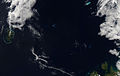 Banc du Geyser Panorama MODIS.jpg 1,200 × 763; 170 KB
-
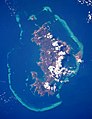
 Coral lagoons, Mayotte.jpg 2,048 × 1,280; 582 KB
-

-
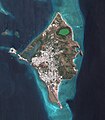 Mayotte - Petite-Terre, vue par Sentinel 2 (cropped) (cropped).jpg 532 × 606; 301 KB
-
 Mayotte Island faces severe drought.jpg 4,137 × 3,543; 4.51 MB
-
 Mayotte ISS.jpg 1,176 × 1,525; 558 KB
-
 Mayotte oli 2015196 lrg.jpg 4,254 × 5,183; 2.21 MB
-
 Mayotte oli 2015196.jpg 720 × 800; 379 KB
-
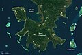
 Mayotte, vue par Sentinel 2 (cropped).jpg 4,100 × 4,381; 11.67 MB
-
 Mayotte, vue par Sentinel 2.jpg 5,000 × 5,000; 14.14 MB
-
 Mayottezm oli 2015196.jpg 720 × 480; 270 KB
-
 Mayottezm2 oli 2015196.jpg 720 × 480; 237 KB
-
 Randy Bresnik 2017.jpg 2,048 × 1,363; 601 KB
-
 The Mayotte archipelago, a French overseas department and region (iss071e345427).jpg 8,256 × 5,504; 10.49 MB


.jpg)
_(cropped).jpg)


.jpg)


.jpg)