Category:Satellite pictures of McMurdo Dry Valleys
Media in category "Satellite pictures of McMurdo Dry Valleys"
The following 16 files are in this category, out of 16 total.
-
 Apocalypse Peaks ASTER.jpg 1,296 × 864; 178 KB
-
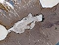
 DonJuanSTILL.0560 web.jpg 2,650 × 1,920; 942 KB
-
 DonJuanSTILL.0660 web.jpg 2,650 × 1,920; 1.63 MB
-
 Dry Valleys and McMurdo Sound - LIMA image.png 1,052 × 996; 1.91 MB
-
 Dry Valleys, Antarctica.jpg 3,900 × 4,331; 1.93 MB
-
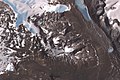
 Ferrar Glacier, Antarctica (15473959520).jpg 1,280 × 720; 340 KB
-
 Green and Canfield Mesas ASTER.jpg 624 × 416; 22 KB
-
 Insel Range ASTER.jpg 1,280 × 960; 168 KB
-
 Labyrinth Antarctica ASTER.jpg 960 × 640; 77 KB
-
 Lake Brownworth 2022-01-27 Sentinel-2 L2A Highlight Optimized Natural Color.jpg 2,500 × 2,356; 715 KB
-
 Lake Fryxell 2022-01-27 Sentinel-2 L2A Highlight Optimized Natural Color.jpg 2,500 × 1,935; 669 KB
-
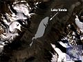 Lake Vanda Landsat 7 image.jpg 560 × 421; 80 KB
-
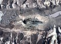
 Lake Vida 2022-01-27 Sentinel-2 L2A Highlight Optimized Natural Color.jpg 2,500 × 1,812; 699 KB
-
 Landsat7 dry valley lrg.jpg 6,245 × 3,640; 2.96 MB
-
 Miers Valley 2022-01-27 Sentinel-2 L2A Highlight Optimized Natural Color.jpg 2,500 × 1,628; 922 KB
-
 Simmons Basin ASTER.jpg 640 × 363; 28 KB


.jpg)


