Category:Satellite pictures of San Francisco
Media in category "Satellite pictures of San Francisco"
The following 30 files are in this category, out of 30 total.
-
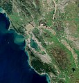
 Bay Area by Sentinel-2, 2019-03-11 (big version).jpg 20,389 × 21,539; 487.33 MB
-
 Bay Area by Sentinel-2, 2019-03-11 (small version).jpg 10,200 × 10,776; 123.14 MB
-
 Bayarea.jpg 277 × 283; 26 KB
-
 BayareaUSGS.jpg 769 × 798; 613 KB
-
 Districts San Fransisco.png 618 × 520; 734 KB
-
 GlenCanyonPark Satellite Photo.jpg 516 × 713; 204 KB
-
 ISS-43 San Francisco Bay.jpg 4,928 × 3,280; 6.34 MB
-
 ISS-46 San Fransisco, California.jpg 4,928 × 3,280; 4.99 MB
-
 ISS015-E-7973 - View of California.jpg 3,032 × 2,064; 1.03 MB
-
 Iss064e053178.jpg 5,504 × 8,256; 10.88 MB
-
 Iss069e000857.jpg 5,568 × 3,712; 2.94 MB
-
 San Francisco Bay Area, California USA - Planet Labs satellite image.jpg 3,522 × 2,642; 2.08 MB
-
 San francisco bay map.jpg 557 × 787; 78 KB
-
 San Francisco Landsat7 Lg.jpg 475 × 784; 394 KB
-
 San Francisco Peninsula by Sentinel-2, 2019-03-11 (cropped).jpg 1,696 × 1,416; 3.26 MB
-
 San Francisco Peninsula by Sentinel-2, 2019-03-11.jpg 2,072 × 2,717; 6.25 MB
-
 San Francisco Peninsula JPLLandsat.jpg 1,152 × 870; 161 KB
-
 San Francisco S2A MSI 432 crop 10 (27643146210).jpg 8,496 × 10,980; 76.55 MB
-
 San Francisco SPOT 1257.jpg 500 × 500; 110 KB
-
 San Francisco STS058-083-023.jpg 3,872 × 3,904; 11 MB
-
 San Francisco, California by Planet Labs.jpg 7,013 × 5,259; 20.61 MB
-
 San Fransisco Bay satellite.jpg 10,600 × 4,800; 40.12 MB
-
 Sanfrancisco Bay Fog ali 2012229 lrg.jpg 3,050 × 2,938; 2.43 MB
-
 SanFranCity2.jpg 1,043 × 831; 187 KB
-
 Satellite view of fog over the Golden Gate.jpg 2,721 × 4,081; 10.21 MB
-
 SF Bay area USGS.jpg 770 × 800; 337 KB
-
 STS073-706-012 Columbia above San Francisco.jpg 4,015 × 4,000; 9.65 MB
-
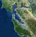
 View of the Bay Area and the Californian Delta.jpg 6,034 × 4,838; 39.04 MB
-
 Wfm twim peaks 1.jpg 1,280 × 948; 248 KB
-
 WW sanfrancisco.png 771 × 610; 691 KB
.jpg)
.jpg)


.jpg)


.jpg)


