Category:Satellite pictures of coral reefs
Wikimedia category | |||||
| Upload media | |||||
| Instance of | |||||
|---|---|---|---|---|---|
| Category combines topics | |||||
| |||||
Deutsch: Satellitenbilder von Korallenriffen
English: Satellite pictures of coral reefs
Subcategories
This category has the following 2 subcategories, out of 2 total.
S
Media in category "Satellite pictures of coral reefs"
The following 32 files are in this category, out of 32 total.
-
 Aguijan ISS017-E-20419 (crop - no Naftan Rock).JPG 670 × 480; 38 KB
-
 Aguijan ISS017-E-20419 (cropped).JPG 913 × 705; 47 KB
-
 Aguijan ISS017-E-20419.JPG 1,280 × 1,024; 79 KB
-
 Belize Barrier Reef (52224339954).png 11,000 × 7,267; 90.24 MB
-
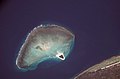
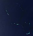 Bellona Reefs.jpg 663 × 729; 15 KB
-
 Cargados Carajos - Landsat OLI 151.jpg 2,000 × 2,500; 329 KB
-
 Cargados Carajos Shoals ISS.jpg 1,000 × 667; 153 KB
-
 Chesterfield Islands.jpg 2,000 × 2,992; 576 KB
-
 Climate change threatens corals in the western Indian Ocean (Copernicus).png 4,408 × 2,540; 7.38 MB
-
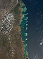
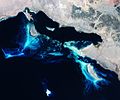 Deep blue Red Sea reefs.jpg 1,920 × 1,601; 2.39 MB
-
 Iles Chesterfield (Atoll) (without Bellona Reefs cropped).jpg 658 × 590; 33 KB
-
 IlesChesterfield 250m a.jpg 1,333 × 2,000; 732 KB
-
 IlesChesterfield 250m b.jpg 1,333 × 2,000; 776 KB
-
 IlesChesterfield 250m.jpg 1,000 × 1,500; 95 KB
-
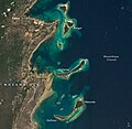
 ISS016-E-20175 - View of Tanzania.jpg 3,032 × 2,008; 807 KB
-
 ISS016-E-20176 - View of Tanzania.jpg 3,032 × 2,008; 793 KB
-
 ISS029-E-31811 - View of Earth.jpg 4,288 × 2,848; 1.06 MB
-
 Iss066e081982.jpg 720 × 999; 702 KB
-
 Iss066e081982zm.jpg 720 × 700; 486 KB
-
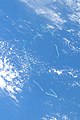
 Louisiade archipelago.jpg 2,000 × 1,500; 449 KB
-
 Madagascar l7 2000179 coral reefs.jpg 540 × 405; 101 KB
-
 Madagascar l7 2000179 lrg coral reefs.jpg 4,000 × 4,000; 3.06 MB
-
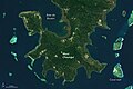
 Mayotte oli 2015196 lrg.jpg 4,254 × 5,183; 2.21 MB
-
 Mayotte oli 2015196.jpg 720 × 800; 379 KB
-
 Mayottezm oli 2015196.jpg 720 × 480; 270 KB
-
 Mayottezm2 oli 2015196.jpg 720 × 480; 237 KB
-
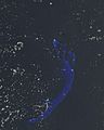
 Middle Bellona Reef ISS photograph 2002.jpg 3,032 × 2,064; 754 KB
-
 Quirimbas Islands 2021-11-24 from ISS (ISS066-E-81982).jpg 3,206 × 4,449; 3.97 MB
-
 Sandy Island (Alleged Location) 2002-01-10, Landsat 7 ETM+, Thermal Fusion.png 2,074 × 1,264; 4.88 MB
-
 Sandy Island (Alleged Location) 2002-01-10, Landsat 7 ETM+.png 5,388 × 2,778; 21.87 MB
-
 Signs of Recovery for the Great Barrier Reef coral (Copernicus).png 4,408 × 2,540; 2.15 MB
-
 SOUTH BELLONA REEF.jpg 3,000 × 2,000; 402 KB
.JPG)
.JPG)

.png)


.png)

_(without_Bellona_Reefs_cropped).jpg)


.jpg)
_2002-01-10,_Landsat_7_ETM%2B,_Thermal_Fusion.png)
_2002-01-10,_Landsat_7_ETM%2B.png)
.png)
