Category:Satellite pictures of the Bay of Gibraltar
Media in category "Satellite pictures of the Bay of Gibraltar"
The following 9 files are in this category, out of 9 total.
-
 Algeciras and Gibraltar.jpg 3,508 × 2,540; 1.9 MB
-
 Bahía de Algeciras - ic Landsat.jpg 1,060 × 989; 440 KB
-
 Bay of Gibraltar, Mediterranean Sea by Planet Labs.jpg 4,840 × 3,630; 6.4 MB
-
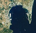
 Bay of Gibraltar.jpg 540 × 405; 89 KB
-
 Gibraltar (satellite view).jpg 2,048 × 1,280; 611 KB
-
 Gibraltar-NLT Landsat7.jpg 1,018 × 694; 489 KB
-
 ISS015-E-5271 - View of Spain.jpg 3,032 × 2,008; 1,005 KB
-
 ISS063-E-70346 - View of Earth.jpg 5,568 × 3,712; 3.43 MB
-
 ISS063-E-70349 - View of Earth.jpg 5,568 × 3,712; 3.48 MB


.jpg)


