Category:Satellite pictures of wildfires in Canada
Satellite pictures of wildfires in:
Lua error: too many expensive function calls.
Subcategories
This category has the following 2 subcategories, out of 2 total.
Media in category "Satellite pictures of wildfires in Canada"
The following 13 files are in this category, out of 13 total.
-
 Alberta Wildfire 2016-05-03 1950Z.jpg 800 × 600; 74 KB
-
 Alberta Wildfire 2016-05-23 1925Z.jpg 800 × 600; 71 KB
-
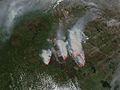 Alberta Wildfire 2016-05-24 2010Z.jpg 1,600 × 1,200; 395 KB
-
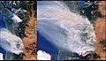
 Britishcolumbiafires oli 2018219.jpg 720 × 480; 371 KB
-
 Britishcolumbiafires tmo 2018225 lrg.jpg 6,738 × 7,855; 8.74 MB
-
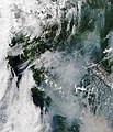
 Canada 2016-05-09 1915Z (26841970572).jpg 4,400 × 3,400; 1.62 MB
-
 Canada Wildfire Season Sets Alarming Record.jpg 4,492 × 2,543; 7.34 MB
-
 Fire season in Canada (fire-season-canada).jpg 3,508 × 2,530; 2.47 MB
-
 Multiple wildfires affecting Canada as intense heatwave hits.jpg 4,410 × 2,540; 3.6 MB
-
 Rauch über Lytton.jpg 500 × 782; 261 KB
-
 Severe wildfires ongoing in North America.jpg 4,412 × 2,544; 2.69 MB
-
 Smoke over the Pacific Northwest.jpg 4,000 × 3,000; 2.52 MB
-
 Wildfire in Fort McMurray, Alberta, Canada May 25th 2016 (26649348513).jpg 1,753 × 2,048; 1.96 MB


.jpg)

.jpg)


.jpg)