Category:Scarborough, North Yorkshire
town in North Yorkshire, England .jpg) | |||||
| Upload media | |||||
| Instance of | |||||
|---|---|---|---|---|---|
| Location | Scarborough, North Yorkshire, Yorkshire and the Humber, England | ||||
| Located in or next to body of water | |||||
| Population |
| ||||
| official website | |||||
 | |||||
Subcategories
This category has the following 32 subcategories, out of 32 total.
Pages in category "Scarborough, North Yorkshire"
This category contains only the following page.
Media in category "Scarborough, North Yorkshire"
The following 200 files are in this category, out of 1,144 total.
(previous page) (next page)-

-
 'The Snicket' - geograph.org.uk - 800967.jpg 640 × 400; 65 KB
-
 'The Snicket' - geograph.org.uk - 800973.jpg 640 × 399; 70 KB
-
 'The Snicket' - geograph.org.uk - 800988.jpg 640 × 400; 92 KB
-

-
 (Scarborough, Hayburn Wyke, Yorkshire, England) (LOC) (16801688511).jpg 759 × 1,024; 292 KB
-
 (Scarborough, South Bay, Yorkshire, England) (LOC) (16801701832).jpg 1,024 × 766; 190 KB
-
 (Scarborough, the children's corner, Yorkshire, England) (LOC) (16180458614).jpg 1,024 × 768; 264 KB
-
 (Scarborough, the spa, Yorkshire, England) (LOC) (16180458104).jpg 1,024 × 774; 174 KB
-
 1885-1918 Scarborough.png 351 × 280; 8 KB
-
 21 Foreshore Rd, Scarborough YO11 1PB, UK - panoramio.jpg 1,569 × 1,523; 387 KB
-
 A framed gull - geograph.org.uk - 5335343.jpg 769 × 1,024; 185 KB
-
 A garden near Scarborough-15 (4629151583).jpg 3,277 × 4,000; 5.03 MB
-
 A grand view from the Grand Hotel - geograph.org.uk - 5786094.jpg 800 × 363; 59 KB
-
 A Seagull (9114972908).jpg 4,608 × 2,592; 3.26 MB
-
 A second plaque on Scarborough lighthouse - geograph.org.uk - 3767415.jpg 1,929 × 1,302; 547 KB
-
 A sunny day at Scalby Mills - geograph.org.uk - 1717777.jpg 640 × 360; 98 KB
-
 A verbose sign - geograph.org.uk - 5932002.jpg 6,032 × 4,014; 5.51 MB
-
 A very light house, Scarborough (9703331512).jpg 4,256 × 2,832; 1.32 MB
-
 Aberdeen Street, Scarborough - geograph.org.uk - 4830242.jpg 640 × 480; 73 KB
-
 Aberdeen Walk - geograph.org.uk - 6101415.jpg 1,280 × 1,143; 1,004 KB
-
 Aberdeen Walk, Scarborough - geograph.org.uk - 4830244.jpg 640 × 480; 78 KB
-
 Across North Bay - geograph.org.uk - 4456857.jpg 640 × 428; 77 KB
-
 Across North Bay - geograph.org.uk - 6244450.jpg 1,024 × 768; 805 KB
-
 Action across the bay - geograph.org.uk - 4932394.jpg 3,675 × 2,183; 1.73 MB
-

-
 After the storm the sand is level with the prom - geograph.org.uk - 4818195.jpg 4,606 × 3,454; 5.38 MB
-
 Albemarle Crescent, Scarborough - geograph.org.uk - 4830243.jpg 640 × 480; 72 KB
-
 Albert Road - geograph.org.uk - 4830997.jpg 640 × 480; 74 KB
-

-

-

-
 Along the castle walls - geograph.org.uk - 5084709.jpg 3,456 × 2,304; 2.32 MB
-
 Alpamare Waterpark, Scarborough - geograph.org.uk - 5449515.jpg 2,000 × 1,500; 474 KB
-
 Amazon Hub.jpg 5,184 × 3,888; 9.67 MB
-
 Amusement arcade - geograph.org.uk - 5577559.jpg 640 × 480; 77 KB
-

-
 An Eclectic Gallery - geograph.org.uk - 5932577.jpg 6,032 × 4,014; 5.29 MB
-

-
 An RAF Tucano, is shown here flying over Scarborough North Yorkshire. MOD 45132300.jpg 1,958 × 1,387; 509 KB
-
 Antons , Sandside - geograph.org.uk - 6154952.jpg 2,241 × 3,811; 1.29 MB
-
 Apartments on Lowdale Avenue - geograph.org.uk - 4835382.jpg 640 × 407; 59 KB
-
 Apartments on Lowdale Avenue - geograph.org.uk - 4835384.jpg 640 × 480; 75 KB
-
 Argument Yard, Whitby (NBY 440593).jpg 3,600 × 2,337; 928 KB
-
 Artwork on Blands Cliff, Scarborough - geograph.org.uk - 4831621.jpg 376 × 640; 70 KB
-
 At the Roman signal station, Scarborough Headland - geograph.org.uk - 5563472.jpg 5,179 × 3,885; 4.3 MB
-
 Avenue Victoria - geograph.org.uk - 5391373.jpg 640 × 426; 55 KB
-
 Avviso di vendita del materiale dell'Osservatorio di Scarborough.jpg 1,240 × 1,600; 559 KB
-
 B08055.jpg 472 × 354; 103 KB
-
 B12119.jpg 3,024 × 4,032; 7.14 MB
-
 Back to port - geograph.org.uk - 3846330.jpg 2,000 × 1,245; 1.46 MB
-
 Balconies, North Bay, Scarborough - geograph.org.uk - 4952232.jpg 604 × 640; 94 KB
-
 Balustrade of Glen Bridge, Scarborough - geograph.org.uk - 5332493.jpg 1,024 × 768; 169 KB
-
 Barrowcliff Road, Scarborough - geograph.org.uk - 4843229.jpg 640 × 480; 59 KB
-
 Basketball court, Clarence Gardens - geograph.org.uk - 4831011.jpg 640 × 403; 63 KB
-
 Bay window, Merchants Row - geograph.org.uk - 4764504.jpg 640 × 640; 148 KB
-
 Beach cafe, North Bay, Scarborough - geograph.org.uk - 4952216.jpg 640 × 480; 74 KB
-
 Beach goods for sale, North Bay, Scarborough (geograph 4952212).jpg 640 × 531; 131 KB
-
 Beach Huts and Sea Life Centre - geograph.org.uk - 3522733.jpg 640 × 480; 46 KB
-
 Bench mark below the North Bay miniature railway - geograph.org.uk - 5005019.jpg 1,024 × 768; 313 KB
-
 Bench mark in North Marine Road, Scarborough - geograph.org.uk - 6033437.jpg 1,600 × 1,201; 818 KB
-
 Bench mark in Peasholm Drive, Scarborough - geograph.org.uk - 5669031.jpg 768 × 1,024; 303 KB
-
 Bench mark on ^55 Oakville Avenue, Scarborough - geograph.org.uk - 5669535.jpg 767 × 1,024; 219 KB
-

-
 Black Rocks, South Bay - geograph.org.uk - 1398483.jpg 640 × 480; 77 KB
-
 Blands Cliff Mural - panoramio.jpg 1,917 × 1,896; 548 KB
-
 Blands Cliff Murals - panoramio.jpg 1,719 × 1,883; 685 KB
-
 Blands Cliff, Scarborough - geograph.org.uk - 4829133.jpg 2,592 × 1,944; 1.26 MB
-
 Blands Cliff, Scarborough - geograph.org.uk - 4829136.jpg 640 × 454; 65 KB
-
 Blenheim Terrace, Scarborough - geograph.org.uk - 4830626.jpg 2,592 × 1,944; 1.32 MB
-
 Blenheim Terrace, Scarborough - geograph.org.uk - 4830628.jpg 640 × 480; 70 KB
-

-
 Boat house - panoramio.jpg 1,282 × 1,275; 284 KB
-
 Boat outside Scarborough Harbour - geograph.org.uk - 1908226.jpg 640 × 430; 105 KB
-
 Boats at Scarborough (27881810742).jpg 2,792 × 1,994; 5.55 MB
-
 Boats in the Old Harbour at Scarborough - geograph.org.uk - 5786238.jpg 800 × 600; 131 KB
-
 Boats in the Old Harbour at Scarborough - geograph.org.uk - 6002299.jpg 800 × 559; 122 KB
-
 Boats in the Old Harbour at Scarborough - geograph.org.uk - 6002302.jpg 800 × 481; 103 KB
-
 Boxing Day fresh air - geograph.org.uk - 5242784.jpg 4,320 × 3,240; 2.87 MB
-
 Boxing Day fun at Scarborough - geograph.org.uk - 5242755.jpg 3,240 × 4,320; 2.99 MB
-
 Bridge and harbour - panoramio.jpg 1,572 × 1,599; 456 KB
-
 Broadway, Scarborough - geograph.org.uk - 4845222.jpg 3,648 × 2,736; 4.32 MB
-
 Broadway, Scarborough - geograph.org.uk - 4845228.jpg 3,415 × 2,226; 3.73 MB
-

-
 Buildings between Foreshore Road and King Street - geograph.org.uk - 6154917.jpg 5,202 × 3,465; 2.95 MB
-
 Built in 1921 the Futurist Theatre reduced to rubble - geograph.org.uk - 5934079.jpg 4,608 × 3,456; 3.28 MB
-
-
 Burlington bay, Scarbrough and Hartlepoole - btv1b53010307s.jpg 7,721 × 6,746; 6.99 MB
-
 BURLINGTON BAY, Scarbrouth and Hartlepoole NYPL1640566.tiff 7,230 × 5,428; 112.28 MB
-
 Burr Bank, Scarborough - geograph.org.uk - 5336413.jpg 1,024 × 768; 219 KB
-
-

-

-
 Car park off Wrea Lane Scarborough - geograph.org.uk - 4830223.jpg 640 × 480; 70 KB
-
 Caravan Site Falsgrave Moor Farm - geograph.org.uk - 1081051.jpg 640 × 480; 89 KB
-

-
 Castle Cliff from North Bay - geograph.org.uk - 878048.jpg 640 × 423; 53 KB
-
 Castle Cliff, Scarborough - geograph.org.uk - 5450555.jpg 2,000 × 1,500; 764 KB
-
 Castle Hill - panoramio.jpg 1,059 × 983; 225 KB
-
 Castle Road house - geograph.org.uk - 5596132.jpg 3,165 × 4,219; 2.67 MB
-
 Castle Road, Scarborough - geograph.org.uk - 4827290.jpg 2,592 × 1,944; 1.13 MB
-
 Castle Road, Scarborough - geograph.org.uk - 4831599.jpg 640 × 480; 72 KB
-
 Castle Road, Scarborough - geograph.org.uk - 5664471.jpg 5,343 × 3,005; 4.41 MB
-

-
 Castlegate Street - geograph.org.uk - 4705117.jpg 1,600 × 1,067; 564 KB
-
 Castlegate, Scarborough - geograph.org.uk - 5664446.jpg 5,343 × 3,562; 2.97 MB
-
 Cat and mouse on Royal Albert Drive - geograph.org.uk - 4932398.jpg 3,179 × 2,081; 1.53 MB
-
 Central Passageway - geograph.org.uk - 5932982.jpg 6,032 × 4,014; 5.42 MB
-
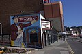
 Central Tramway - geograph.org.uk - 6227374.jpg 1,533 × 2,000; 3.22 MB
-
 Central Tramway station on Foreshore Road - geograph.org.uk - 6154900.jpg 5,202 × 3,465; 3.36 MB
-
 Chalet cafe, North Bay - geograph.org.uk - 6155010.jpg 5,202 × 3,465; 2.51 MB
-
 Chapel of Our Lady at Scarborough castle - geograph.org.uk - 5336363.jpg 1,024 × 768; 238 KB
-

-
 Chatsworth Gardens, Scarborough - geograph.org.uk - 4843214.jpg 640 × 480; 94 KB
-
 Chest tombs - geograph.org.uk - 5594083.jpg 4,320 × 3,240; 3.14 MB
-

-

-
 Chimneys and a view over Scarborough - geograph.org.uk - 5090524.jpg 819 × 1,024; 1.16 MB
-
 Church Stairs Street, Scarborough - geograph.org.uk - 4831605.jpg 640 × 480; 107 KB
-
 Church Stairs Street, Scarborough - geograph.org.uk - 5248605.jpg 1,200 × 799; 348 KB
-
 Church Stairs Street, Scarborough - geograph.org.uk - 5248607.jpg 1,200 × 799; 503 KB
-
 Clarence Gardens - geograph.org.uk - 943979.jpg 640 × 458; 254 KB
-
 Clarence Gardens and North Bay - geograph.org.uk - 4831596.jpg 640 × 480; 70 KB
-
-
 Clarence Gardens and Scarborough Castle - geograph.org.uk - 5219937.jpg 4,408 × 2,918; 2.23 MB
-
 Cleveland Way coast IMG 1689.jpg - panoramio.jpg 1,600 × 1,067; 536 KB
-
 Cleveland Way IMG 2206 - panoramio.jpg 954 × 1,400; 603 KB
-
 Cliff top bomb shelter - panoramio.jpg 4,608 × 3,072; 7.09 MB
-
 Cliffs, North Bay, Scarborough - geograph.org.uk - 4831019.jpg 640 × 480; 74 KB
-
 Clifton Street, Scarborough - geograph.org.uk - 4830230.jpg 640 × 480; 82 KB
-
 Clifton Street, Scarborough - geograph.org.uk - 4830234.jpg 640 × 480; 73 KB
-
 Clouds over North Bay - geograph.org.uk - 3667410.jpg 1,600 × 1,200; 1.59 MB
-
 Coastal Defences, Scarborough - geograph.org.uk - 5528817.jpg 640 × 480; 55 KB
-
 Coastguard station, Scarborough - geograph.org.uk - 1518608.jpg 640 × 480; 59 KB
-
 Columbus Ravine (A165), Scarborough - geograph.org.uk - 4828715.jpg 640 × 480; 92 KB
-
 Columbus Ravine (Road) in Scarborough - geograph.org.uk - 5880394.jpg 5,200 × 3,900; 3.69 MB
-
 Columbus Ravine, Scarborough - geograph.org.uk - 4837335.jpg 640 × 371; 73 KB
-
 Concrete Posts and Field - geograph.org.uk - 1215429.jpg 640 × 441; 114 KB
-
 Coney Island Amusements - geograph.org.uk - 5517267.jpg 1,024 × 750; 135 KB
-
 Coney Island, Scarborough - geograph.org.uk - 4831619.jpg 640 × 480; 60 KB
-
 Continuing around Marine Drive - geograph.org.uk - 5489559.jpg 640 × 372; 42 KB
-
 Cormorant drying out - geograph.org.uk - 3846239.jpg 1,558 × 1,558; 1.49 MB
-

-
-
 Crossgates Quarry.jpg 4,032 × 1,960; 4.1 MB
-
 Crowds gathering on North Bay - geograph.org.uk - 4932374.jpg 4,320 × 2,266; 1.81 MB
-

-
 Datestone on Wilson's Mariners' Homes - geograph.org.uk - 5335271.jpg 1,024 × 768; 62 KB
-
 Dean Road, Scarborough - geograph.org.uk - 4830220.jpg 640 × 480; 48 KB
-
 Dean Road, Scarborough - geograph.org.uk - 4830647.jpg 2,395 × 1,630; 915 KB
-
 Dean Road, Scarborough - geograph.org.uk - 4830650.jpg 2,414 × 1,662; 958 KB
-
 Dean Road, Scarborough - geograph.org.uk - 4837394.jpg 640 × 480; 84 KB
-
 Dean Road, Scarborough - geograph.org.uk - 4837396.jpg 640 × 480; 75 KB
-
 December View of the Lighthouse - geograph.org.uk - 3770764.jpg 1,978 × 1,324; 1.64 MB
-
 Deep Dale - geograph.org.uk - 925135.jpg 640 × 461; 101 KB
-
 Don't fall out of the train^ - geograph.org.uk - 5332509.jpg 1,024 × 768; 229 KB
-
 Double Doors - geograph.org.uk - 5933134.jpg 6,032 × 4,014; 5.41 MB
-

-
 Dredging the harbour entrance, Scarborough - geograph.org.uk - 2785346.jpg 1,024 × 768; 184 KB
-
 Drinking fountain, Sandside - geograph.org.uk - 5517374.jpg 1,024 × 768; 203 KB
-
 Dry at low tide - geograph.org.uk - 2064259.jpg 1,024 × 768; 135 KB
-
 Durham Place, Scarborough - geograph.org.uk - 4830372.jpg 640 × 480; 63 KB
-
 East Harbour - geograph.org.uk - 4779923.jpg 640 × 425; 149 KB
-
 East Harbour - geograph.org.uk - 5054060.jpg 2,399 × 1,599; 608 KB
-
 East Harbour at Scarborough - geograph.org.uk - 6002330.jpg 800 × 447; 102 KB
-
 East Harbour, Scarborough - geograph.org.uk - 2059083.jpg 640 × 480; 68 KB
-
 East Harbour, Scarborough - geograph.org.uk - 5648189.jpg 3,264 × 2,448; 1.79 MB
-
 East Pier, Scarborough Harbour - geograph.org.uk - 1908511.jpg 640 × 430; 70 KB
-
 East Yorkshire Coaster.jpg 3,986 × 2,658; 1.7 MB
-
 Elmville Avenue, Scarborough - geograph.org.uk - 4840887.jpg 640 × 480; 70 KB
-

-

-
 Entrance to Jacobs Mount Holiday Park - geograph.org.uk - 1355169.jpg 640 × 480; 102 KB
-
 Entrance to Scarborough Harbour - geograph.org.uk - 1908209.jpg 640 × 430; 116 KB
-
 Entrance to the Paradise Play Area - geograph.org.uk - 1778525.jpg 2,560 × 1,920; 772 KB
-

-
 Evening News ^ Mercury Office - geograph.org.uk - 6101513.jpg 1,280 × 1,516; 1.19 MB
-
 Falsgrave Road and the 'Snicket' - geograph.org.uk - 789427.jpg 640 × 400; 80 KB
-

-
 Farmland near Seamer - geograph.org.uk - 1354334.jpg 640 × 480; 82 KB
-
 Farmland near the A170 - geograph.org.uk - 1355173.jpg 640 × 480; 84 KB
-
 Fieldside, Scarborough - geograph.org.uk - 4843216.jpg 640 × 480; 65 KB
-
 First World War Propaganda Posters Q33151.jpg 521 × 800; 83 KB
-
 Fishdock view - geograph.org.uk - 5932117.jpg 6,032 × 4,014; 4.82 MB
-
 Fisherman's Cottage in Scarborough.jpg 2,048 × 1,536; 1.53 MB
-
 Fishing boat leaving the Old Harbour - geograph.org.uk - 4040515.jpg 640 × 480; 68 KB
-
 Fishing Boats at Scarborough - geograph.org.uk - 5899346.jpg 2,048 × 1,536; 1.01 MB
-

-

-

-
 Fishing tackle in Scarborough old harbour - geograph.org.uk - 5336442.jpg 1,024 × 768; 295 KB
-
 Fishing, East Pier, Scarborough - geograph.org.uk - 4040528.jpg 640 × 480; 47 KB
-
 Footpath alongside Marine Drive, Scarborough - geograph.org.uk - 5450545.jpg 2,000 × 1,500; 317 KB
-
 Footpath towards Scalby Mills - geograph.org.uk - 5005027.jpg 768 × 1,024; 181 KB
-
 Foreshore Road - geograph.org.uk - 6227388.jpg 2,000 × 1,328; 3.19 MB
-
 Foreshore Road in Scarborough - geograph.org.uk - 5297320.jpg 1,500 × 1,125; 166 KB
-
 Foreshore Road park - geograph.org.uk - 6154907.jpg 5,202 × 3,465; 4.96 MB
-
 Foreshore Road seen from South Sands, Scarborough (geograph 7430217).jpg 2,000 × 1,190; 2.1 MB
-

-


_(LOC)_(16182882643).jpg)
_(LOC)_(16801688511).jpg)
_(LOC)_(16801701832).jpg)
_(LOC)_(16180458614).jpg)
_(LOC)_(16180458104).jpg)


.jpg)

.jpg)


.jpg)


_(14574088487).jpg)


.jpg)


.jpg)


.jpg)


_(34854491541).jpg)
_(34143884624).jpg)


,_Scarborough_-_geograph.org.uk_-_4828715.jpg)
_in_Scarborough_-_geograph.org.uk_-_5880394.jpg)


.jpg)

