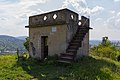
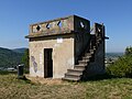
Category:Schützenhüttle (Weinstadt)
| Object location | | View all coordinates using: OpenStreetMap |
|---|
hill in Germany   | |||||
| Upload media | |||||
| Instance of | |||||
|---|---|---|---|---|---|
| Location | Weinstadt, Rems-Murr, Stuttgart Government Region, Baden-Württemberg, Germany | ||||
| Inception |
| ||||
 | |||||
Media in category "Schützenhüttle (Weinstadt)"
The following 7 files are in this category, out of 7 total.
-
 Schützenhütte weinstadt.jpg 5,184 × 3,456; 10.12 MB
-
 Schützenhüttle - Weinstadt-1.jpg 981 × 780; 293 KB
-
 Schützenhüttle - Weinstadt-2.jpg 2,365 × 1,531; 1.15 MB
-
 Schützenhüttle - Weinstadt-3.jpg 1,368 × 1,824; 825 KB
-
 Schützenhüttle - Weinstadt-4.jpg 1,368 × 1,824; 844 KB
-
 Schützenhüttle - Weinstadt-5.jpg 2,369 × 2,020; 1.46 MB
-
 Schützenhüttle Weinstadt.jpg 3,648 × 2,736; 2.91 MB


