Category:Schaopedobbe
| Object location | | View all coordinates using: OpenStreetMap |
|---|
_03.jpg) | |||||
| Upload media | |||||
| Instance of | |||||
|---|---|---|---|---|---|
| Location | Elsloo, Ooststellingwerf, Friesland, Netherlands | ||||
| Maintained by | |||||
| Area |
| ||||
 | |||||
Schaopedobbe edit
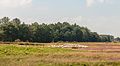
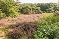
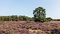
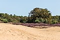
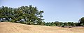
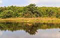
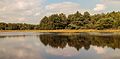
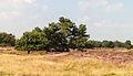
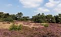
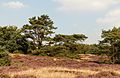
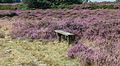
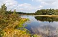
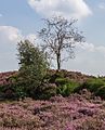
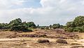
Schaopedobbe is een afwisselend natuurgebied in Friesland, eigendom van de vereniging It Fryske Gea en bestaat uit een afwisseling van droge en minder droge heideveldjes, voormalige hooilandjes, boomgroepen, bos en singels, en een zandverstuiving. Het natuurgebied ligt bij Elsloo in de provincie Friesland
Schaopedobbe is a varied nature in Friesland, owned by the association It Fryske Gea and consists of a variety of dry and less dry heath fields, former hayfields, groups of trees, forests and canals, and a sand drift. The Nature located in Elsloo in the province Friesland.
Media in category "Schaopedobbe"
The following 122 files are in this category, out of 122 total.
-
 Bijeengedreven heideschapen. Locatie, Schaopedobbe (Schapenpoel) 01.jpg 5,144 × 2,818; 9.37 MB
-
 Bijeengedreven heideschapen. Locatie, Schaopedobbe (Schapenpoel) 02.jpg 4,554 × 1,085; 4.77 MB
-
 Bloeiende heide. Locatie, Schaopedobbe (Schapenpoel) 01.jpg 5,145 × 2,051; 6.72 MB
-
 Bloeiende heide. Locatie, Schaopedobbe (Schapenpoel) 02.jpg 5,130 × 2,206; 7.67 MB
-
 Bloeiende heide. Locatie, Schaopedobbe (Schapenpoel) 03.jpg 5,120 × 3,286; 13.39 MB
-
 Bloeiende heide. Locatie, Schaopedobbe (Schapenpoel) 04.jpg 5,184 × 3,456; 16.49 MB
-
 Bloeiende heide. Locatie, Schaopedobbe (Schapenpoel) 05.jpg 5,184 × 3,456; 18.15 MB
-
 Bloeiende heide. Locatie, Schaopedobbe (Schapenpoel) 06.jpg 4,460 × 3,374; 10.92 MB
-
 Bloeiende heide. Locatie, Schaopedobbe (Schapenpoel) 07.jpg 5,184 × 3,456; 21.64 MB
-
 Bloeiende heide. Locatie, Schaopedobbe (Schapenpoel) 08.jpg 5,183 × 1,584; 10.31 MB
-
 Handwijzer naar schaopedobbe.JPG 5,058 × 3,372; 19.67 MB
-
 Heide ven. Locatie, Schaopedobbe (Schapenpoel) 01.jpg 5,123 × 2,779; 10.57 MB
-
 Heide ven. Locatie, Schaopedobbe (Schapenpoel) 02.jpg 5,166 × 2,293; 9.22 MB
-
 Heide ven. Locatie, Schaopedobbe (Schapenpoel) 03.jpg 5,048 × 3,201; 14.14 MB
-
 Heide ven. Locatie, Schaopedobbe (Schapenpoel) 04.jpg 5,072 × 3,126; 12.31 MB
-
 Heide ven. Locatie, Schaopedobbe (Schapenpoel) 05.jpg 5,144 × 2,197; 10.38 MB
-
 Informatiebord. Locatie, Schaopedobbe (Schapenpoel).jpg 4,215 × 2,965; 9.85 MB
-
 Karrenspoor door bloeiende heide. Locatie, Schaopedobbe (Schapenpoel) 01.jpg 3,760 × 2,887; 11.55 MB
-
 Karrenspoor door bloeiende heide. Locatie, Schaopedobbe (Schapenpoel) 02.jpg 4,291 × 2,702; 12.56 MB
-
 Karrenspoor door bloeiende heide. Locatie, Schaopedobbe (Schapenpoel) 03.jpg 4,944 × 3,296; 15.38 MB
-
 Karrenspoor door bloeiende heide. Locatie, Schaopedobbe (Schapenpoel) 04.jpg 4,132 × 2,487; 11.04 MB
-
 Lijsterbes (Sorbus) met rijpe vruchten. Locatie, Schaopedobbe (Schapenpoel).jpg 3,122 × 3,447; 10.95 MB
-
 Muizenoor (Hieracium pilosella) 01.JPG 1,882 × 2,352; 2.9 MB
-
 Schaopedobbe (Schapenpoel) 23-08-2021 (actm.) 01.jpg 5,184 × 3,456; 16.1 MB
-
 Schaopedobbe (Schapenpoel) 23-08-2021 (actm.) 02.jpg 4,335 × 3,251; 12.43 MB
-
 Schaopedobbe (Schapenpoel) 23-08-2021 (actm.) 03.jpg 5,184 × 2,742; 13.89 MB
-
 Schaopedobbe (Schapenpoel) 23-08-2021 (actm.) 04.jpg 5,039 × 3,019; 16.87 MB
-
 Schaopedobbe (Schapenpoel) 23-08-2021 (actm.) 05.jpg 5,184 × 2,785; 15.28 MB
-
 Schaopedobbe (Schapenpoel) 23-08-2021 (actm.) 06.jpg 4,608 × 2,592; 12.21 MB
-
 Schaopedobbe (Schapenpoel) 23-08-2021 (actm.) 07.jpg 4,961 × 2,791; 14.18 MB
-
 Schaopedobbe (Schapenpoel) 23-08-2021 (actm.) 08.jpg 4,771 × 2,722; 12.19 MB
-
 Schaopedobbe (Schapenpoel) 23-08-2021 (actm.) 09.jpg 5,184 × 3,456; 15.19 MB
-
 Schaopedobbe (Schapenpoel) 23-08-2021 (actm.) 10.jpg 5,184 × 2,751; 11.4 MB
-
 Schaopedobbe (Schapenpoel) 23-08-2021 (actm.) 11.jpg 5,184 × 2,916; 12.6 MB
-
 Schaopedobbe (Schapenpoel) 23-08-2021 (actm.) 12.jpg 5,183 × 2,082; 10.23 MB
-
 Schapenpoel (Schaopedobbe). Locatie, Schaopedobbe (Schapenpoel) 01.jpg 5,098 × 3,260; 12.61 MB
-
 Schapenpoel (Schaopedobbe). Locatie, Schaopedobbe (Schapenpoel) 02.jpg 5,157 × 2,744; 12.38 MB
-
 Schapenpoel (Schaopedobbe). Locatie, Schaopedobbe (Schapenpoel) 03.jpg 5,136 × 3,318; 9.41 MB
-
 Schapenpoel (Schaopedobbe). Locatie, Schaopedobbe (Schapenpoel) 04.jpg 5,096 × 3,270; 13.59 MB
-
 Schapenpoel (Schaopedobbe). Locatie, Schaopedobbe (Schapenpoel) 05.jpg 5,045 × 2,215; 9.28 MB
-
 Schapenpoel (Schaopedobbe). Locatie, Schaopedobbe (Schapenpoel) 06.jpg 5,170 × 3,173; 9.29 MB
-
 Schapenpoel (Schaopedobbe). Locatie, Schaopedobbe (Schapenpoel) 07.jpg 5,131 × 3,375; 10.63 MB
-
 Schapenpoel (Schaopedobbe). Locatie, Schaopedobbe (Schapenpoel) 08.jpg 5,184 × 2,534; 10.89 MB
-
 Schapenpoel (Schaopedobbe). Locatie, Schaopedobbe (Schapenpoel) 09.jpg 5,157 × 1,867; 5.82 MB
-
 Schapenpoel (Schaopedobbe). Locatie, Schaopedobbe (Schapenpoel) 10.jpg 5,097 × 2,920; 8.2 MB
-
 Schapenpoel (Schaopedobbe). Locatie, Schaopedobbe (Schapenpoel) 11.jpg 5,178 × 3,452; 10.31 MB
-
 Schapenpoel (Schaopedobbe). Locatie, Schaopedobbe (Schapenpoel) 12.jpg 4,192 × 3,452; 9.03 MB
-
 Schapenpoel (Schaopedobbe). Locatie, Schaopedobbe (Schapenpoel) 13.jpg 2,391 × 3,048; 5.18 MB
-
 Schapenpoel (Schaopedobbe). Locatie, Schaopedobbe (Schapenpoel) 14.jpg 5,118 × 2,645; 7.86 MB
-
 Schapenpoel (Schaopedobbe). Locatie, Schaopedobbe (Schapenpoel) 15.jpg 5,137 × 2,028; 8.31 MB
-
 Schapenpoel (Schaopedobbe). Locatie, Schaopedobbe (Schapenpoel) 16.jpg 5,151 × 3,014; 13.11 MB
-
 Trap naar hogergelegen Schaopedobbe. Locatie, Schaopedobbe (Schapenpoel) 01.jpg 5,079 × 3,386; 18.85 MB
-
 Trap naar hogergelegen Schaopedobbe. Locatie, Schaopedobbe (Schapenpoel) 02.jpg 2,670 × 3,386; 9.41 MB
-
 Verruigde heide. Locatie, Schaopedobbe (Schapenpoel) 01.jpg 5,184 × 3,456; 23.14 MB
-
 Verruigde heide. Locatie, Schaopedobbe (Schapenpoel) 02.jpg 5,125 × 3,417; 16.89 MB
-
 Verruigde heide. Locatie, Schaopedobbe (Schapenpoel) 03.jpg 5,122 × 2,897; 17.45 MB
-
 Verruigde heide. Locatie, Schaopedobbe (Schapenpoel) 04.jpg 4,669 × 3,268; 12.34 MB
-
 Verruigde heide. Locatie, Schaopedobbe (Schapenpoel) 05.jpg 4,750 × 2,501; 11.47 MB
-
 Verruigde heide. Locatie, Schaopedobbe (Schapenpoel) 06.jpg 4,750 × 2,227; 11.12 MB
-
 Vliegden (Pinus sylvestris) tussen bloeiende heide. Locatie, Schaopedobbe (Schapenpoel) 01.jpg 5,084 × 3,143; 14.59 MB
-
 Vliegden (Pinus sylvestris) tussen bloeiende heide. Locatie, Schaopedobbe (Schapenpoel) 02.jpg 4,888 × 3,304; 14.34 MB
-
 Vliegden (Pinus sylvestris) tussen bloeiende heide. Locatie, Schaopedobbe (Schapenpoel) 03.jpg 4,366 × 3,434; 11.41 MB
-
 Vliegden (Pinus sylvestris) tussen bloeiende heide. Locatie, Schaopedobbe (Schapenpoel) 04.jpg 4,400 × 3,082; 12.32 MB
-
 Vliegden (Pinus sylvestris) tussen bloeiende heide. Locatie, Schaopedobbe (Schapenpoel) 05.jpg 4,636 × 3,319; 14.36 MB
-

-

-

-

-

-

-

-

-
-

-

-

-

-

-
-
-

-

-

-

-

-

-
-

-

-

-

-
-

-

-

-

-

-

-

-

-

-
-

-

-

-

-

-

-

-

-

-

-

-

-
 Windgestriemde vliegdennen (Pinus sylvestris). Locatie, Schaopedobbe (Schapenpoel) 01.jpg 4,396 × 2,459; 6.33 MB
-
 Windgestriemde vliegdennen (Pinus sylvestris). Locatie, Schaopedobbe (Schapenpoel) 02.jpg 2,957 × 3,456; 7.74 MB
-
 Zanderig gebied met verspreid staande bomen. Locatie, Schaopedobbe (Schapenpoel) 01.jpg 5,184 × 3,456; 14.69 MB
-
 Zanderig gebied met verspreid staande bomen. Locatie, Schaopedobbe (Schapenpoel) 02.jpg 5,131 × 2,937; 10.46 MB
-
 Zandverstuiving. Locatie, Schaopedobbe (Schapenpoel) 01.jpg 5,184 × 3,456; 14.41 MB
-
 Zandverstuiving. Locatie, Schaopedobbe (Schapenpoel) 02.jpg 5,184 × 3,456; 14.24 MB
-
 Zandverstuiving. Locatie, Schaopedobbe (Schapenpoel) 03.jpg 5,184 × 3,009; 14.27 MB
-
 Zandverstuiving. Locatie, Schaopedobbe (Schapenpoel) 04.jpg 5,112 × 3,408; 12.8 MB
_01.jpg)
_02.jpg)
_03.jpg)
_04.jpg)
_05.jpg)
_06.jpg)
_07.jpg)

_01.jpg)
_02.jpg)
_04.jpg)
_05.jpg)
.jpg)
_01.jpg)
_02.jpg)
_03.jpg)
_04.jpg)
_met_rijpe_vruchten._Locatie,_Schaopedobbe_(Schapenpoel).jpg)
_01.JPG)
_23-08-2021_(actm.)_01.jpg)
_23-08-2021_(actm.)_02.jpg)
_23-08-2021_(actm.)_03.jpg)
_23-08-2021_(actm.)_04.jpg)
_23-08-2021_(actm.)_05.jpg)
_23-08-2021_(actm.)_06.jpg)
_23-08-2021_(actm.)_07.jpg)
_23-08-2021_(actm.)_08.jpg)
_23-08-2021_(actm.)_09.jpg)
_23-08-2021_(actm.)_10.jpg)
_23-08-2021_(actm.)_11.jpg)
._Locatie,_Schaopedobbe_(Schapenpoel)_01.jpg)
._Locatie,_Schaopedobbe_(Schapenpoel)_02.jpg)
._Locatie,_Schaopedobbe_(Schapenpoel)_03.jpg)
._Locatie,_Schaopedobbe_(Schapenpoel)_04.jpg)
._Locatie,_Schaopedobbe_(Schapenpoel)_05.jpg)
._Locatie,_Schaopedobbe_(Schapenpoel)_06.jpg)
._Locatie,_Schaopedobbe_(Schapenpoel)_07.jpg)
._Locatie,_Schaopedobbe_(Schapenpoel)_08.jpg)
._Locatie,_Schaopedobbe_(Schapenpoel)_10.jpg)
._Locatie,_Schaopedobbe_(Schapenpoel)_11.jpg)
._Locatie,_Schaopedobbe_(Schapenpoel)_12.jpg)
._Locatie,_Schaopedobbe_(Schapenpoel)_13.jpg)
._Locatie,_Schaopedobbe_(Schapenpoel)_14.jpg)
._Locatie,_Schaopedobbe_(Schapenpoel)_16.jpg)
_01.jpg)
_02.jpg)
_01.jpg)
_02.jpg)
_03.jpg)
_04.jpg)
_05.jpg)
_06.jpg)
_tussen_bloeiende_heide._Locatie,_Schaopedobbe_(Schapenpoel)_01.jpg)
_tussen_bloeiende_heide._Locatie,_Schaopedobbe_(Schapenpoel)_02.jpg)
_tussen_bloeiende_heide._Locatie,_Schaopedobbe_(Schapenpoel)_03.jpg)
_tussen_bloeiende_heide._Locatie,_Schaopedobbe_(Schapenpoel)_04.jpg)
_tussen_bloeiende_heide._Locatie,_Schaopedobbe_(Schapenpoel)_05.jpg)
_tussen_bloeiende_heide._Locatie,_Schaopedobbe_(Schapenpoel)_06.jpg)
_tussen_bloeiende_heide._Locatie,_Schaopedobbe_(Schapenpoel)_07.jpg)
_tussen_bloeiende_heide._Locatie,_Schaopedobbe_(Schapenpoel)_08.jpg)
_01.jpg)
_02.jpg)
_03.jpg)
_04.jpg)
_05.jpg)
_06.jpg)
_07.jpg)
_08.jpg)
_09.jpg)
_10.jpg)
_11.jpg)
_12.jpg)
_13.jpg)
_14.jpg)
_15.jpg)
_16.jpg)
_17.jpg)
_18.jpg)
_19.jpg)
_20.jpg)
_21.jpg)
_22.jpg)
_23.jpg)
_24.jpg)
_25.jpg)
_26.jpg)
_27.jpg)
_28.jpg)
_29.jpg)
_30.jpg)
_31.jpg)
_32.jpg)
_35.jpg)
_36.jpg)
_37.jpg)
_38.jpg)
_39.jpg)
_40.jpg)
_41.jpg)
.jpg)
._Locatie,_Schaopedobbe_(Schapenpoel)_01.jpg)
._Locatie,_Schaopedobbe_(Schapenpoel)_02.jpg)
_01.jpg)
_02.jpg)
_01.jpg)
_02.jpg)
_03.jpg)
_04.jpg)
_02.jpg)
_01.jpg)
_08.jpg)
_23-08-2021_(actm.)_12.jpg)
._Locatie,_Schaopedobbe_(Schapenpoel)_09.jpg)
._Locatie,_Schaopedobbe_(Schapenpoel)_15.jpg)
_42.jpg)
_43.jpg)