Category:Schematic maps for geography terminology
Media in category "Schematic maps for geography terminology"
The following 54 files are in this category, out of 54 total.
-
 118 of '(The Geological Observer.)' (11017526663).jpg 1,058 × 455; 64 KB
-
 122 of 'Elementary Physical Geography' (11143753515).jpg 765 × 868; 152 KB
-
 123 of 'Elementary Physical Geography' (11140435035).jpg 762 × 862; 163 KB
-
 125 of 'Elementary Physical Geography' (11141776916).jpg 551 × 490; 52 KB
-
 129 of 'The Geological Observer' (11013210244).jpg 1,066 × 502; 82 KB
-
 150 of 'Chambers's Alternative Geography Readers. Standard IV.(-VII.)' (11292496335).jpg 1,220 × 1,431; 271 KB
-

-

-

-
 222 of 'The Geological Observer' (11013391443).jpg 918 × 706; 92 KB
-

-

-

-
 325 of 'Elementary Physical Geography' (11143940155).jpg 523 × 623; 67 KB
-
 326 of 'Elementary Physical Geography' (11142882265).jpg 810 × 785; 100 KB
-
 327 of 'Elementary Physical Geography' (11138301084).jpg 881 × 528; 75 KB
-
 334 of 'Elementary Physical Geography' (11142539143).jpg 981 × 582; 92 KB
-

-

-

-
 455 of '(The Geological Observer.)' (11016611613).jpg 661 × 425; 38 KB
-

-

-
 460 of '(The Geological Observer.)' (11017682726).jpg 1,419 × 617; 126 KB
-

-
 524 of 'The Geological Observer' (11011998095).jpg 648 × 430; 51 KB
-
 527 of '(The Geological Observer.)' (11018149763).jpg 1,330 × 617; 136 KB
-
 536 of '(The Geological Observer.)' (11230659264).jpg 1,085 × 1,175; 294 KB
-

-

-
 607 of 'The Geological Observer' (11013525783).jpg 1,275 × 668; 173 KB
-

-
 77 of '(The Geological Observer.)' (11016958453).jpg 972 × 463; 67 KB
-

-
 89 of '(The Geological Observer.)' (11016926243).jpg 855 × 576; 57 KB
-
 91 of '(The Geological Observer.)' (11232784296).jpg 1,385 × 1,048; 183 KB
-
 APN2002-figure326a.png 675 × 581; 257 KB
-

-

-
-
 Bastide place et trame viaire.jpg 2,412 × 1,603; 334 KB
-
 Bastide principe de plan masse.jpg 2,326 × 1,739; 312 KB
-
 Bastide-Desserte en croix grecque.jpg 6,797 × 4,967; 2.63 MB
-
 Boulder Survey Example.jpg 1,600 × 959; 252 KB
-
-
 COMPARAÇÕES.jpg 4,032 × 3,024; 1.76 MB
-
 Example of determing geological structures.png 1,705 × 850; 257 KB
-
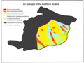 Landform studies 2.png 2,160 × 1,620; 363 KB
-
 Landforms studies.png 2,149 × 1,604; 276 KB
-
 Landslides from hk.png 2,845 × 2,051; 422 KB
-
 Living, meandering river constructed (14932315518).jpg 1,908 × 1,200; 373 KB
-
 Schéma bastide modèle Aquitain.jpg 483 × 386; 19 KB
-
 Schéma bastide modèle Gascon.jpg 483 × 386; 21 KB
-
 Sketch diagram on 1989 aerial photograph.jpg 1,961 × 1,437; 244 KB
%27_(11017526663).jpg)
.jpg)
.jpg)
.jpg)
.jpg)
%27_(11292496335).jpg)
.jpg)
.jpg)
.jpg)
%27_(11161860376).jpg)
%27_(11122065963).jpg)
.jpg)
.jpg)
.jpg)
.jpg)
.jpg)
.jpg)
.jpg)
,_etc%27_(11150571553).jpg)
%27_(11016611613).jpg)
.jpg)
.jpg)
%27_(11017682726).jpg)
.jpg)
.jpg)
%27_(11018149763).jpg)
%27_(11230659264).jpg)
.jpg)
.jpg)
.jpg)
.jpg)
%27_(11016958453).jpg)
%27_(11018878824).jpg)
%27_(11016926243).jpg)
%27_(11232784296).jpg)

_-_dessin%C3%A9s_par..._-_btv1b52503974g_(013_of_106).jpg)
_-_dessin%C3%A9s_par..._-_btv1b52503974g_(015_of_106).jpg)
.jpg)


.jpg)


.jpg)


%27_(11238387434).jpg)