Category:School XIX
| Object location | | View all coordinates using: OpenStreetMap |
|---|
 | |||||
| Upload media | |||||
| Instance of | |||||
|---|---|---|---|---|---|
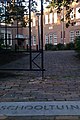
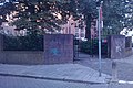
| Location | Arnhem, Gelderland, Netherlands | ||||
| Street address |
| ||||
| Located on street | |||||
| Heritage designation |
| ||||
 | |||||
|
This is a category about rijksmonument number 516935
|
| Address |
|
Media in category "School XIX"
The following 6 files are in this category, out of 6 total.
-
 Arnhem - Spijkerstraat 49-1.jpg 1,728 × 2,592; 1.65 MB
-
 Arnhem - Spijkerstraat 49-2.jpg 2,592 × 1,728; 1.67 MB
-
 Arnhem - Spijkerstraat 49-3.jpg 2,592 × 1,728; 1.12 MB
-
 Arnhem - Spijkerstraat 49-4.jpg 2,592 × 1,728; 1.2 MB
-
 Arnhem - Spijkerstraat 49-5.jpg 2,592 × 1,728; 925 KB
-
 Arnhem - Spijkerstraat 49.jpg 2,592 × 1,728; 1.47 MB


