Category:Schools in the East Riding of Yorkshire
Ceremonial counties of England: Bedfordshire · Berkshire · Buckinghamshire · Cambridgeshire · Cheshire · Cornwall · Cumbria · Derbyshire · Devon · Dorset · Durham · East Riding of Yorkshire · East Sussex · Essex · Gloucestershire · Greater London · Greater Manchester · Hampshire · Herefordshire · Hertfordshire · Kent · Lancashire · Leicestershire · Lincolnshire · Merseyside · Norfolk · North Yorkshire · Northamptonshire · Northumberland · Nottinghamshire · Oxfordshire · Rutland · Shropshire · Somerset · South Yorkshire · Staffordshire · Suffolk · Surrey · Tyne and Wear · Warwickshire · West Midlands · West Sussex · West Yorkshire · Wiltshire · Worcestershire
City-counties: Bristol · City of London
Former historic counties: Huntingdonshire · Middlesex · Yorkshire
Other former counties:
City-counties: Bristol · City of London
Former historic counties: Huntingdonshire · Middlesex · Yorkshire
Other former counties:
Wikimedia category | |||||
| Upload media | |||||
| Instance of | |||||
|---|---|---|---|---|---|
| |||||
Subcategories
This category has the following 17 subcategories, out of 17 total.
B
C
D
- Schools in Driffield (5 F)
F
H
- Schools in Hessle (5 F)
M
- Schools in Market Weighton (3 F)
P
- Pocklington School (5 F)
S
T
- Tranby (25 F)
Media in category "Schools in the East Riding of Yorkshire"
The following 51 files are in this category, out of 51 total.
-
 "The Coach and Horses" at Dunswell (geograph 4506539).jpg 4,435 × 3,558; 3.77 MB
-

-
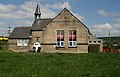
 Barmby on the Marsh school.jpg 598 × 405; 123 KB
-
 Beswick and Watton Primary School.jpg 640 × 503; 207 KB
-
 Bransholme, Kingston upon Hull current county-UA top (joint) (geograph 3325499).jpg 1,600 × 1,200; 547 KB
-
 Dunswell Primary School (geograph 4349882).jpg 640 × 480; 70 KB
-
 Ganton Special School, Anlaby (geograph 3314211).jpg 800 × 600; 182 KB
-
 Greens Lane, Wawne (geograph 5955076).jpg 1,600 × 1,064; 653 KB
-
 Hill Top Farm and Cumbrian Way junction (geograph 4474201).jpg 3,550 × 2,623; 2.61 MB
-
 Homethorpe, Orchard Park Estate, Hull (geograph 3250715).jpg 800 × 600; 216 KB
-
 Hornsea School.jpg 640 × 480; 93 KB
-
 Inmans' Phoenix - geograph.org.uk - 1729745.jpg 3,558 × 2,312; 2.9 MB
-
 K6 telephone box on Beverley Road, Dunswell (geograph 6104306).jpg 800 × 612; 120 KB
-
 Kirk Ella Community School.jpg 640 × 480; 196 KB
-
 Langtoft Primary School.jpg 640 × 480; 72 KB
-
 Langtoft(StephenHorncastle)Apr2006.jpg 640 × 480; 117 KB
-

-
 Nursery and Church, Sancton - geograph.org.uk - 801819.jpg 640 × 371; 178 KB
-

-

-
 Rawcliffe Bridge School.jpg 640 × 442; 75 KB
-
 School - Church Road (geograph 2530560).jpg 640 × 480; 52 KB
-
 School and War Memorial Brandesburton.jpg 640 × 353; 302 KB
-
 School Lane, Beverley - geograph.org.uk - 1519301.jpg 640 × 480; 86 KB
-
 Sir Henry Cooper School Hull.jpg 640 × 480; 117 KB
-
 Snaith, Old Grammar School - geograph.org.uk - 242953.jpg 640 × 480; 122 KB
-
-
 St Andrew's Primary School, Kirk Ella (geograph 6117487).jpg 4,883 × 3,120; 2.71 MB
-
 St. Anne's School, Welton - geograph.org.uk - 903111.jpg 640 × 376; 69 KB
-
 Sunrise over Ketwell School - geograph.org.uk - 639335.jpg 640 × 480; 106 KB
-
 Sutton upon Derwent Primary School - geograph.org.uk - 353956.jpg 640 × 480; 52 KB
-
 Sydney Smith School - geograph.org.uk - 1774466.jpg 640 × 480; 72 KB
-
 Sydney Smith School.jpg 640 × 480; 169 KB
-
 The Coach and Horses, China Red, Dunswell (geograph 6104305).jpg 4,761 × 3,297; 3.32 MB
-
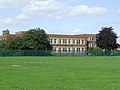
 The new Andrew Marvell college, Hull (geograph 3268767).jpg 800 × 600; 120 KB
-
 The new Welton Primary School - geograph.org.uk - 714638.jpg 640 × 389; 170 KB
-
 The nursery, Sancton - geograph.org.uk - 801785.jpg 640 × 412; 84 KB
-
 The Snaith School (geograph 4231567).jpg 1,024 × 768; 159 KB
-

-
 The Village School Wawne.jpg 640 × 427; 158 KB
-

-
 White telephone box on Beverley Road (A1174) (geograph 4351230).jpg 640 × 480; 61 KB
-
 Willerby Carr Lane Primary School. - geograph.org.uk - 1440560.jpg 640 × 480; 70 KB
-
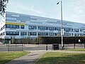 Winifred Holtby School, Bransholme, Hull (geograph 3674681).jpg 800 × 600; 151 KB
-
 Wolfreton School - geograph.org.uk - 407730.jpg 640 × 406; 286 KB
-
 Wolfreton School, Willerby (geograph 6889831).jpg 1,024 × 768; 1.18 MB
-
 Wolfreton School.jpg 640 × 466; 77 KB
-
 Woodmansey Church of England Primary School (geograph 4808640).jpg 1,024 × 768; 134 KB
-
 Woodmansey CofE Primary School.jpg 640 × 458; 159 KB
-
 Woodmansey Primary School (geograph 4349901).jpg 640 × 480; 76 KB
-
 Woodmansey Primary School (geograph 6349396).jpg 800 × 524; 67 KB
.jpg)
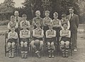
_Football_team_1954-55_(archive_ref_SL250-1)_(27728207745).jpg)


_(geograph_3325499).jpg)
.jpg)
.jpg)
.jpg)
.jpg)
.jpg)


.jpg)


Apr2006.jpg)
_(35373187200).jpg)

_(25317698901).jpg)
_(28000556750).jpg)

.jpg)


_Football_team_1953_(archive_ref_SL10-24)_(27450171240).jpg)
.jpg)


.jpg)
.jpg)


.jpg)
.jpg)

.jpg)
_(geograph_4351230).jpg)

.jpg)

.jpg)

.jpg)

.jpg)
.jpg)