Category:Schools in the London Borough of Barking and Dagenham

Wikimedia category | |||||
| Upload media | |||||
| Instance of | |||||
|---|---|---|---|---|---|
| Category combines topics | |||||
| London | |||||
capital and largest city of England and the United Kingdom     .svg)   | |||||
| Pronunciation audio | |||||
| Instance of |
| ||||
| Location |
| ||||
| Located in or next to body of water | |||||
| Official language | |||||
| Head of government |
| ||||
| Inception |
| ||||
| Significant event |
| ||||
| Highest point |
| ||||
| Population |
| ||||
| Area |
| ||||
| Elevation above sea level |
| ||||
| Replaces | |||||
| IATA airport code |
| ||||
| Different from | |||||
| official website | |||||
 | |||||
Media in category "Schools in the London Borough of Barking and Dagenham"
The following 17 files are in this category, out of 17 total.
-
 Barking Abbey Comprenhesive School - geograph.org.uk - 3397396.jpg 4,288 × 3,216; 7.23 MB
-
 Barking Abbey School Escutcheon.png 311 × 342; 45 KB
-
 Barking reach school.jpg 3,072 × 2,304; 1.31 MB
-
 Eastbury Comprehensive School - geograph.org.uk - 2566240.jpg 1,024 × 768; 234 KB
-
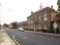
 Eastbury School - geograph.org.uk - 151886.jpg 640 × 426; 60 KB
-
 Ecslogo.svg 1,024 × 256; 8 KB
-
 Entrance to Eastbury Comprehensive School - geograph.org.uk - 2566261.jpg 1,024 × 768; 270 KB
-
 Goresbrook School.jpg 3,568 × 2,296; 2.13 MB
-
 Jo Richardson Community School 1.jpg 4,096 × 2,113; 1.89 MB
-
 Jo Richardson Community School 2.jpg 4,096 × 3,072; 3.29 MB
-
 Jo Richardson Community School 3.jpg 4,096 × 3,072; 3.07 MB
-
 Manor Junior School - main building - geograph.org.uk - 2566108.jpg 1,024 × 768; 234 KB
-
 Manor Junior School - main building, south end - geograph.org.uk - 2566126.jpg 1,024 × 768; 199 KB
-
 Northbury Junior and Infant School, Barking - geograph.org.uk - 3265663.jpg 4,288 × 3,216; 4.89 MB
-
 St Joseph's RC Primary School - geograph.org.uk - 2783748.jpg 640 × 480; 65 KB
-
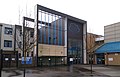
 The Westbury Centre - geograph.org.uk - 166518.jpg 640 × 480; 77 KB
-


