Category:Schoorlse Duinen
protected area in Kingdom of the Netherlands | |||||
| Upload media | |||||
| Instance of |
| ||||
|---|---|---|---|---|---|
| Location | Schoorl, North Holland, Netherlands | ||||
| IUCN protected areas category | |||||
| Inception |
| ||||
| Area |
| ||||
 | |||||
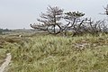
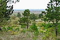
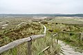
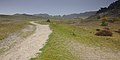
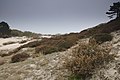
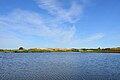
Nederlands: Afbeeldingen van de Schoorlse Duinen, een duingebied ten westen van Schoorl, behorende tot de gemeente Bergen, in de provincie Noord-Holland in het noorden van Nederland. De Schoorlse Duinen zijn de hoogste (55,4 meter) en breedste (5 kilometer) duinen van Nederland
Subcategories
This category has the following 4 subcategories, out of 4 total.
Media in category "Schoorlse Duinen"
The following 37 files are in this category, out of 37 total.
-
 20170926 Schoorlsche Duinen13.jpg 2,552 × 1,701; 619 KB
-
 20170926 Schoorlsche Duinen2.jpg 2,592 × 1,728; 1.16 MB
-
 20170926 Schoorlsche Duinen3.jpg 2,495 × 1,663; 1.01 MB
-
 20170926 Schoorlsche Duinen5.jpg 2,592 × 1,728; 1,023 KB
-
 20170926 Schoorlsche Duinen6.jpg 2,592 × 1,728; 1.09 MB
-
 20170926 Schoorlsche Duinen7.jpg 2,526 × 1,684; 1.24 MB
-
 20170926 Schoorlsche Duinen8.jpg 2,575 × 1,716; 1.04 MB
-
 20170926 Schoorlsche Duinen9.jpg 2,592 × 1,728; 892 KB
-
 360° panoramics op Schoorlse Duinen.jpg 21,350 × 2,053; 47.34 MB
-
 Cougarblussing.JPG 2,448 × 3,264; 1.53 MB
-
 De duinen van Schoorl.jpg 4,032 × 3,024; 2.89 MB
-
 Een duintop in de duinen van Schoorl.jpg 4,032 × 3,024; 3.85 MB
-
 Klein Zwitserland tussen Bergen en Schoorl.jpg 3,426 × 2,194; 761 KB
-
 Schoorlse Duinen (02).jpg 4,310 × 2,868; 4.99 MB
-
 Schoorlse Duinen (03).jpg 4,310 × 2,868; 6.43 MB
-
 Schoorlse Duinen (04).jpg 4,310 × 2,868; 5.08 MB
-
 Schoorlse Duinen (05).jpg 4,200 × 2,793; 4.87 MB
-
 Schoorlse Duinen (06).jpg 4,310 × 2,868; 5.5 MB
-
 Schoorlse Duinen (07).jpg 2,499 × 3,758; 3.65 MB
-
 Schoorlse Duinen (08).jpg 4,310 × 2,868; 5.39 MB
-
 Schoorlse Duinen (09).jpg 4,310 × 2,868; 6.66 MB
-
 Schoorlse Duinen (10).jpg 4,310 × 2,868; 7.25 MB
-
 Schoorlse Duinen (11).jpg 4,310 × 2,868; 5.66 MB
-
 Schoorlse Duinen (12).jpg 4,310 × 2,155; 4.06 MB
-
 Schoorlse Duinen 01.jpg 5,472 × 3,648; 4.91 MB
-
 Schoorlse Duinen 02.jpg 5,472 × 3,648; 4.87 MB
-
 Schoorlse Duinen 03.jpg 5,472 × 3,648; 6.15 MB
-
 Schoorlse Duinen 04.jpg 3,648 × 5,472; 6.15 MB
-
 Schoorlse Duinen 05.jpg 3,648 × 5,472; 5.95 MB
-
 Schoorlse Duinen 06.jpg 5,472 × 3,648; 5.99 MB
-
 Schoorlse Duinen 07.jpg 5,472 × 3,648; 5.33 MB
-
 Schoorlse Duinen 08.jpg 5,472 × 3,648; 7.97 MB
-
 Schoorlse Duinen 09.jpg 5,472 × 3,648; 4.65 MB
-
 Schoorlse Duinen 10.jpg 5,472 × 3,648; 6.43 MB
-
 Schoorlse Duinen.jpg 4,310 × 2,868; 4.86 MB
-
 Speelkuil, Schoorlse Duinen, 2022.jpg 5,835 × 3,880; 13.02 MB
-
 Vogelmeer, Schoorlse Duinen, 2022.jpg 5,979 × 3,975; 12.27 MB


.jpg)
.jpg)
.jpg)
.jpg)
.jpg)
.jpg)
.jpg)
.jpg)
.jpg)
.jpg)
.jpg)


