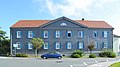
Category:Schulstraße 3-5 (Wehrheim)
| Object location | | View all coordinates using: OpenStreetMap |
|---|
| Upload media | |||||
| Instance of | |||||
|---|---|---|---|---|---|
| Location |
| ||||
| Heritage designation | |||||
| Inception |
| ||||
| Dissolved, abolished or demolished date |
| ||||
 | |||||
This is the category of the Hessian Kulturdenkmal (cultural monument) with the ID 100457 (Wikidata)
|
Media in category "Schulstraße 3-5 (Wehrheim)"
The following 2 files are in this category, out of 2 total.
-
 Wehrheim, Schulstraße 3-5 (1).jpg 5,615 × 3,160; 13.32 MB
-
 Wehrheim, Schulstraße 3-5.jpg 5,848 × 3,264; 12.52 MB
.jpg)
