Category:Sculthorpe, Norfolk
English: Sculthorpe is a village and civil parish in the English county of Norfolk. The village is situated some south-east of South Creake.
village and civil parish in Norfolk, England   | |||||
| Upload media | |||||
| Instance of | |||||
|---|---|---|---|---|---|
| Location | North Norfolk, Norfolk, East of England, England | ||||
| Area |
| ||||
 | |||||
Subcategories
This category has the following 4 subcategories, out of 4 total.
Media in category "Sculthorpe, Norfolk"
The following 108 files are in this category, out of 108 total.
-
 A colourful collection in Sculthorpe - geograph.org.uk - 2313334.jpg 2,848 × 2,136; 2.88 MB
-
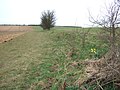
 A new hedge and plantation - geograph.org.uk - 2313191.jpg 2,848 × 2,136; 3.04 MB
-
 A rear view of Sculthorpe Mill, Norfolk - geograph.org.uk - 2165434.jpg 2,848 × 2,136; 2.91 MB
-
 A1065 - geograph.org.uk - 3835013.jpg 640 × 430; 46 KB
-

-
 A1065 near Fakenham - geograph.org.uk - 4638191.jpg 640 × 427; 351 KB
-
 A1065, Fakenham - geograph.org.uk - 5557827.jpg 640 × 480; 74 KB
-
 A148 - geograph.org.uk - 3835017.jpg 640 × 430; 49 KB
-
 A148 Creake Road - geograph.org.uk - 5019869.jpg 1,932 × 1,264; 1.57 MB
-
 A148 towards Cromer - geograph.org.uk - 5557830.jpg 640 × 480; 76 KB
-
 Approaching roundabout on A1065 - geograph.org.uk - 5019835.jpg 640 × 405; 74 KB
-
 B1105 towards Wells - geograph.org.uk - 5557833.jpg 640 × 480; 62 KB
-
 B1355 along Lodge Plantation - geograph.org.uk - 5019919.jpg 1,600 × 1,099; 477 KB
-
 Car Boot site advertising board beside the B1105 - geograph.org.uk - 5950693.jpg 2,592 × 1,944; 2.86 MB
-
 Claypit Clump near Cranmer Park - geograph.org.uk - 2313197.jpg 2,848 × 2,136; 3.19 MB
-
 Countryside off New Road - geograph.org.uk - 2313158.jpg 2,848 × 2,136; 3.2 MB
-

-
 Derelict building on New Road - geograph.org.uk - 2313168.jpg 2,848 × 2,136; 3.24 MB
-
 Designated car boot sale site off the B1105 - geograph.org.uk - 5950701.jpg 2,592 × 1,944; 2.92 MB
-
 End of the boardwalk, Hempton Marsh - geograph.org.uk - 5807126.jpg 1,600 × 1,200; 806 KB
-
 Entrance to Hempton Marsh - geograph.org.uk - 5807118.jpg 1,600 × 1,200; 640 KB
-
 Fakenham Driving Range Clubhouse - geograph.org.uk - 419823.jpg 640 × 480; 113 KB
-
 Fakenham new cemetery - geograph.org.uk - 5616238.jpg 3,332 × 2,455; 1.8 MB
-
 Fields from the B1355 - geograph.org.uk - 6017374.jpg 768 × 1,024; 97 KB
-
 Fields near Fakenham - geograph.org.uk - 2077105.jpg 800 × 531; 102 KB
-
 Ford at Sculthorpe mill - geograph.org.uk - 2047215.jpg 640 × 480; 118 KB
-
 Ford at Sculthorpe Mill on the River Wensum - geograph.org.uk - 2783774.jpg 3,264 × 2,448; 3.01 MB
-
 Grain dryer north of Fakenham - geograph.org.uk - 5557832.jpg 640 × 374; 58 KB
-
 Grassland towards Trap Lane - geograph.org.uk - 5557831.jpg 640 × 480; 86 KB
-
 Hide at Hempton Marsh - geograph.org.uk - 5807119.jpg 1,600 × 1,200; 643 KB
-
-
 Moor Lane in Sculthorpe, Norfolk - geograph.org.uk - 2313330.jpg 2,848 × 2,136; 3.11 MB
-
 National speed limit signs near Sculthorpe church - geograph.org.uk - 5592511.jpg 3,456 × 2,592; 3.95 MB
-
 New Road near Sculthorpe, Norfolk - geograph.org.uk - 2313112.jpg 2,848 × 2,136; 3.15 MB
-
 New Road, Sculthorpe, Norfolk - geograph.org.uk - 2165470.jpg 2,848 × 2,136; 3.04 MB
-
 No sign of spring yet - geograph.org.uk - 1761130.jpg 2,848 × 2,136; 3.08 MB
-
 Passing by Fakenham - geograph.org.uk - 6230298.jpg 1,946 × 1,290; 569 KB
-
 Perimeter Gate, Sculthorpe Airfield - geograph.org.uk - 440893.jpg 640 × 480; 108 KB
-
 Ploughing west of Fakenham - geograph.org.uk - 1761151.jpg 2,848 × 2,136; 2.99 MB
-
 Power lines cross the B1355 - geograph.org.uk - 5019895.jpg 2,125 × 1,415; 1.96 MB
-
 River Wensum from bridge at Doughton - geograph.org.uk - 441007.jpg 640 × 480; 145 KB
-
 Rudham Road Gate Plantation - geograph.org.uk - 2313179.jpg 2,848 × 2,136; 3.14 MB
-

-
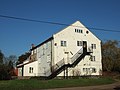
 Sculthorpe Mill - geograph.org.uk - 556668.jpg 640 × 427; 94 KB
-
 Sculthorpe mill, Norfolk - geograph.org.uk - 2047438.jpg 640 × 480; 118 KB
-
 Sculthorpe mill. - geograph.org.uk - 1541612.jpg 640 × 480; 79 KB
-
 Sculthorpe War Memorials - geograph.org.uk - 4583188.jpg 3,456 × 2,592; 3.87 MB
-
 Sculthorpe, Manor Farm - geograph.org.uk - 4644224.jpg 3,678 × 2,456; 4.74 MB
-
 Sculthorpe, St. Mary and All Saints Church - geograph.org.uk - 4644197.jpg 4,653 × 2,825; 7.04 MB
-
 Sculthorpe, St. Mary and All Saints Church - geograph.org.uk - 4644201.jpg 3,678 × 2,456; 4.87 MB
-
 Sculthorpe, St. Mary and All Saints Church - geograph.org.uk - 4644202.jpg 3,602 × 2,336; 3.92 MB
-
 Sculthorpe, St. Mary and All Saints Church - geograph.org.uk - 4644206.jpg 3,577 × 2,287; 4.4 MB
-
 Sculthorpe, St. Mary and All Saints Church - geograph.org.uk - 4644210.jpg 4,801 × 2,915; 7.39 MB
-
 Sculthorpe, St. Mary and All Saints Church - geograph.org.uk - 4644215.jpg 3,964 × 2,664; 5.49 MB
-
 Sculthorpe, St. Mary and All Saints Church - geograph.org.uk - 4644219.jpg 3,539 × 2,234; 3.71 MB
-
 Sculthorpe, St. Mary and All Saints Church - geograph.org.uk - 4644221.jpg 3,627 × 2,373; 4.81 MB
-
 Sculthorpe, St. Mary and All Saints Church - geograph.org.uk - 4644226.jpg 3,627 × 2,373; 5.23 MB
-

-

-
 Sculthorpe, St. Mary and All Saints Church, nave capital - geograph.org.uk - 4644284.jpg 3,902 × 2,191; 4.32 MB
-

-

-

-
 Sculthorpe, St. Mary and All Saints Church, The nave - geograph.org.uk - 4644264.jpg 5,156 × 3,284; 7.39 MB
-
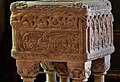
 Sculthorpe, St. Mary and All Saints Church, The Norman font - geograph.org.uk - 4644229.jpg 3,678 × 2,456; 5.96 MB
-
 Sculthorpe, St. Mary and All Saints Church, The Norman font - geograph.org.uk - 4644233.jpg 2,233 × 2,765; 3.07 MB
-
 Sculthorpe, St. Mary and All Saints Church, The Norman font - geograph.org.uk - 4644241.jpg 3,451 × 2,936; 6.19 MB
-
 Sculthorpe, St. Mary and All Saints Church, The Norman font - geograph.org.uk - 4644242.jpg 3,564 × 2,909; 6.69 MB
-
 Sculthorpe, St. Mary and All Saints Church, The Norman font - geograph.org.uk - 4644248.jpg 4,019 × 2,701; 7.45 MB
-
 Sculthorpe, St. Mary and All Saints Church, The Norman font - geograph.org.uk - 4644249.jpg 3,663 × 2,431; 6.21 MB
-
 Sculthorpe, St. Mary and All Saints Church, The Norman font - geograph.org.uk - 4644254.jpg 3,708 × 3,601; 6.69 MB
-
 Sculthorpe, St. Mary and All Saints Church, The Norman font - geograph.org.uk - 4644256.jpg 3,646 × 2,399; 5.87 MB
-
 Sculthorpe, St. Mary and All Saints Church, The Norman font - geograph.org.uk - 4644272.jpg 3,564 × 2,438; 4.82 MB
-
 Sign for Sculthorpe Mill near Fakenham, Norfolk - geograph.org.uk - 2165438.jpg 2,848 × 2,136; 3.02 MB
-
 The B1355 - geograph.org.uk - 2077114.jpg 800 × 531; 117 KB
-
 The B1355 Fakenham to South Creake Road - geograph.org.uk - 2077097.jpg 800 × 531; 108 KB
-
 The River Wensum at Sculthorpe Mill near Fakenham - geograph.org.uk - 2165472.jpg 2,848 × 2,136; 2.89 MB
-
 The River Wensum flowing under Sculthorpe Mill in Norfolk - geograph.org.uk - 2165435.jpg 2,848 × 2,136; 3.04 MB
-
 Tractor on the A148 near Fakenham - geograph.org.uk - 4638200.jpg 640 × 427; 347 KB
-
 UK Sculthorpe.jpg 658 × 1,855; 271 KB
-
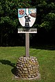 Village sign - geograph.org.uk - 1411747.jpg 428 × 639; 76 KB
-
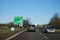
 Welcome to Fakenham - geograph.org.uk - 5557823.jpg 640 × 480; 105 KB
-
-
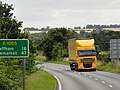 Yellow HGV on A1065 near Fakenham - geograph.org.uk - 4638196.jpg 640 × 480; 362 KB
-
 Barn - geograph.org.uk - 456347.jpg 640 × 480; 109 KB
-

-

-

-
 Fakenham Road, Sculthorpe - geograph.org.uk - 419706.jpg 640 × 480; 87 KB
-
 Falgate Farm, Sculthorpe - geograph.org.uk - 419709.jpg 640 × 480; 97 KB
-
 Farm in North Norfolk - geograph.org.uk - 261725.jpg 640 × 480; 87 KB
-
 Farmhouse, Dunton Farm - geograph.org.uk - 440992.jpg 640 × 480; 135 KB
-
 Grange Barns - geograph.org.uk - 401434.jpg 640 × 480; 110 KB
-
 Hereford Barn, Shereford - geograph.org.uk - 441009.jpg 640 × 480; 119 KB
-

-
 Mill Cottage - geograph.org.uk - 556679.jpg 640 × 427; 85 KB
-
 Mill Restaurant, Shereford - geograph.org.uk - 441013.jpg 640 × 480; 114 KB
-
 Moor Plantation, Sculthorpe Moor - geograph.org.uk - 441023.jpg 640 × 480; 99 KB
-
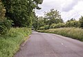
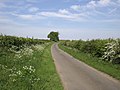
 New Road, near Sculthorpe - geograph.org.uk - 401430.jpg 640 × 480; 123 KB
-

-
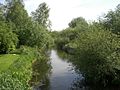
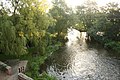 River Wensum - geograph.org.uk - 556676.jpg 640 × 427; 100 KB
-
 Roman Road - geograph.org.uk - 261721.jpg 640 × 480; 95 KB
-
 Rudham Road near Sculthorpe Airfield - geograph.org.uk - 400590.jpg 640 × 480; 102 KB
-
 Sculthorpe Mill - geograph.org.uk - 556673.jpg 640 × 427; 83 KB
-

-
 Taxi way, Sculthorpe Airfield - geograph.org.uk - 401420.jpg 640 × 480; 94 KB
-
 Track running west from Dunton - geograph.org.uk - 440900.jpg 640 × 480; 136 KB
-


