Category:Seaton, East Riding of Yorkshire
English: Seaton is a village and civil parish in the East Riding of Yorkshire, England. It is situated approximately 2.5 miles (4 km) west of Hornsea on the B1244 road.
village in the East Riding of Yorkshire, England, United Kingdom  | |||||
| Upload media | |||||
| Instance of | |||||
|---|---|---|---|---|---|
| Location | East Riding of Yorkshire, Yorkshire and the Humber, England | ||||
 | |||||
Subcategories
This category has the following 2 subcategories, out of 2 total.
Media in category "Seaton, East Riding of Yorkshire"
The following 185 files are in this category, out of 185 total.
-
 "The Swan Inn", Seaton - geograph.org.uk - 4266924.jpg 4,981 × 3,576; 4.63 MB
-
 A flood on the Nunkeeling Road - geograph.org.uk - 2198566.jpg 800 × 600; 287 KB
-
 A footpath to Brockholme Farm - geograph.org.uk - 2278676.jpg 800 × 600; 223 KB
-
 A Seaton Land Drain - geograph.org.uk - 1816312.jpg 3,648 × 2,736; 4.05 MB
-
 AA road sign, The Swan Inn, Seaton - geograph.org.uk - 5540280.jpg 1,110 × 833; 204 KB
-
 Alongside Catfoss Drain - geograph.org.uk - 5621121.jpg 1,024 × 768; 199 KB
-
 Alongside Catfoss Whin Covert - geograph.org.uk - 5620996.jpg 1,024 × 768; 213 KB
-
 An unusual Letterbox - geograph.org.uk - 3351688.jpg 3,000 × 4,000; 2.83 MB
-
 Autumn sown crop near Goxhill - geograph.org.uk - 5583384.jpg 1,024 × 768; 247 KB
-
 Autumn sown field near Bassymore - geograph.org.uk - 5621007.jpg 1,024 × 768; 174 KB
-
 Avenue at Wassand - geograph.org.uk - 1821952.jpg 2,900 × 2,192; 2.98 MB
-
 B1244 towards Seaton - geograph.org.uk - 1326407.jpg 640 × 480; 78 KB
-
 B1244 towards Seaton - geograph.org.uk - 1326427.jpg 640 × 480; 72 KB
-
 Back Lane, Seaton - geograph.org.uk - 5621094.jpg 1,024 × 768; 160 KB
-
 Bales by Bewholme Lane - geograph.org.uk - 4841449.jpg 574 × 640; 595 KB
-
 Bassymore Farm - geograph.org.uk - 5621004.jpg 1,024 × 768; 127 KB
-
 Bassymore Hill and Bassymore Plantation - geograph.org.uk - 5621000.jpg 1,024 × 768; 172 KB
-
 Bewholme Lane leading out of Seaton - geograph.org.uk - 3351603.jpg 4,000 × 3,000; 4.01 MB
-
 Bewholme Lane, Seaton - geograph.org.uk - 2097114.jpg 800 × 600; 253 KB
-
 Bewholme Lane, Seaton - geograph.org.uk - 4841207.jpg 640 × 427; 137 KB
-
 Blashills, near Seaton - geograph.org.uk - 4840647.jpg 427 × 640; 130 KB
-
 Bonfield Farm - geograph.org.uk - 1326482.jpg 640 × 480; 90 KB
-
 Bonfield Farm - geograph.org.uk - 41165.jpg 640 × 480; 110 KB
-
 Bridleway near Home Farm - geograph.org.uk - 4841554.jpg 1,200 × 799; 590 KB
-
 Butcher Row, Seaton - geograph.org.uk - 425780.jpg 640 × 503; 91 KB
-
 Buttercup Farm, Seaton - geograph.org.uk - 857252.jpg 640 × 396; 111 KB
-
 Carr Dike - geograph.org.uk - 5621010.jpg 1,024 × 768; 160 KB
-
 Catfoss Aerodrome southside - geograph.org.uk - 2890979.jpg 3,264 × 2,448; 2.13 MB
-
 Catfoss Bridge - geograph.org.uk - 4842219.jpg 640 × 427; 420 KB
-
 Catfoss Bridge - geograph.org.uk - 5621127.jpg 1,024 × 768; 259 KB
-
 Catfoss Bridge looking East - geograph.org.uk - 2890838.jpg 3,264 × 2,448; 1.98 MB
-
 Catfoss Drain from Washdike Bridge - geograph.org.uk - 2890822.jpg 3,264 × 2,448; 3.19 MB
-
 Catfoss Grange and field of oilseed rape - geograph.org.uk - 5620991.jpg 1,024 × 768; 173 KB
-
 Catfoss Grange Farm - geograph.org.uk - 1326920.jpg 640 × 480; 88 KB
-
 Catfoss Postbox and set back houses - geograph.org.uk - 3361142.jpg 4,000 × 3,000; 3.35 MB
-
 Catfoss Whin Covert - geograph.org.uk - 1326916.jpg 640 × 480; 106 KB
-
 Cleaned out field drain and new fence - geograph.org.uk - 4892666.jpg 1,024 × 767; 400 KB
-
 Common Farm - geograph.org.uk - 5621025.jpg 1,024 × 768; 159 KB
-
 Common Farm and Nicholson Lane - geograph.org.uk - 5621028.jpg 1,024 × 768; 248 KB
-
 Common Farm from Nicholson Lane (Tk) - geograph.org.uk - 3351599.jpg 4,000 × 3,000; 4.57 MB
-
 Common Lane - geograph.org.uk - 5621022.jpg 1,024 × 768; 217 KB
-
 Communications mast at Seaton Grange - geograph.org.uk - 5621016.jpg 1,024 × 768; 135 KB
-
 Cottages in Back Lane, Seaton - geograph.org.uk - 5621106.jpg 1,024 × 768; 217 KB
-
 Cottages on Bewholme Lane, Seaton - geograph.org.uk - 5621101.jpg 1,024 × 768; 172 KB
-
 Cousin Closes, Seaton - geograph.org.uk - 857255.jpg 640 × 476; 114 KB
-
 Crofting Drain near Seaton - geograph.org.uk - 4841868.jpg 1,200 × 799; 617 KB
-
 Croftings, Seaton - geograph.org.uk - 612256.jpg 640 × 457; 98 KB
-
 Disused Aerodrome Catfoss - geograph.org.uk - 2890964.jpg 3,264 × 2,448; 1.51 MB
-
 Driveway to Wassand Hall - geograph.org.uk - 4638620.jpg 640 × 427; 84 KB
-
 East of Seaton - geograph.org.uk - 857253.jpg 640 × 480; 128 KB
-
 Entering Catfoss - geograph.org.uk - 4842221.jpg 640 × 427; 387 KB
-
 Entering Catfoss from the south - geograph.org.uk - 3361158.jpg 4,000 × 3,000; 2.68 MB
-
 Farm and houses, Breamer Lane, Seaton - geograph.org.uk - 5621112.jpg 1,024 × 768; 164 KB
-
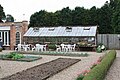
 Farm Buildings at Wassand Hall - geograph.org.uk - 2096966.jpg 800 × 600; 359 KB
-
 Farm Flowers - geograph.org.uk - 1335083.jpg 480 × 640; 186 KB
-
 Farm track and footpath near Buttercup Farm - geograph.org.uk - 5737137.jpg 1,024 × 768; 166 KB
-
 Farmhouse at Seaton Hold - geograph.org.uk - 4841768.jpg 640 × 480; 563 KB
-
 Farmland - Bewholme, Seaton Road - geograph.org.uk - 41160.jpg 640 × 480; 127 KB
-
 Farmland East of Seaton - geograph.org.uk - 1326445.jpg 640 × 480; 72 KB
-
 Farmland near Seaton - geograph.org.uk - 4841849.jpg 1,200 × 799; 414 KB
-
 Field Boundary - geograph.org.uk - 1326456.jpg 640 × 480; 95 KB
-
 Field drain off Bewholme Lane - geograph.org.uk - 1841209.jpg 640 × 480; 96 KB
-

-
 Footpath across pastureland - geograph.org.uk - 5540298.jpg 2,000 × 1,500; 388 KB
-
 Footpath through grassland - geograph.org.uk - 5540296.jpg 2,000 × 1,500; 475 KB
-
 Footpath to Wassand - geograph.org.uk - 5581086.jpg 1,024 × 768; 260 KB
-
 Former post office, Seaton - geograph.org.uk - 5540272.jpg 2,000 × 1,500; 477 KB
-
 Garage, Mill Hill - geograph.org.uk - 5540248.jpg 2,000 × 1,500; 402 KB
-
 Gardens, Wassand Hall - geograph.org.uk - 4638653.jpg 640 × 427; 97 KB
-

-
 Grundill Lane, Seaton - geograph.org.uk - 612255.jpg 640 × 473; 120 KB
-
 Harsell Lane north of Seaton - geograph.org.uk - 2278701.jpg 800 × 600; 291 KB
-
 Harsell Lane, near Catfoss Grange - geograph.org.uk - 4842220.jpg 427 × 640; 452 KB
-
 Harsell Lane, near Seaton - geograph.org.uk - 4840635.jpg 640 × 427; 119 KB
-
 Hawthorns by Bewholme Lane - geograph.org.uk - 4841776.jpg 480 × 640; 553 KB
-
 Heading north towards Nunkeeling - geograph.org.uk - 2198569.jpg 800 × 600; 174 KB
-

-
 Home Farm at Wassand Park - geograph.org.uk - 4841558.jpg 1,200 × 799; 578 KB
-
 Hornsea Mere from Wassand Hall - geograph.org.uk - 6213660.jpg 4,608 × 3,456; 4.14 MB
-
 Hornsea Road Garage - geograph.org.uk - 828539.jpg 640 × 427; 57 KB
-
 Junction of paths at Springfield Wood - geograph.org.uk - 4841504.jpg 1,200 × 799; 543 KB
-
 Late Daffodils at Wassand - geograph.org.uk - 1821088.jpg 3,200 × 2,400; 3.26 MB
-
 Leafy Beck near Seaton - geograph.org.uk - 1326464.jpg 640 × 480; 137 KB
-
 Leas Lane, Seaton - geograph.org.uk - 5540250.jpg 2,000 × 1,500; 472 KB
-

-
 Main Street, Seaton - geograph.org.uk - 857256.jpg 640 × 454; 73 KB
-
 Manor Farm, Seaton - geograph.org.uk - 5540255.jpg 2,000 × 1,500; 474 KB
-
 Mill Lane - geograph.org.uk - 1326418.jpg 640 × 480; 103 KB
-
 Mill Lane Towards Bewholme - geograph.org.uk - 1326439.jpg 640 × 480; 79 KB
-
 Mill Lane, Seaton - geograph.org.uk - 1816308.jpg 3,648 × 2,736; 2.54 MB
-
 Minor Road Towards B1244 - geograph.org.uk - 1326930.jpg 640 × 480; 71 KB
-
 Minor Road Towards Seaton - geograph.org.uk - 1326489.jpg 640 × 480; 69 KB
-
 Minor Road Towards Seaton - geograph.org.uk - 1326915.jpg 640 × 480; 45 KB
-
 Minor Road Towards Seaton - geograph.org.uk - 1326922.jpg 640 × 480; 100 KB
-
 NE of Seaton - geograph.org.uk - 252092.jpg 640 × 480; 129 KB
-
 Nicholson Lane - geograph.org.uk - 5621026.jpg 1,024 × 768; 232 KB
-
 Nicholson Lane - geograph.org.uk - 5621113.jpg 1,024 × 768; 280 KB
-
 Parkland, Wassand Hall - geograph.org.uk - 4638752.jpg 640 × 451; 59 KB
-
 Parkland, Wassand Hall - geograph.org.uk - 4638756.jpg 640 × 427; 69 KB
-
 Path leading towards Seaton - geograph.org.uk - 4841569.jpg 1,200 × 783; 788 KB
-
 Path near Decoy Plantation - geograph.org.uk - 4841490.jpg 1,200 × 799; 535 KB
-
 Path near Decoy Plantation - geograph.org.uk - 4841502.jpg 1,200 × 799; 596 KB
-
 Pillboxes on a Hill - geograph.org.uk - 2890990.jpg 3,264 × 2,448; 1.54 MB
-
 Ploughing near Seaton Hold - geograph.org.uk - 4841467.jpg 640 × 450; 554 KB
-
 Pond, Seaton Common - geograph.org.uk - 5621108.jpg 1,024 × 768; 308 KB
-
 Poppies in the Rapeseed - geograph.org.uk - 1335093.jpg 539 × 640; 223 KB
-
 Postbox, Seaton - geograph.org.uk - 5540268.jpg 1,500 × 2,000; 424 KB
-
 Prepared field and Buttercup Farm - geograph.org.uk - 5737142.jpg 1,024 × 768; 156 KB
-
 Remington Avenue, Catfoss - geograph.org.uk - 2198572.jpg 800 × 600; 352 KB
-
 Round house - geograph.org.uk - 41174.jpg 640 × 480; 106 KB
-
 Seaton - geograph.org.uk - 30642.jpg 640 × 480; 116 KB
-
 Seaton and Sigglesthorne Recreation Hall - geograph.org.uk - 5540286.jpg 2,000 × 1,500; 362 KB
-
 Seaton Farm - geograph.org.uk - 41161.jpg 640 × 480; 130 KB
-
 Seaton Hold - geograph.org.uk - 1841205.jpg 640 × 480; 87 KB
-
 Seaton Hold Farm, Bewholme Lane, Seaton - geograph.org.uk - 2230572.jpg 800 × 600; 271 KB
-
 Seaton House 1.jpg 640 × 354; 176 KB
-
 Seaton House.jpg 640 × 427; 214 KB
-
 Seaton Infant School - geograph.org.uk - 30644.jpg 640 × 480; 107 KB
-
 Seaton Service Station - geograph.org.uk - 1497664.jpg 640 × 433; 195 KB
-
 Seaton, East Riding of Yorkshire UK parish locator map.svg 1,425 × 1,107; 1.68 MB
-
 Service Station, B1244 - geograph.org.uk - 1326400.jpg 640 × 480; 74 KB
-
 Sheep near Seaton Hold - geograph.org.uk - 4841781.jpg 640 × 482; 613 KB
-
 Signpost near Seaton - geograph.org.uk - 6131003.jpg 5,152 × 3,864; 2.83 MB
-
 Stable block, Wassand Hall - geograph.org.uk - 4638621.jpg 640 × 427; 81 KB
-
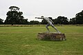
 Statue in grounds, Wassand Hall - geograph.org.uk - 4638651.jpg 640 × 427; 71 KB
-
 Struck in Series - geograph.org.uk - 1334782.jpg 640 × 529; 137 KB
-
 The B1244, Main Street, Seaton - geograph.org.uk - 2097108.jpg 800 × 600; 254 KB
-
 The driveway to Wassand Hall in Springtime - geograph.org.uk - 4892863.jpg 1,024 × 752; 631 KB
-
 The eastern edge of Seaton - geograph.org.uk - 5540288.jpg 2,000 × 1,500; 442 KB
-

-
 The Methodist chapel in Seaton, Yorkshire - geograph.org.uk - 4266923.jpg 4,946 × 3,754; 5.94 MB
-

-
 The Swan Inn - geograph.org.uk - 788415.jpg 640 × 427; 88 KB
-
 The Swan Inn, Seaton - geograph.org.uk - 1326472.jpg 640 × 480; 78 KB
-
 The Swan Inn, Seaton - geograph.org.uk - 5540275.jpg 2,000 × 1,500; 367 KB
-
 The way to Catfoss Hall - geograph.org.uk - 2198564.jpg 800 × 600; 327 KB
-
 Towards Seaton Grange - geograph.org.uk - 4841253.jpg 640 × 427; 128 KB
-
 Track at TA173472 - geograph.org.uk - 252093.jpg 640 × 480; 110 KB
-
 Track into Weather Hill Farm - geograph.org.uk - 4892658.jpg 1,024 × 759; 690 KB
-
 Track leading to Keepers Cottage - geograph.org.uk - 4841563.jpg 1,200 × 799; 452 KB
-
 Track leading to Wassand Balk - geograph.org.uk - 4841858.jpg 1,200 × 799; 485 KB
-
 Track leading to Wassand Balk - geograph.org.uk - 4841863.jpg 1,200 × 799; 572 KB
-
 Two geese and a puddle - geograph.org.uk - 5621027.jpg 1,024 × 768; 165 KB
-

-
 Village pond, Seaton - geograph.org.uk - 4840594.jpg 640 × 427; 208 KB
-
 Walking towards Wassand Hall - geograph.org.uk - 2096964.jpg 800 × 600; 323 KB
-

-

-
-
 Wassand Hall - front elevation - geograph.org.uk - 4638715.jpg 640 × 427; 54 KB
-
 Wassand Hall - front elevation - geograph.org.uk - 4638716.jpg 640 × 427; 62 KB
-
 Wassand Hall - front entrance - geograph.org.uk - 4638662.jpg 640 × 427; 73 KB
-

-
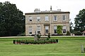
 Wassand Hall - geograph.org.uk - 4638645.jpg 640 × 427; 85 KB
-
-
 Wassand Hall - hydrangea border - geograph.org.uk - 4638750.jpg 640 × 427; 122 KB
-

-

-

-

-
 Wassand Hall - rear elevation - geograph.org.uk - 4638747.jpg 640 × 427; 59 KB
-
 Wassand Hall - side elevation - geograph.org.uk - 4638717.jpg 640 × 427; 64 KB
-
 Wassand Hall - side elevation - geograph.org.uk - 4638723.jpg 640 × 427; 74 KB
-

-
 Wassand Hall - statue in grounds - geograph.org.uk - 4638719.jpg 640 × 427; 56 KB
-

-

-

-

-
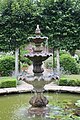
 Wassand Hall - walled garden - geograph.org.uk - 4638687.jpg 640 × 427; 118 KB
-
 Wassand Hall - walled kitchen garden - geograph.org.uk - 4638688.jpg 640 × 427; 109 KB
-
 Wassand Hall - walled kitchen garden - geograph.org.uk - 4638691.jpg 640 × 427; 116 KB
-
 Wassand Hall - walled kitchen garden - geograph.org.uk - 4638695.jpg 640 × 427; 120 KB
-
 Wassand Hall - walled kitchen garden - geograph.org.uk - 4638700.jpg 640 × 427; 115 KB
-
 Wassand Hall - walled kitchen garden - geograph.org.uk - 4638702.jpg 640 × 427; 116 KB
-
 Wassand Hall - walled kitchen garden - geograph.org.uk - 4638706.jpg 640 × 427; 93 KB
-

-

-

-

-
 Wassand Hall Lodge - geograph.org.uk - 5945257.jpg 1,024 × 820; 984 KB
-
 Wassand Road - geograph.org.uk - 5540292.jpg 1,500 × 2,000; 499 KB
-
 West Lodge on Grundill Lane, Wassand - geograph.org.uk - 4841885.jpg 1,200 × 799; 479 KB
-
 Where's the bridleway^ - geograph.org.uk - 5621125.jpg 1,024 × 768; 202 KB
-
 Wild Flowers in the Crop - geograph.org.uk - 1335072.jpg 640 × 480; 209 KB


_-_geograph.org.uk_-_3351599.jpg)


