Category:Seckington
village and civil parish in Warwickshire, United Kingdom  The Green. | |||||
| Upload media | |||||
| Instance of | |||||
|---|---|---|---|---|---|
| Location | North Warwickshire, Warwickshire, West Midlands, England | ||||
 | |||||
Subcategories
This category has the following 2 subcategories, out of 2 total.
S
- Seckington Castle (1 F)
Media in category "Seckington"
The following 23 files are in this category, out of 23 total.
-

-
 B5493 heading west - geograph.org.uk - 4505520.jpg 640 × 480; 62 KB
-
 B5493 towards No Man's Heath - geograph.org.uk - 5045517.jpg 640 × 480; 65 KB
-
 B5493 towards Tamworth - geograph.org.uk - 4505517.jpg 640 × 480; 52 KB
-
 Crop field and hedgerow - geograph.org.uk - 4505444.jpg 640 × 480; 55 KB
-
 Crop field and woodland - geograph.org.uk - 4505454.jpg 640 × 480; 40 KB
-
 Crop field off Main Road - geograph.org.uk - 4505445.jpg 640 × 480; 41 KB
-
 Crop field, Thorpe Constantine - geograph.org.uk - 4491134.jpg 640 × 480; 71 KB
-
 Entering Seckington - geograph.org.uk - 4505462.jpg 640 × 480; 66 KB
-
 Entering Staffordshire - geograph.org.uk - 4505524.jpg 640 × 480; 73 KB
-
 Farmyard Behind Gates, Seckington - geograph.org.uk - 2635619.jpg 640 × 428; 72 KB
-
 Field entrance off Hangmans Lane - geograph.org.uk - 4505459.jpg 640 × 480; 76 KB
-
 Field entrance, Thorpe Constantine - geograph.org.uk - 4505516.jpg 640 × 480; 69 KB
-
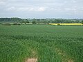
 Fields looking toward Seckington - geograph.org.uk - 98060.jpg 640 × 480; 98 KB
-
 Fields north of the B5493 - geograph.org.uk - 4491141.jpg 640 × 480; 83 KB
-
 Grazing, Seckington - geograph.org.uk - 4491131.jpg 640 × 480; 51 KB
-
 Hangmans Lane - geograph.org.uk - 4505457.jpg 640 × 480; 50 KB
-
 Hangmans Lane at Seckington - geograph.org.uk - 1027770.jpg 640 × 481; 99 KB
-

-

-
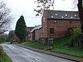
 Lodge house, Thorpe Constantine - geograph.org.uk - 4505514.jpg 640 × 480; 69 KB
-

-
 The Green - Seckington - geograph.org.uk - 570017.jpg 640 × 480; 60 KB


