Category:Seminole maps
Media in category "Seminole maps"
The following 17 files are in this category, out of 17 total.
-
 1842seminolereservation.png 300 × 295; 9 KB
-
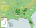
 Area of the Second Seminole War 1836-1842.jpg 451 × 628; 105 KB
-
 Bulletin (1922) (20235765530).jpg 6,276 × 8,262; 7.42 MB
-
 Cessions Southeastern Tribes- Andrew Jackson.jpg 2,030 × 1,512; 1.91 MB
-
 Creek Country 1812-1814.jpg 806 × 667; 151 KB
-
 Flickr - USCapitol - Timucuan Village.jpg 2,893 × 2,256; 2.45 MB
-
 Indigenous people of Everglades map.jpg 2,197 × 2,249; 479 KB
-
 Location of Big Cypress Indian Reservation.png 500 × 499; 48 KB
-
 Map of Seminole Nation. LOC 2007627488.jpg 3,215 × 5,280; 1.42 MB
-
 Map of Seminole Nation. LOC 2007627488.tif 3,215 × 5,280; 48.57 MB
-
 Mappa a'n Hyns Dagrow.png 2,025 × 1,547; 3.19 MB
-
 Moultriecreekreservation.PNG 300 × 295; 9 KB
-
 Second Seminole War map-es.svg 800 × 1,115; 247 KB
-
 Second Seminole War map-fr.svg 800 × 1,115; 246 KB
-
 Trails of Tears de.png 2,025 × 1,547; 3.05 MB
-
 Trails of Tears en.png 2,025 × 1,547; 3.04 MB
-
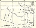 University of California publications in history (1911) (14750237496).jpg 2,940 × 2,336; 1,001 KB


_(20235765530).jpg)


_(14750237496).jpg)