Category:Sharpham
English: Sharpham is a village and civil parish on the Somerset Levels near Street and Glastonbury in the Mendip district of Somerset, England. For Sharpham, Devon seeCategory:Ashprington.
Nederlands: Sharpham is een plaats in het bestuurlijke gebied Mendip (graafschap Somerset). De plaats telt 92 inwoners.
village in Somerset, UK  | |||||
| Upload media | |||||
| Instance of | |||||
|---|---|---|---|---|---|
| Location | Mendip, Somerset, South West England, England | ||||
 | |||||
Media in category "Sharpham"
The following 74 files are in this category, out of 74 total.
-
 Abbots Sharpham - geograph.org.uk - 5397576.jpg 1,600 × 1,180; 304 KB
-
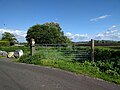
 Access to nature reserve - geograph.org.uk - 2838196.jpg 1,024 × 768; 199 KB
-
 Aqueduct Crossing - geograph.org.uk - 5420731.jpg 1,024 × 768; 244 KB
-
 Back River Drove crossing Glastonbury Heath - geograph.org.uk - 5604759.jpg 1,600 × 1,200; 711 KB
-
 Bagged up peat by Sharpham Lane - geograph.org.uk - 5397618.jpg 1,600 × 1,088; 236 KB
-
 Bungalow at Sunnyside Farm - geograph.org.uk - 5331519.jpg 1,024 × 759; 189 KB
-
 Cows by Sharpham Lane - geograph.org.uk - 5397512.jpg 1,600 × 1,135; 237 KB
-
 Cradle Bridge over River Brue - geograph.org.uk - 5604716.jpg 1,600 × 1,200; 811 KB
-
 Drain and farmland - geograph.org.uk - 5499398.jpg 640 × 480; 156 KB
-
 Drainage channel, Ham Wall RSPB Nature Reserve - geograph.org.uk - 5258909.jpg 1,024 × 781; 239 KB
-
 Drive to Cradlebridge Farm - geograph.org.uk - 5604754.jpg 1,600 × 962; 613 KB
-
 Durstons site by Sharpham Lane - geograph.org.uk - 5397626.jpg 1,600 × 1,196; 294 KB
-
 Entrance Drive, Abbotts Sharpham - geograph.org.uk - 5420571.jpg 1,024 × 760; 293 KB
-
 Fishpond Farm - geograph.org.uk - 5986210.jpg 1,600 × 1,231; 542 KB
-
 Flooded peat excavations - geograph.org.uk - 5499401.jpg 640 × 480; 171 KB
-
 Footbridge, Ham Wall RSPB Nature Reserve - geograph.org.uk - 5258918.jpg 1,024 × 739; 242 KB
-
 Footpath by peat extraction site - geograph.org.uk - 5377047.jpg 1,600 × 1,200; 486 KB
-
 Footpath to Sharpham Drove - geograph.org.uk - 5377058.jpg 1,600 × 1,200; 362 KB
-
 Former peat extraction site - geograph.org.uk - 5377033.jpg 1,600 × 1,230; 362 KB
-
 Gadwall (Anas strepera), Ham Wall - geograph.org.uk - 6271742.jpg 1,600 × 1,069; 536 KB
-
 Glastonbury Canal - geograph.org.uk - 5986111.jpg 1,600 × 1,200; 446 KB
-
 Glastonbury Heath - geograph.org.uk - 5650680.jpg 640 × 427; 255 KB
-
 Glastonbury Tor from Ham Wall nature reserve - geograph.org.uk - 6271734.jpg 1,600 × 1,065; 537 KB
-
 Glastonbury Tor, Distant View - geograph.org.uk - 2253341.jpg 1,600 × 1,046; 1.66 MB
-
 Ham Wall Nature Reserve - geograph.org.uk - 2438630.jpg 1,024 × 768; 222 KB
-
-
 Hulk Moor Rhyne - geograph.org.uk - 5420625.jpg 1,024 × 768; 242 KB
-
 Hulk Moor Rhyne - geograph.org.uk - 5420632.jpg 1,024 × 768; 264 KB
-
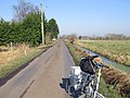
 Lane looking south west - geograph.org.uk - 5499403.jpg 640 × 480; 167 KB
-
 Little Ranch - geograph.org.uk - 5331335.jpg 1,024 × 731; 237 KB
-
 Meare Road crosses River Brue - geograph.org.uk - 5331319.jpg 1,024 × 752; 244 KB
-
 Modern timber building, Glastonbury Heath - geograph.org.uk - 5331528.jpg 1,024 × 846; 201 KB
-
 Murmuration, Ham Wall - geograph.org.uk - 2249794.jpg 750 × 476; 509 KB
-
 Oak Tree Farm - geograph.org.uk - 5331515.jpg 1,024 × 768; 177 KB
-
 Offices at Durstons peat works - geograph.org.uk - 5420608.jpg 1,024 × 768; 216 KB
-
 Old peat diggings on Hulk Moor - geograph.org.uk - 5420616.jpg 1,024 × 768; 216 KB
-
 Old railway track and road, looking west - geograph.org.uk - 5499406.jpg 640 × 480; 190 KB
-

-
 Peat digging by Sharpham Lane - geograph.org.uk - 5397622.jpg 1,600 × 1,182; 352 KB
-
 Peat digging near Avalon Farm - geograph.org.uk - 5397619.jpg 1,600 × 1,200; 419 KB
-
 Peat Excavation Site - geograph.org.uk - 2820404.jpg 1,024 × 768; 186 KB
-
 Peat excavations by Sharpham Lane - geograph.org.uk - 5397614.jpg 1,600 × 1,085; 299 KB
-
 Peat extraction site - geograph.org.uk - 5986219.jpg 1,600 × 1,218; 344 KB
-
 Peat extraction, Glastonbury Heath - geograph.org.uk - 5331325.jpg 1,024 × 786; 210 KB
-
 Peat Heap^ - geograph.org.uk - 2820407.jpg 1,024 × 768; 192 KB
-
 Peat mound, Walton Heath - geograph.org.uk - 5332530.jpg 1,024 × 758; 168 KB
-
 Peat Works, Walton Heath - geograph.org.uk - 5332547.jpg 1,024 × 758; 204 KB
-
 Reedbed in peat extraction site - geograph.org.uk - 5986209.jpg 1,600 × 1,200; 446 KB
-
 Rice Farm - geograph.org.uk - 5331312.jpg 1,024 × 768; 181 KB
-
 River Brue from Cradle Bridge - geograph.org.uk - 5604722.jpg 1,600 × 1,200; 776 KB
-
 Road junction at Cold Harbour Bridge - geograph.org.uk - 5604762.jpg 1,600 × 960; 714 KB
-
 Route of old railway to Glastonbury - geograph.org.uk - 5499408.jpg 640 × 480; 155 KB
-
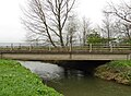
 Sharpham Bridge - geograph.org.uk - 5420729.jpg 1,024 × 777; 243 KB
-
 Sharpham Crossing - geograph.org.uk - 2820401.jpg 1,024 × 768; 270 KB
-

-
 Sharpham Drove - geograph.org.uk - 2820402.jpg 1,024 × 768; 207 KB
-
 Sharpham Drove - geograph.org.uk - 5353692.jpg 1,600 × 1,243; 295 KB
-
 Sharpham Lane - geograph.org.uk - 2820403.jpg 1,024 × 768; 237 KB
-
 Sharpham Lane - geograph.org.uk - 5397627.jpg 1,600 × 1,207; 322 KB
-
 Sharpham Level crossing and keeper's cottage - geograph.org.uk - 5331533.jpg 1,024 × 768; 172 KB
-
 Sharpham, on the Dart, No.2 (10723968096).jpg 1,000 × 693; 648 KB
-
 Sharpham.jpg 640 × 405; 79 KB
-
 Small Moor Rhyne by Sharpham Drove - geograph.org.uk - 5397577.jpg 1,600 × 1,284; 441 KB
-
 South Drain - geograph.org.uk - 2820412.jpg 1,024 × 768; 165 KB
-
 South Drain at Sharpham Bridge - geograph.org.uk - 5420599.jpg 1,024 × 768; 282 KB
-
 South Drain from Sharpham Lane - geograph.org.uk - 5397516.jpg 1,600 × 1,225; 359 KB
-
 Street Heath, RSPB Ham Wall - geograph.org.uk - 5604822.jpg 1,600 × 1,200; 790 KB
-
-
 Track - geograph.org.uk - 2838194.jpg 1,024 × 768; 223 KB
-
 Track to Whitebridge Farm - geograph.org.uk - 5331512.jpg 1,024 × 781; 261 KB
-
 Trackbed of former S^D rail line to Highbridge - geograph.org.uk - 5331539.jpg 1,024 × 776; 267 KB
-
 Travellers' caravan on Back River Drove - geograph.org.uk - 5331322.jpg 1,024 × 754; 142 KB
-
 Tree-lined ride, Sharpham Park - geograph.org.uk - 5420576.jpg 1,024 × 768; 233 KB
-
 Trees and reeds on Street Heath, RSPB Ham Wall - geograph.org.uk - 5604825.jpg 1,600 × 1,200; 777 KB


,_Ham_Wall_-_geograph.org.uk_-_6271742.jpg)


.jpg)


