Category:Shilton, Oxfordshire
village and civil parish in West Oxfordshire, England  | |||||
| Upload media | |||||
| Instance of | |||||
|---|---|---|---|---|---|
| Location | West Oxfordshire, Oxfordshire, South East England, England | ||||
| official website | |||||
 | |||||
Subcategories
This category has only the following subcategory.
H
Media in category "Shilton, Oxfordshire"
The following 117 files are in this category, out of 117 total.
-
 "Hen and Chick Lane" - geograph.org.uk - 1524876.jpg 640 × 427; 114 KB
-
 "Shilton Dip" - geograph.org.uk - 1514753.jpg 640 × 427; 95 KB
-
 'Friesland Cottage' - geograph.org.uk - 5312956.jpg 1,024 × 683; 215 KB
-
 'Ivy Cottage' and 'Hilltop Cottage', The Hill - geograph.org.uk - 5312912.jpg 1,024 × 683; 152 KB
-
 'Stonelands', Burford Road - geograph.org.uk - 5333200.jpg 1,024 × 687; 238 KB
-
 2 bridleways on the edge of Carterton - geograph.org.uk - 1514655.jpg 427 × 640; 116 KB
-
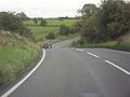
 A40 approaching White Hill - geograph.org.uk - 2512869.jpg 640 × 480; 62 KB
-

-
 Autumn colour in Hen and Chick lane - geograph.org.uk - 1525801.jpg 640 × 427; 117 KB
-
 B4020 Shilton Road east of Shilton Downs Farm - geograph.org.uk - 3054575.jpg 2,928 × 2,395; 1.12 MB
-

-
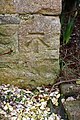
 Benchmark on 'Friesland Cottage' - geograph.org.uk - 5312925.jpg 660 × 1,024; 252 KB
-
 Benchmark on 'Ivy Cottage' - geograph.org.uk - 5312895.jpg 674 × 1,024; 327 KB
-
 Benchmark on 'Stonelands' - geograph.org.uk - 5333191.jpg 662 × 1,024; 220 KB
-
-

-
 Benchmark on roadside wall near Johnsons Farm - geograph.org.uk - 5316891.jpg 664 × 1,024; 325 KB
-

-

-

-
 Benchmark on wooden gatepost near Stonelands - geograph.org.uk - 5316953.jpg 683 × 1,024; 262 KB
-
 Bend and dip in the B4020 - geograph.org.uk - 2089925.jpg 640 × 480; 49 KB
-
 Bend in the road in Shilton - geograph.org.uk - 1554063.jpg 640 × 427; 76 KB
-
 Bridleway across the fields - geograph.org.uk - 1514672.jpg 427 × 640; 56 KB
-

-

-

-
 Burford Caravan Club Site - geograph.org.uk - 3446376.jpg 2,095 × 1,422; 604 KB
-
 Burford Caravan Park - geograph.org.uk - 5916722.jpg 4,320 × 3,240; 3.61 MB
-
 Bus shelter and post box in Shilton - geograph.org.uk - 1552535.jpg 640 × 427; 109 KB
-
 Caravan Club site - Burford - geograph.org.uk - 952075.jpg 640 × 480; 106 KB
-
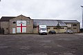 Carterton FC - geograph.org.uk - 294650.jpg 640 × 427; 55 KB
-
 Climbing away from Shilton ford - geograph.org.uk - 1516013.jpg 640 × 427; 67 KB
-
 Crossroads near Cotswold Wildlife Park - geograph.org.uk - 6145347.jpg 1,925 × 1,434; 2.49 MB
-
 Derelict wind pump - geograph.org.uk - 1614258.jpg 640 × 427; 59 KB
-
 Dry stone wall between minor road and field - geograph.org.uk - 5316962.jpg 1,024 × 683; 299 KB
-
 East Lodge - geograph.org.uk - 5916726.jpg 4,320 × 3,240; 3.9 MB
-
 East Lodge on the A361 - geograph.org.uk - 2808093.jpg 800 × 600; 145 KB
-

-
 Field by the A40 near Widford - geograph.org.uk - 5863880.jpg 2,048 × 1,536; 1.78 MB
-
 Flooded fields east of Burford - geograph.org.uk - 3853797.jpg 640 × 480; 49 KB
-
 Footbridge beside Shilton ford - geograph.org.uk - 1554081.jpg 640 × 427; 108 KB
-
 Footpath to Sturt Farm - geograph.org.uk - 3274657.jpg 640 × 480; 60 KB
-
 Ford ahead - geograph.org.uk - 2089937.jpg 640 × 480; 131 KB
-
 Ford at Shilton - geograph.org.uk - 1556195.jpg 640 × 480; 141 KB
-
 Former electricity substation, RAF Broadwell - geograph.org.uk - 6146293.jpg 4,000 × 3,000; 4.97 MB
-
 Foxwood Lane - geograph.org.uk - 5916724.jpg 4,320 × 3,240; 3.72 MB
-
 Gateway to Frieslands Farm - geograph.org.uk - 1525768.jpg 640 × 427; 104 KB
-
 Hen and Chicken wood - geograph.org.uk - 1525810.jpg 640 × 427; 143 KB
-
 Hen ^ Chick Lane - geograph.org.uk - 3274628.jpg 640 × 480; 96 KB
-
 Horse chestnut tree beside Shilton ford - geograph.org.uk - 1554050.jpg 427 × 640; 122 KB
-
-

-
 Junction with A361 - geograph.org.uk - 3274615.jpg 640 × 480; 93 KB
-
 Kilkenny Lane, near Carterton, Oxon - geograph.org.uk - 4544079.jpg 1,024 × 683; 226 KB
-
 Kilkenny Lane, near Carterton, Oxon - geograph.org.uk - 4545388.jpg 1,024 × 683; 236 KB
-
 Ladburn Lane, Shilton - geograph.org.uk - 1554090.jpg 640 × 427; 86 KB
-
 Layby on the A40 near Widford - geograph.org.uk - 5863876.jpg 2,048 × 1,536; 1.52 MB
-
 Looking down the hill in Shilton - geograph.org.uk - 1552545.jpg 640 × 427; 77 KB
-
 Minor road from Shilton to the B4477 - geograph.org.uk - 1554360.jpg 640 × 427; 127 KB
-
 Nearing the B4020 - geograph.org.uk - 1516038.jpg 640 × 427; 110 KB
-
 No through road - geograph.org.uk - 1480490.jpg 640 × 427; 85 KB
-

-
 Old pump at Shilton - geograph.org.uk - 1556199.jpg 640 × 480; 135 KB
-
 Private track near Shilton - geograph.org.uk - 1554369.jpg 640 × 427; 79 KB
-
 Pump and Shill Brook, Bridge Street, Shilton - geograph.org.uk - 3444475.jpg 2,088 × 1,408; 1.26 MB
-
 RAF Broadwell ancillary building - geograph.org.uk - 6147669.jpg 4,000 × 3,000; 7.29 MB
-
 RAF Broadwell ancillary feature - geograph.org.uk - 6147666.jpg 4,000 × 3,000; 7.31 MB
-
 RAF Broadwell WW2 ancillary building - geograph.org.uk - 6147984.jpg 4,000 × 3,000; 4.66 MB
-
 RAF Broadwell WW2 ancillary buildings - geograph.org.uk - 6147622.jpg 4,000 × 3,000; 5.19 MB
-
 RAF Broadwell WW2 ancillary buildings - geograph.org.uk - 6147981.jpg 4,000 × 3,000; 4.85 MB
-
 RAF Broadwell WW2 ancillary feature - geograph.org.uk - 6147672.jpg 4,000 × 3,000; 4.76 MB
-
 RAF Broadwell WW2 hut bases - geograph.org.uk - 6147597.jpg 1,925 × 1,444; 1.61 MB
-
 Road through Shilton (2) - geograph.org.uk - 1554399.jpg 640 × 427; 100 KB
-
 Road through Shilton - geograph.org.uk - 1554012.jpg 640 × 427; 81 KB
-
 Road to Shilton church - geograph.org.uk - 1554409.jpg 640 × 427; 54 KB
-
 Shilton Downs - geograph.org.uk - 2579554.jpg 2,816 × 2,112; 1.76 MB
-
 Shilton ford - geograph.org.uk - 1554005.jpg 640 × 427; 87 KB
-
 Shilton ford - geograph.org.uk - 2089897.jpg 640 × 480; 101 KB
-
 Shilton Ford on the Shill Brook - geograph.org.uk - 2586169.jpg 3,872 × 2,592; 2.38 MB
-

-
 Shilton Road approaches junction with Bridge Street - geograph.org.uk - 3054561.jpg 2,994 × 2,432; 1.24 MB
-
 Shilton Road enters Shilton - geograph.org.uk - 3054555.jpg 3,271 × 2,504; 1.3 MB
-
 Shilton war memorial - geograph.org.uk - 1554027.jpg 427 × 640; 121 KB
-
 Shilton War Memorial - geograph.org.uk - 3274640.jpg 640 × 480; 119 KB
-
 ShiltonBarn drawings.tif 2,450 × 1,890; 3.52 MB
-
 Small bridge in Shilton - geograph.org.uk - 1554386.jpg 640 × 427; 83 KB
-

-
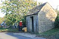
 Small stone shed - geograph.org.uk - 1480523.jpg 640 × 427; 79 KB
-
 Steps and pump beside Shilton ford - geograph.org.uk - 1554038.jpg 427 × 640; 144 KB
-
 The Church of the Holy Rood - geograph.org.uk - 5308660.jpg 1,024 × 683; 178 KB
-
 The Church of The Holy Rood - geograph.org.uk - 5308663.jpg 1,024 × 683; 204 KB
-

-
 The ford at Shilton - geograph.org.uk - 1556196.jpg 640 × 480; 100 KB
-
 The ford in Shilton - geograph.org.uk - 5289011.jpg 1,024 × 683; 225 KB
-
 The road to Shilton - geograph.org.uk - 5916725.jpg 4,320 × 3,240; 3.87 MB
-
 The road to Shilton ford - geograph.org.uk - 1516027.jpg 640 × 427; 109 KB
-
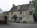 The Rose ^ Crown, Shilton - geograph.org.uk - 2089875.jpg 640 × 480; 76 KB
-
 The Rose ^ Crown, Shilton - geograph.org.uk - 2808063.jpg 800 × 600; 140 KB
-
 The Rose ^ Crown, Shilton - geograph.org.uk - 2808066.jpg 600 × 800; 143 KB
-
 This way to the animals - geograph.org.uk - 5916723.jpg 4,320 × 3,240; 3.44 MB
-
 Track near Stonelands Quarry - geograph.org.uk - 346860.jpg 640 × 430; 118 KB
-
 Track to Signet Hill farm - geograph.org.uk - 1469318.jpg 640 × 427; 62 KB
-
 Turning to Shilton from B4020 - geograph.org.uk - 5289690.jpg 1,024 × 683; 233 KB
-
 Village street, Shilton - geograph.org.uk - 6147303.jpg 1,925 × 1,444; 2.55 MB
-
 Westfield Riding School - geograph.org.uk - 1480499.jpg 640 × 427; 92 KB
-
 Wood and fields in the Windrush Valley - geograph.org.uk - 4017048.jpg 1,500 × 999; 156 KB
-
 Woodside Drive, Bradwell - geograph.org.uk - 5541154.jpg 2,304 × 1,728; 1.45 MB
-
 Alvescot Downs Farm Cottages - geograph.org.uk - 350400.jpg 640 × 447; 100 KB
-
 Alvescot Stud and Field Farm - geograph.org.uk - 294730.jpg 640 × 427; 86 KB
-
 Bridleway to Brize Norton - geograph.org.uk - 1516046.jpg 640 × 427; 90 KB
-
 Concrete road to nowhere - geograph.org.uk - 294718.jpg 640 × 427; 96 KB
-
 Microwave mast near Shilton - geograph.org.uk - 294686.jpg 427 × 640; 56 KB
-
 Scrubs Farm Shilton Burford - geograph.org.uk - 311467.jpg 640 × 480; 97 KB
-
 Scrubs Farm Shilton Burford - geograph.org.uk - 311475.jpg 640 × 480; 92 KB
-
 Shilton Ford - geograph.org.uk - 657618.jpg 640 × 480; 73 KB
-
 The Shill Brook - geograph.org.uk - 294663.jpg 640 × 427; 75 KB


.jpg)


_-_geograph.org.uk_-_1554399.jpg)


_entering_Carterton_from_the_NW_-_geograph.org.uk_-_5289557.jpg)


