Category:Shotley, Suffolk
English: Shotley is the parish giving its name to the peninsula between the River Orwell and the River Stour in Suffolk. The village of the same name is located about half a mile from the tip of the peninsula where the larger Shotley Gate settlement is.
village and civil parish in Babergh, Suffolk, England  | |||||
| Upload media | |||||
| Instance of | |||||
|---|---|---|---|---|---|
| Location | Babergh, Suffolk, East of England, England | ||||
 | |||||
Subcategories
This category has the following 4 subcategories, out of 4 total.
Media in category "Shotley, Suffolk"
The following 200 files are in this category, out of 237 total.
(previous page) (next page)-
 'The Shipwreck', Shotley Gate - geograph.org.uk - 4028061.jpg 640 × 377; 41 KB
-

-
 A view looking from the shore towards Shotley pier at low tide. RMG P27498.tiff 4,800 × 3,390; 46.55 MB
-

-
 Afternoon siesta^ - geograph.org.uk - 4818336.jpg 3,872 × 2,592; 4.67 MB
-
-
 Arable field near the Orwell - geograph.org.uk - 2618499.jpg 3,648 × 2,255; 2.38 MB
-
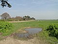
 Area of saltmarsh by the Orwell - geograph.org.uk - 941440.jpg 640 × 449; 75 KB
-
 At anchor in Orwell Haven - geograph.org.uk - 4422383.jpg 1,024 × 768; 241 KB
-
 B1456 past Old Mill House - geograph.org.uk - 4422657.jpg 1,024 × 768; 450 KB
-
 Beacon at Shotley Gate - geograph.org.uk - 3937236.jpg 600 × 800; 65 KB
-
 Bench at Shotley Gate - geograph.org.uk - 3966499.jpg 800 × 600; 162 KB
-
 Blackheaded Gull looking for titbits - geograph.org.uk - 4422426.jpg 1,024 × 768; 196 KB
-
 Bloody Point - geograph.org.uk - 2131341.jpg 1,024 × 768; 241 KB
-
 Blue boat at Shotley Gate - geograph.org.uk - 3965994.jpg 800 × 600; 110 KB
-
 Blue hose on pier at Shotley Gate - geograph.org.uk - 3967635.jpg 800 × 600; 156 KB
-
 Boat with chain on pallet at Shotley Gate - geograph.org.uk - 3967659.jpg 768 × 1,024; 152 KB
-
 Boats in Shotley Marina - geograph.org.uk - 2168081.jpg 2,048 × 1,536; 606 KB
-
 Bridge at Shotley Gate - geograph.org.uk - 3966041.jpg 800 × 600; 129 KB
-
 By the Orwell - geograph.org.uk - 941320.jpg 640 × 470; 67 KB
-

-
 Channel and embankment by the Orwell - geograph.org.uk - 941416.jpg 640 × 476; 96 KB
-
 Channel and sluice by the Orwell - geograph.org.uk - 941443.jpg 640 × 386; 49 KB
-

-
 Charity Farm cereal crop - geograph.org.uk - 4818321.jpg 3,872 × 2,592; 3.77 MB
-
 Charity Farm cereal crop - geograph.org.uk - 4818327.jpg 3,872 × 2,592; 4.67 MB
-
 Collimer Point - geograph.org.uk - 1573320.jpg 640 × 480; 80 KB
-
 Collimer Point and the Orwell - geograph.org.uk - 941383.jpg 640 × 396; 61 KB
-

-
 Container ships at Trinity Terminal, Felixstowe Docks - geograph.org.uk - 4113753.jpg 1,600 × 1,067; 377 KB
-
 Country Lane - geograph.org.uk - 1573242.jpg 480 × 640; 111 KB
-

-

-
 Crane's Hill, north-east of Shotley - geograph.org.uk - 4113404.jpg 640 × 427; 91 KB
-
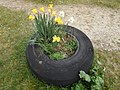 Daffodils in old tire, Shotley Gate - geograph.org.uk - 3966251.jpg 800 × 600; 184 KB
-
 Daffodils in old tire, Shotley Gate - geograph.org.uk - 3966410.jpg 800 × 600; 179 KB
-
 Dead tree and glimpse of the Orwell - geograph.org.uk - 941272.jpg 640 × 517; 109 KB
-
 Disused as a buoy, now used for advertising - geograph.org.uk - 4422764.jpg 1,024 × 768; 230 KB
-
 Do Not Feed sign at Shotley, Suffolk - geograph.org.uk - 1584358.jpg 480 × 640; 85 KB
-
 Dock cranes at Felixstowe Docks - geograph.org.uk - 4422750.jpg 1,024 × 768; 308 KB
-

-

-
 Drainage ditches - geograph.org.uk - 4874172.jpg 3,264 × 2,176; 983 KB
-
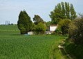
 Farm outbuildings at Charity Farm - geograph.org.uk - 941231.jpg 640 × 433; 68 KB
-
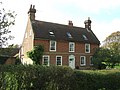
 Farmhouse at Red House Farm - geograph.org.uk - 941259.jpg 640 × 525; 113 KB
-
 Farmland off wade's Lane - geograph.org.uk - 4422681.jpg 1,024 × 768; 346 KB
-
 Farmland south of Shotley - geograph.org.uk - 4029323.jpg 640 × 354; 46 KB
-
 Felixstowe Cranes - geograph.org.uk - 3301996.jpg 640 × 421; 65 KB
-
 Felixstowe Docks - geograph.org.uk - 2087225.jpg 2,048 × 1,360; 1.74 MB
-

-
 Field and the first houses in Shotley - geograph.org.uk - 1282493.jpg 640 × 422; 108 KB
-
 Field by Redhouse Plantation - geograph.org.uk - 941249.jpg 640 × 431; 77 KB
-
 Field near Church End, Shotley - geograph.org.uk - 941122.jpg 640 × 412; 75 KB
-
 Field rising south of the Orwell - geograph.org.uk - 941290.jpg 640 × 491; 97 KB
-
 Field with cows - geograph.org.uk - 2565233.jpg 3,648 × 2,280; 2.18 MB
-
 Field with cows and swans - geograph.org.uk - 2565229.jpg 3,648 × 2,280; 2.7 MB
-
 Field with free range chickens - geograph.org.uk - 2565211.jpg 3,648 × 2,280; 3.39 MB
-

-
 Field, horse, farm building - geograph.org.uk - 2619664.jpg 3,648 × 2,255; 2.74 MB
-
 Fields behind the Orwell embankment - geograph.org.uk - 941394.jpg 640 × 465; 73 KB
-
 Fields by the River Orwell - geograph.org.uk - 4873607.jpg 3,264 × 2,176; 760 KB
-
 Fields near the end of the day - geograph.org.uk - 2513737.jpg 3,648 × 2,736; 2.28 MB
-
-
 Fields overlooking the Orwell - geograph.org.uk - 941262.jpg 640 × 381; 59 KB
-
 Fields west of Oldhall Road - geograph.org.uk - 941165.jpg 640 × 436; 82 KB
-
 Fir Tree at Shotley Gate - geograph.org.uk - 3966237.jpg 768 × 1,024; 145 KB
-
 Footbridge over dyke - geograph.org.uk - 2565236.jpg 3,648 × 2,736; 3.27 MB
-
 Footpath at a footpath crossroads - geograph.org.uk - 941245.jpg 640 × 465; 78 KB
-

-
 Footpath between Shotley and Shotley Hall - geograph.org.uk - 941112.jpg 640 × 456; 110 KB
-

-
 Footpath by the B1456 to Shotley Gate - geograph.org.uk - 941576.jpg 640 × 488; 97 KB
-
 Footpath looking east - geograph.org.uk - 941238.jpg 640 × 414; 73 KB
-
 Footpath north from Shotley - geograph.org.uk - 941091.jpg 640 × 480; 81 KB
-
 Footpath on track, near Colton Cottage - geograph.org.uk - 2577424.jpg 3,648 × 2,736; 3.69 MB
-

-

-
 Foreshore near Erwarton Bay - geograph.org.uk - 2565107.jpg 3,648 × 2,280; 2.57 MB
-
 Funny place to leave a boat - geograph.org.uk - 4422688.jpg 1,024 × 768; 560 KB
-
 Gas canisters, Shotley Gate - geograph.org.uk - 3966062.jpg 800 × 600; 117 KB
-

-
 Glimpse across fields towards Shotley - geograph.org.uk - 941142.jpg 640 × 473; 91 KB
-
 Graves of the Cadets at Shotley - geograph.org.uk - 4423085.jpg 1,024 × 768; 446 KB
-
 Green ring, Shotley Gate - geograph.org.uk - 3966570.jpg 800 × 600; 227 KB
-
 Guelder Rose berries, Vibernum opulus - geograph.org.uk - 941315.jpg 640 × 416; 127 KB
-
 Gull on pier, Shotley Gate - geograph.org.uk - 3967625.jpg 800 × 600; 95 KB
-
 Hare's Creek, Tufted Duck - geograph.org.uk - 4818306.jpg 2,583 × 1,730; 2.26 MB
-
 Harwich CO12 - geograph.org.uk - 3486648.jpg 3,689 × 1,266; 800 KB
-
 Harwich from Shotley Gate - geograph.org.uk - 3937227.jpg 800 × 600; 81 KB
-
 Harwich International Port from Shotley - geograph.org.uk - 4818268.jpg 3,872 × 2,592; 3.79 MB
-
 HMS Ganges Museum - geograph.org.uk - 2565248.jpg 2,704 × 1,690; 944 KB
-
 HMS Ganges, Shotley Gate - geograph.org.uk - 3937240.jpg 800 × 600; 134 KB
-
 Hole at Shotley beach - geograph.org.uk - 3966383.jpg 800 × 600; 195 KB
-
 Jill's Hole and the Orwell - geograph.org.uk - 941350.jpg 640 × 382; 53 KB
-

-
 Jill's Hole on the River Orwell - geograph.org.uk - 4874177.jpg 3,264 × 2,176; 1.1 MB
-
 Junction in Shotley - geograph.org.uk - 3937190.jpg 800 × 600; 70 KB
-
 Kingsland - geograph.org.uk - 3937199.jpg 800 × 600; 92 KB
-
 Lake - geograph.org.uk - 1584566.jpg 640 × 480; 87 KB
-
 Lightship at anchor in the River Stour - geograph.org.uk - 4422755.jpg 1,024 × 768; 231 KB
-
 Livestock (Cattle) Pen - geograph.org.uk - 2566033.jpg 3,648 × 2,736; 3.99 MB
-

-

-
 Looking over the fields towards the Orwell - geograph.org.uk - 2513745.jpg 3,648 × 2,736; 2.95 MB
-
 Looking towards Alderton's Grove - geograph.org.uk - 941129.jpg 640 × 427; 89 KB
-
 Looking towards the wooded section of Man's Cliff - geograph.org.uk - 2619663.jpg 3,648 × 2,255; 2.44 MB
-

-

-
 Luxury barns - geograph.org.uk - 2514760.jpg 3,648 × 2,736; 3.02 MB
-
 Map of Shotley, OS 1946.png 333 × 231; 133 KB
-
 Marina Entrance Lock at Shotley Gate - geograph.org.uk - 3967648.jpg 800 × 600; 101 KB
-

-
 Naval cemetery at Shotley, Suffolk - geograph.org.uk - 4552162.jpg 1,920 × 1,080; 677 KB
-
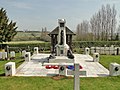
 Naval War Memorial at Shotley (detail) - geograph.org.uk - 4422728.jpg 1,024 × 768; 353 KB
-
 Naval War Memorial at Shotley - geograph.org.uk - 4422722.jpg 1,024 × 768; 384 KB
-
 Naval War Memorial at Shotley - geograph.org.uk - 4422725.jpg 1,024 × 768; 379 KB
-
 Naval War Memorial at Shotley - geograph.org.uk - 4422726.jpg 1,024 × 768; 342 KB
-
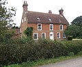
 Nether Hall, Shotley - geograph.org.uk - 4422745.jpg 1,024 × 768; 396 KB
-
 No access, Shotley Gate - geograph.org.uk - 3966012.jpg 800 × 600; 95 KB
-
 North bank of the Stour - geograph.org.uk - 1120710.jpg 640 × 360; 55 KB
-
 Old Hall Grove, Shotley - geograph.org.uk - 4422704.jpg 1,024 × 768; 491 KB
-
 Old Mill House on the B1456 - geograph.org.uk - 4422658.jpg 1,024 × 768; 501 KB
-
 Oldhall Road - geograph.org.uk - 1573216.jpg 480 × 640; 84 KB
-
 Orwell embankment - geograph.org.uk - 941337.jpg 640 × 396; 63 KB
-

-
 Orwell Haven - geograph.org.uk - 2131347.jpg 1,024 × 768; 215 KB
-
 Outlook across open fields - geograph.org.uk - 1284630.jpg 640 × 445; 84 KB
-
 Over Hall Farm building - geograph.org.uk - 2565220.jpg 3,648 × 2,736; 2.72 MB
-
 Over Hall Farm, Shotley - geograph.org.uk - 4422743.jpg 1,024 × 768; 342 KB
-
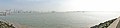 Panorama of Orwell Haven and the River Stour - geograph.org.uk - 4422391.jpg 4,691 × 1,080; 918 KB
-
 Pier at Shotley Gate - geograph.org.uk - 3967614.jpg 800 × 600; 132 KB
-
 Plaque on bench at Shotley Gate - geograph.org.uk - 3966515.jpg 800 × 600; 109 KB
-

-
 Pond on farmland near Man's Cliff - geograph.org.uk - 2618496.jpg 3,648 × 2,255; 2.53 MB
-
 Porkers^ - geograph.org.uk - 4422662.jpg 1,024 × 768; 337 KB
-
 Port of Felixstowe - geograph.org.uk - 2565271.jpg 2,518 × 1,349; 586 KB
-
 Red House Farm, Wade's Lane - geograph.org.uk - 4422685.jpg 1,024 × 768; 312 KB
-
 Redhouse Farm - geograph.org.uk - 1584544.jpg 640 × 480; 91 KB
-
 River Orwell east of Chelmondiston - geograph.org.uk - 4874186.jpg 3,264 × 2,176; 736 KB
-
 River Orwell Foreshore - geograph.org.uk - 4874148.jpg 3,264 × 2,176; 869 KB
-

-
 Road signs on the B1456 - geograph.org.uk - 4422660.jpg 1,024 × 768; 380 KB
-
 Rocks at Shotley Gate - geograph.org.uk - 3937230.jpg 800 × 600; 145 KB
-
 Rocks at Shotley Gate - geograph.org.uk - 3966372.jpg 800 × 600; 183 KB
-
-
 Salt Marsh - geograph.org.uk - 1573342.jpg 640 × 480; 71 KB
-
 Salt Marsh - geograph.org.uk - 1573456.jpg 640 × 480; 58 KB
-
 Salt Marsh - geograph.org.uk - 1584602.jpg 480 × 640; 37 KB
-
 Salt marsh beside River Orwell - geograph.org.uk - 4113375.jpg 640 × 427; 69 KB
-
 Saltings near Shotley Marina - geograph.org.uk - 2565262.jpg 3,648 × 2,736; 2.37 MB
-
 Saltmarsh and mud by the Orwell - geograph.org.uk - 941424.jpg 640 × 452; 55 KB
-
 Saltmarsh at Crane's Creek - geograph.org.uk - 4874166.jpg 3,264 × 2,176; 1.08 MB
-
 Saltmarsh at the edge of the Orwell - geograph.org.uk - 941305.jpg 640 × 397; 73 KB
-
 Saltmarsh beside River Orwell - geograph.org.uk - 4425832.jpg 1,920 × 1,080; 629 KB
-
 Saltmarsh on the River Orwell - geograph.org.uk - 4874156.jpg 3,264 × 2,176; 872 KB
-
 Sandy Beach at Shotley Gate - geograph.org.uk - 4873624.jpg 3,264 × 2,176; 1.01 MB
-
 Sea Defences below Shotley Cliffs - geograph.org.uk - 3425499.jpg 1,435 × 902; 711 KB
-
 Semi clad tree near the Orwell - geograph.org.uk - 2513743.jpg 3,648 × 2,736; 2.71 MB
-
 Septaria on the Shotley shore - geograph.org.uk - 3428789.jpg 4,045 × 2,708; 5.33 MB
-
 Shotley - rolling fields - geograph.org.uk - 1120722.jpg 640 × 360; 70 KB
-
 Shotley Cliff sea defences - geograph.org.uk - 2565115.jpg 3,648 × 2,280; 2.89 MB
-
 Shotley cottage - geograph.org.uk - 1284640.jpg 640 × 480; 143 KB
-
 Shotley Cottage - geograph.org.uk - 4873595.jpg 3,264 × 2,176; 1.05 MB
-
 Shotley Gate - geograph.org.uk - 4910834.jpg 1,024 × 768; 78 KB
-
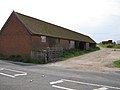
 Shotley Hall and Barns - geograph.org.uk - 941147.jpg 640 × 416; 69 KB
-
 Shotley Marina - geograph.org.uk - 4422761.jpg 1,024 × 768; 234 KB
-
 Shotley Marina - geograph.org.uk - 4818271.jpg 2,592 × 3,872; 4.21 MB
-
 Shotley Marina - geograph.org.uk - 4818274.jpg 3,872 × 2,592; 3.96 MB
-
 Shotley Marina control building - geograph.org.uk - 4028039.jpg 640 × 427; 61 KB
-
 Shotley Marina landing, Shotley Gate - geograph.org.uk - 4028019.jpg 640 × 427; 39 KB
-
 Shotley Marina monument - geograph.org.uk - 3967671.jpg 1,200 × 1,600; 215 KB
-

-
 Shotley Marina with Martello Tower - geograph.org.uk - 3966550.jpg 800 × 600; 86 KB
-
 Shotley Marine Services - geograph.org.uk - 3966024.jpg 800 × 600; 98 KB
-
 Shotley Marshes, Beached boat - geograph.org.uk - 4818285.jpg 2,592 × 2,592; 3.8 MB
-

-
 Shotley Post Office - geograph.org.uk - 3937183.jpg 800 × 600; 83 KB
-
 Shotley Royal Naval Cemetery and War Memorial - geograph.org.uk - 4422707.jpg 1,024 × 768; 421 KB
-
 Shotley Royal Naval Cemetery and War Memorial - geograph.org.uk - 4422708.jpg 1,024 × 768; 369 KB
-
 Shotley sea defences.JPG 448 × 336; 111 KB
-
 Shotley village hall - geograph.org.uk - 4422702.jpg 1,012 × 697; 293 KB
-
 Shotley Walk - geograph.org.uk - 2131367.jpg 1,024 × 768; 265 KB
-

-
 Shotley War Memorial - geograph.org.uk - 4422739.jpg 2,592 × 3,456; 2.79 MB
-

-
 Shotley, Crane's Hill Creek - geograph.org.uk - 4818288.jpg 2,452 × 1,506; 1.64 MB
-
 Shotley, Foreshore - geograph.org.uk - 4818279.jpg 2,592 × 3,872; 5.72 MB
-
 Shotley, Shelduck on foreshore - geograph.org.uk - 4818280.jpg 2,583 × 1,729; 2.55 MB
-
 Shotley, Swan - geograph.org.uk - 4818297.jpg 2,583 × 1,730; 2.46 MB
-
 Shotley, Yachting in the Orwell off Crane's Hill Creek - geograph.org.uk - 4818292.jpg 2,537 × 1,659; 1.77 MB
-

-
 Small Oak Tree in Shotley Gate - geograph.org.uk - 3966081.jpg 800 × 600; 94 KB
-
 Small Oak Tree in Shotley Gate - geograph.org.uk - 3966194.jpg 800 × 600; 109 KB
-
 Small Sycamore Tree, Shotley Gate - geograph.org.uk - 3966530.jpg 768 × 1,024; 175 KB
-
 Stour and Orwell walk - geograph.org.uk - 4873600.jpg 3,264 × 2,176; 1.12 MB
-

-

-
 Stour Estuary - geograph.org.uk - 2131348.jpg 1,024 × 768; 242 KB
-
 Suffolk Coast And Heaths Path - geograph.org.uk - 1573298.jpg 640 × 480; 88 KB
-
 Thames Barge and attendants - geograph.org.uk - 2565255.jpg 2,810 × 1,737; 1.01 MB


_Pen_-_geograph.org.uk_-_2566033.jpg)


_-_geograph.org.uk_-_4422728.jpg)


