Category:Shotwick
village and former civil parish in Cheshire, UK  | |||||
| Upload media | |||||
| Instance of |
| ||||
|---|---|---|---|---|---|
| Location | Puddington, Cheshire West and Chester, Cheshire, North West England, England | ||||
 | |||||
Subcategories
This category has the following 4 subcategories, out of 4 total.
M
- St Michael's Church, Shotwick (32 F)
P
- Puddington to Shotwick footpath (49 F)
S
- Shotwick Hall (7 F)
- Shotwick Lake (3 F)
Media in category "Shotwick"
The following 57 files are in this category, out of 57 total.
-
 A550 Trunk road - geograph.org.uk - 36619.jpg 640 × 396; 116 KB
-
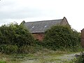
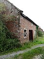
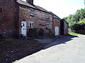
 Barn, Shotwick Hall Farm.JPG 3,648 × 2,736; 3.53 MB
-
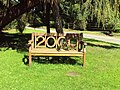
 Bench, Shotwick 1.JPG 3,648 × 2,736; 3.66 MB
-
 Bench, Shotwick 2.JPG 3,648 × 2,736; 3.67 MB
-
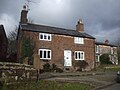
 Church Cottage, Shotwick 01.jpg 4,000 × 3,000; 1.26 MB
-
 Church Cottage, Shotwick 02.jpg 4,000 × 3,000; 1.23 MB
-
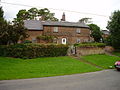
 Church Farm Cottage 01.jpg 4,000 × 3,000; 1.33 MB
-
 Church Farm Cottage 02.jpg 4,000 × 3,000; 1.23 MB
-
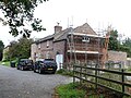
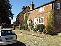
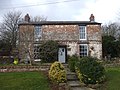
 Church Farm Cottage, Shotwick.jpg 3,296 × 2,472; 1.9 MB
-
 Cottage, Shotwick 1.JPG 3,648 × 2,736; 3.53 MB
-
 Cottages, Shotwick - DSC06447.JPG 3,648 × 2,736; 3.49 MB
-
 Cottages, Shotwick 1.JPG 3,648 × 2,736; 3.53 MB
-
 Cottages, Shotwick 2.JPG 3,648 × 2,736; 3.52 MB
-
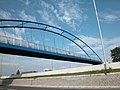 Cycleway Bridge - geograph.org.uk - 36621.jpg 640 × 480; 155 KB
-
 Drainage channel near Shotwick - geograph.org.uk - 222466.jpg 640 × 480; 163 KB
-
 Electricity Station near Shotwick - geograph.org.uk - 222765.jpg 640 × 480; 73 KB
-
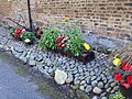 Flowers, Shotwick.JPG 3,648 × 2,736; 3.55 MB
-
 Footpath closed sign, Shotwick - DSC06450.JPG 2,760 × 1,985; 4.47 MB
-
 Granary at Shotwick Lodge Farm 01.jpg 4,000 × 3,000; 5.08 MB
-
 Granary at Shotwick Lodge Farm 02.jpg 3,000 × 4,000; 4.74 MB
-
 Green Lane West gate, Shotwick.JPG 3,648 × 2,736; 3.48 MB
-
 Green Lane West, Shotwick 1.JPG 3,648 × 2,736; 3.58 MB
-
 Greenways Turf near Shotwick - geograph.org.uk - 222489.jpg 640 × 480; 81 KB
-
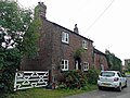
 Greyhound Farmhouse, Shotwick.jpg 3,000 × 4,000; 1.06 MB
-
 Hall Lane, Shotwick - DSC06446.JPG 3,648 × 2,736; 3.61 MB
-
 Horses, Shotwick.JPG 3,648 × 2,736; 3.48 MB
-
 Houses in Shotwick - geograph.org.uk - 203126.jpg 640 × 480; 97 KB
-
 Iron Mooring Ring at Shotwick Churchyard - geograph.org.uk - 437951.jpg 640 × 404; 102 KB
-
 Lamppost, Shotwick.JPG 2,736 × 3,648; 3.62 MB
-
 Leek field on the Welsh border - geograph.org.uk - 649860.jpg 640 × 480; 112 KB
-
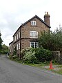
 Manor Farmhouse, Shotwick.jpg 4,052 × 3,070; 1.21 MB
-
 Noticeboard, Shotwick.JPG 3,648 × 2,736; 3.45 MB
-
 Pipeline - geograph.org.uk - 116864.jpg 640 × 480; 225 KB
-
 Roadworks at Shotwick - geograph.org.uk - 872564.jpg 640 × 480; 102 KB
-
 Shotwick 1.JPG 3,648 × 2,736; 3.62 MB
-
 Shotwick 2.JPG 3,648 × 2,736; 3.62 MB
-
 Shotwick 3.JPG 3,648 × 2,736; 3.6 MB
-
 Shotwick 4.JPG 3,648 × 2,736; 3.62 MB
-
 Shotwick 5.JPG 3,648 × 2,736; 3.66 MB
-
 Shotwick 6.JPG 3,648 × 2,736; 3.59 MB
-
 Shotwick 7.JPG 3,648 × 2,736; 3.62 MB
-
 Shotwick 8.JPG 3,648 × 2,736; 3.55 MB
-
 Shotwick Brook - geograph.org.uk - 116857.jpg 640 × 480; 245 KB
-
 Shotwick Junction - geograph.org.uk - 132670.jpg 640 × 480; 140 KB
-
 Shotwick Junction - geograph.org.uk - 872570.jpg 640 × 480; 98 KB
-
 Shotwick Lane, Shotwick.JPG 3,648 × 2,736; 3.51 MB
-
 Shotwick sign - DSC06445.JPG 3,648 × 2,736; 3.58 MB
-
 Shotwick sign and speed limit - DSC06444.JPG 3,648 × 2,736; 3.65 MB
-
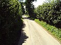 Single track road, Shotwick 1.JPG 3,648 × 2,736; 3.58 MB
-
 Single track road, Shotwick 2.JPG 3,648 × 2,736; 3.68 MB
-
 Stone Cottage, Shotwick 01.jpg 4,000 × 3,000; 1.43 MB
-
 Stone Cottage, Shotwick 02.jpg 4,000 × 3,000; 1.16 MB
-
 Track, Shotwick Hall Farm 1.JPG 3,648 × 2,736; 3.59 MB
-
 Track, Shotwick Hall Farm 2.JPG 3,648 × 2,736; 3.55 MB
-
 Track, Shotwick Hall Farm 3.JPG 3,648 × 2,736; 3.59 MB
-
 Vicarage Farmhouse, Shotwick.jpg 640 × 480; 92 KB
-
 Woodbine Cottage, Shotwick.jpg 3,296 × 2,472; 1.92 MB


