Category:Shuttington
village in Warwickshire, England, UK  | |||||
| Upload media | |||||
| Instance of | |||||
|---|---|---|---|---|---|
| Location | North Warwickshire, Warwickshire, West Midlands, England | ||||
| Population |
| ||||
| Area |
| ||||
 | |||||
English: Shuttington is a village and civil parish in North Warwickshire, England, situated north-east of Tamworth, Staffordshire. In the 2001 census, the parish, which also includes Alvecote, had a population of 563.
Subcategories
This category has the following 2 subcategories, out of 2 total.
A
S
Media in category "Shuttington"
The following 177 files are in this category, out of 177 total.
-
 A Good View Ruined - geograph.org.uk - 2635561.jpg 640 × 428; 110 KB
-
 A Mallard Drake - geograph.org.uk - 1339477.jpg 640 × 424; 122 KB
-

-
 Abandoned boat - geograph.org.uk - 1339464.jpg 640 × 425; 118 KB
-

-
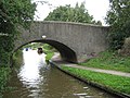
 Alvecote Bridge No 59 - geograph.org.uk - 4836701.jpg 800 × 577; 151 KB
-

-
 Alvecote Cottages - geograph.org.uk - 4894892.jpg 640 × 426; 38 KB
-
 Alvecote Cottages - geograph.org.uk - 5000939.jpg 1,024 × 750; 160 KB
-
 Alvecote Marina - geograph.org.uk - 5000973.jpg 1,024 × 768; 145 KB
-
 Alvecote Marina and the Coventry Canal - geograph.org.uk - 4836732.jpg 800 × 542; 115 KB
-
 Alvecote Pool - geograph.org.uk - 3657650.jpg 611 × 640; 60 KB
-
 Alvecote Pools - geograph.org.uk - 2221794.jpg 640 × 430; 126 KB
-
 Alvecote Pools - geograph.org.uk - 2221795.jpg 640 × 430; 118 KB
-
 Alvecote Pools - geograph.org.uk - 2432872.jpg 3,648 × 2,736; 2.01 MB
-
 Alvecote Pools - geograph.org.uk - 2834087.jpg 640 × 430; 45 KB
-
 Alvecote Pools Nature Reserve - geograph.org.uk - 4489141.jpg 640 × 480; 74 KB
-
 Alvecote Priory from the mound in Pooley Country Park - geograph.org.uk - 3696765.jpg 1,600 × 1,067; 249 KB
-
 Alvecote through the trees - geograph.org.uk - 3657657.jpg 640 × 353; 46 KB
-
 Alvecote, Bridge No 59 - geograph.org.uk - 5000995.jpg 1,024 × 768; 226 KB
-
 Alvecote, Coventry Canal - geograph.org.uk - 5001020.jpg 1,024 × 768; 172 KB
-
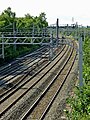
 Alvecote, railway lines - geograph.org.uk - 5000985.jpg 1,024 × 768; 173 KB
-
 Alvecote, Samuel Barlow - geograph.org.uk - 5000963.jpg 1,024 × 768; 100 KB
-
 Alvecote, street furniture - geograph.org.uk - 5000980.jpg 1,024 × 768; 148 KB
-
 Amington Hall Farm - geograph.org.uk - 428068.jpg 640 × 480; 62 KB
-
 Below Oak Tree Halt - geograph.org.uk - 5837978.jpg 1,280 × 853; 563 KB
-

-

-
 Burton and Ashby tram 14 at Oak Tree Halt - geograph.org.uk - 5837969.jpg 1,280 × 853; 411 KB
-
-
 Canal and Towpath - geograph.org.uk - 1296699.jpg 640 × 372; 89 KB
-
 Canal bend at Alvecote - geograph.org.uk - 1291150.jpg 640 × 425; 113 KB
-
 Canal Bridge View - geograph.org.uk - 1338865.jpg 640 × 510; 137 KB
-
 Canalside scene at Alvecote marina - geograph.org.uk - 5049050.jpg 640 × 427; 82 KB
-
 Coventry Canal near Alvecote - geograph.org.uk - 5049226.jpg 640 × 427; 96 KB
-
 Coventry Canal near Alvecote in Staffordshire - geograph.org.uk - 5705587.jpg 960 × 1,280; 1.51 MB
-
 Coventry Canal towpath at Alvecote - geograph.org.uk - 4836738.jpg 800 × 600; 135 KB
-
-
 Coventry Canal, Reach near Alvecote - geograph.org.uk - 3142221.jpg 640 × 480; 97 KB
-
 Coventry Canal, The Samuel Barlow - geograph.org.uk - 3142116.jpg 640 × 480; 68 KB
-
 Crop field off New Road - geograph.org.uk - 4489129.jpg 640 × 480; 83 KB
-
 Crop field, Shuttington - geograph.org.uk - 4494576.jpg 640 × 480; 64 KB
-
 Crop field, Shuttington Bridge - geograph.org.uk - 4489136.jpg 640 × 480; 56 KB
-
 Cropfields by Alvecote Pools in Staffordshire - geograph.org.uk - 5707414.jpg 1,280 × 840; 1.18 MB
-
 CSR 19 approaching Oak Tree Halt - geograph.org.uk - 5837998.jpg 1,280 × 720; 389 KB
-
 Down the Road Towards Seckington - geograph.org.uk - 2635595.jpg 640 × 428; 37 KB
-
 Ducklings next to the canal - geograph.org.uk - 1323225.jpg 640 × 425; 196 KB
-
 Entering Shuttington - geograph.org.uk - 4494569.jpg 640 × 480; 60 KB
-

-
 Express Stores, Shuttington - geograph.org.uk - 4494577.jpg 640 × 480; 47 KB
-
 Farmland and pylon - geograph.org.uk - 3850169.jpg 640 × 480; 42 KB
-
 Farmland by Alvecote Pools in Staffordshire - geograph.org.uk - 5707416.jpg 1,280 × 854; 1.17 MB
-
 Farmland by Alvecote Pools in Staffordshire - geograph.org.uk - 5707421.jpg 1,440 × 1,080; 1.62 MB
-
 Farmland south-east of Copnill Farm - geograph.org.uk - 5326512.jpg 1,024 × 768; 144 KB
-
 Field entrance east of Shuttington - geograph.org.uk - 4489180.jpg 640 × 480; 97 KB
-
 Field of colour - geograph.org.uk - 1296802.jpg 640 × 425; 89 KB
-
 Fields near Statfold Barn Farm - geograph.org.uk - 1770030.jpg 640 × 426; 55 KB
-

-
 Footpath over fields, Shuttington - geograph.org.uk - 4494573.jpg 640 × 480; 66 KB
-
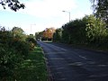 Glascote Road (B5000) - geograph.org.uk - 3850170.jpg 640 × 480; 74 KB
-
 Hidden canal narrowboat - geograph.org.uk - 1323150.jpg 640 × 425; 261 KB
-
 Horses grazing on the land of a property - geograph.org.uk - 1323076.jpg 640 × 425; 155 KB
-

-
 Leaning priory remains - geograph.org.uk - 1323187.jpg 425 × 640; 214 KB
-
-
 Looking north to Copnill Farm - geograph.org.uk - 5324287.jpg 1,024 × 768; 248 KB
-
 M42 bridge over the river Anker - geograph.org.uk - 232133.jpg 640 × 480; 101 KB
-
 Marina building at Alvecote - geograph.org.uk - 5049044.jpg 640 × 427; 68 KB
-

-
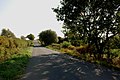
 Minor road towards Seckington - geograph.org.uk - 4489183.jpg 640 × 480; 69 KB
-
 Minor road towards Seckington - geograph.org.uk - 4494585.jpg 640 × 480; 74 KB
-

-
 Moored narrowboat near Alvecote in Staffordshire - geograph.org.uk - 5705590.jpg 1,280 × 960; 1.84 MB
-
 Mooring place - geograph.org.uk - 1338856.jpg 640 × 455; 131 KB
-
 Mother duck and ducklings on the canal - geograph.org.uk - 1323231.jpg 640 × 547; 128 KB
-
 Narrowboat being repaired - geograph.org.uk - 2574618.jpg 1,600 × 951; 414 KB
-
 Narrowboat Cruising - geograph.org.uk - 1359881.jpg 604 × 401; 89 KB
-
 Narrowboat on the Coventry canal - geograph.org.uk - 1367944.jpg 640 × 442; 227 KB
-
 Narrowboats Marina - geograph.org.uk - 2574566.jpg 1,600 × 1,200; 568 KB
-
 Narrowboats Marina Alvecote - geograph.org.uk - 2574580.jpg 1,600 × 1,259; 533 KB
-
 New Road - geograph.org.uk - 4494565.jpg 640 × 480; 52 KB
-
 New Road near Poplars Farm - geograph.org.uk - 4494563.jpg 640 × 480; 53 KB
-
 Oak Tree Halt - geograph.org.uk - 5837974.jpg 1,280 × 853; 378 KB
-

-
 Old Tree - geograph.org.uk - 1296692.jpg 436 × 640; 93 KB
-
 Picnic area by Alvecote Priory in Staffordshire - geograph.org.uk - 5706224.jpg 1,280 × 960; 1.45 MB
-
 Picnic site and Alvecote Priory ruin, Staffordshire - geograph.org.uk - 5705671.jpg 1,440 × 973; 1.65 MB
-
 Priory wall with canal backdrop - geograph.org.uk - 1323241.jpg 640 × 425; 232 KB
-
 Railway lines near Alvecote in Staffordshire - geograph.org.uk - 5706765.jpg 960 × 1,280; 1.7 MB
-
 Railway lines near Alvecote in Staffordshire - geograph.org.uk - 5706768.jpg 1,280 × 898; 1.54 MB
-
 Railway lines near Alvecote in Staffordshire - geograph.org.uk - 5706774.jpg 1,280 × 960; 1.5 MB
-
 Road Bridge Over Alvecote Canal - geograph.org.uk - 1291320.jpg 640 × 425; 75 KB
-
 Road in Alvecote - geograph.org.uk - 1296669.jpg 640 × 425; 91 KB
-
 Road into Alvecote - geograph.org.uk - 614945.jpg 640 × 480; 68 KB
-
 Robey's Lane at Alvecote Bridge, Staffordshire - geograph.org.uk - 5706688.jpg 1,280 × 871; 1.3 MB
-

-
 Samuel Barber pub sign near Alvecote, Staffordshire - geograph.org.uk - 5706715.jpg 960 × 1,280; 1.13 MB
-
 Scrubland vegetation near Alvecote - geograph.org.uk - 2221789.jpg 640 × 430; 65 KB
-
 Shuttington, UK - panoramio (3).jpg 5,472 × 3,648; 8.16 MB
-
 Shuttington, UK - panoramio (4).jpg 5,472 × 3,648; 3.94 MB
-
 Shuttington, UK - panoramio (5).jpg 5,472 × 3,648; 4 MB
-
 Shuttington, UK - panoramio (6).jpg 5,472 × 3,648; 8.92 MB
-
 Shuttington, UK - panoramio (7).jpg 5,472 × 3,648; 7.77 MB
-
 Shuttington, UK - panoramio (8).jpg 5,472 × 3,648; 8.16 MB
-
 Shuttington, UK - panoramio (9).jpg 5,472 × 3,648; 8.14 MB
-

-
 Staffordshire farmland east of Alvecote - geograph.org.uk - 5706800.jpg 1,600 × 913; 1.37 MB
-
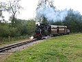 Statfold Barn Narrow Gauge Railway - geograph.org.uk - 564861.jpg 640 × 480; 91 KB
-

-

-

-

-

-
 Statfold Barn Railway - digging in - geograph.org.uk - 4908787.jpg 640 × 427; 98 KB
-
 Statfold Barn Railway - double headed - geograph.org.uk - 6183434.jpg 640 × 427; 121 KB
-
 Statfold Barn Railway - doubleheaded - geograph.org.uk - 6105163.jpg 640 × 427; 101 KB
-

-

-
-

-
 Statfold Barn Railway - geograph.org.uk - 4514384.jpg 640 × 427; 92 KB
-
 Statfold Barn Railway - goods train - geograph.org.uk - 6095951.jpg 640 × 427; 118 KB
-

-

-
 Statfold Barn Railway - Howard - geograph.org.uk - 4163835.jpg 640 × 427; 103 KB
-

-

-
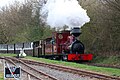
 Statfold Barn Railway - Hunslet trio - geograph.org.uk - 6097552.jpg 640 × 425; 86 KB
-
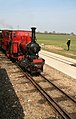
 Statfold Barn Railway - Jack - geograph.org.uk - 6097460.jpg 640 × 427; 81 KB
-

-

-

-

-
-
-
 Statfold Barn Railway - on points duty - geograph.org.uk - 4520217.jpg 640 × 427; 109 KB
-

-

-
 Statfold Barn Railway - sweet - geograph.org.uk - 4163954.jpg 640 × 427; 90 KB
-
 Statfold Barn Railway - sweet - geograph.org.uk - 6099934.jpg 640 × 427; 96 KB
-
 Statfold Barn Railway - top and tailed - geograph.org.uk - 6099751.jpg 640 × 427; 113 KB
-

-
 Statfold Barn Railway - train - geograph.org.uk - 4518855.jpg 640 × 427; 110 KB
-

-
 Statfold Barn Railway - trains crossing - geograph.org.uk - 6105173.jpg 640 × 427; 103 KB
-

-
 Statfold Barn Railway - tram shed - geograph.org.uk - 5488215.jpg 640 × 427; 113 KB
-

-

-
 Statfold Barn Railway Open Day - geograph.org.uk - 3397571.jpg 2,000 × 1,333; 1.41 MB
-
-
 Statfold Barn, Burton and Ashby tram 14 - geograph.org.uk - 5837967.jpg 1,280 × 853; 374 KB
-
 Steps from canal - geograph.org.uk - 1363478.jpg 422 × 640; 116 KB
-
 Stop sign, Balloon Loop, Statfold Barn Railway - geograph.org.uk - 5324282.jpg 1,024 × 769; 178 KB
-

-

-
 The old Farmhouse, New Road, Shuttington - geograph.org.uk - 2635516.jpg 640 × 428; 112 KB
-

-
 The Wolferstan Arms, Shuttington - geograph.org.uk - 2635550.jpg 640 × 428; 62 KB
-
 The Wolferstan Arms, Shuttington - geograph.org.uk - 4489131.jpg 640 × 480; 41 KB
-
 Tram in the countryside - geograph.org.uk - 5837976.jpg 1,280 × 959; 397 KB
-
 Tram in the countryside - geograph.org.uk - 5837991.jpg 1,280 × 853; 285 KB
-
 Uphill on New Road - geograph.org.uk - 4494567.jpg 640 × 480; 48 KB
-

-
 Welcome to Shuttington - geograph.org.uk - 2635536.jpg 640 × 428; 55 KB
-
 Working boat near Alvecote in Warwickshire - geograph.org.uk - 5708886.jpg 1,280 × 867; 1.43 MB
-
 Alvecote - View from road to water - geograph.org.uk - 614948.jpg 640 × 480; 67 KB
-
 Buildings on Kisses Barn Lane - geograph.org.uk - 124571.jpg 640 × 480; 127 KB
-
 Lane to Alvecote - geograph.org.uk - 98087.jpg 640 × 333; 61 KB
-
 Linden Lodge - geograph.org.uk - 124574.jpg 640 × 480; 127 KB
-
 North Warwickshire Colliery Sports Club - geograph.org.uk - 66209.jpg 640 × 480; 149 KB
-
 Pooley Fields Heritage Centre - geograph.org.uk - 15416.jpg 640 × 480; 88 KB
-
 Property next to Pooley Hall - geograph.org.uk - 31583.jpg 640 × 480; 123 KB
-
 Shuttington Bridge - geograph.org.uk - 124576.jpg 640 × 480; 92 KB
-
 The M42 crosses the Coventry Canal - geograph.org.uk - 42814.jpg 640 × 480; 115 KB
-
 The Wolferstan Arms, Shuttington - geograph.org.uk - 98047.jpg 640 × 480; 73 KB
-
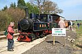
 “Driver for a fiver” - geograph.org.uk - 5837971.jpg 1,280 × 853; 630 KB


_-_geograph.org.uk_-_3850170.jpg)


.jpg)
.jpg)
.jpg)
.jpg)
.jpg)
.jpg)
.jpg)


