Category:Signs by the Department of Conservation (New Zealand)
Media in category "Signs by the Department of Conservation (New Zealand)"
The following 69 files are in this category, out of 69 total.
-
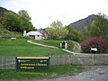 Arrowtown Chinese Settlement.jpg 2,272 × 1,704; 1.19 MB
-
 Awapoto Hut and Moa Park Inland Track intersection - panoramio.jpg 1,024 × 768; 723 KB
-
-
 Castle Rock sign behind Moa Park shelter - panoramio.jpg 1,024 × 768; 512 KB
-
 Catlins - Cannibal Bay signage.jpg 3,072 × 2,304; 3.27 MB
-
 Chummies track sign, Kahurangi, New Zealand.jpg 5,149 × 3,648; 21.65 MB
-
 Craters of the moon,Taupo - měsíční krátery v Taupo - panoramio.jpg 1,280 × 960; 486 KB
-
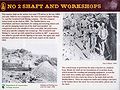 Cromwell Quartz and Gold Mining.jpg 2,560 × 1,920; 452 KB
-

-
 DOC Intentions Shelter on Abel Tasman Inland Track - panoramio.jpg 768 × 1,024; 508 KB
-
 DoC Logo twice.jpg 2,048 × 1,536; 723 KB
-
 DOC sign with walking times in several directions - panoramio.jpg 1,024 × 768; 621 KB
-
 Egmont NP, New Zealand.jpg 1,800 × 1,350; 1.17 MB
-
 Entrance Rakiura National Park.jpg 3,648 × 2,736; 5.12 MB
-
 Fjordland National Park sign.jpg 2,272 × 1,704; 731 KB
-
 Harper Pass 3.jpg 6,000 × 3,376; 8.69 MB
-
 Harper Pass in 2014.jpg 2,048 × 1,361; 1.32 MB
-
 Henry Creek Info.jpg 711 × 949; 160 KB
-
 Hiking sign near Stratford Mountain House.jpg 3,985 × 2,657; 8.72 MB
-
 Hurunui Coastal Track in Manuka Bay, Hurunui District, Canterbury, New Zealand 02.jpg 5,472 × 3,648; 16.04 MB
-
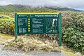
 Information board about Otira Valley Track.jpg 4,035 × 2,690; 13.37 MB
-
 Information board about Otira Valley.jpg 4,477 × 3,171; 14.56 MB
-
 Information board in Abel Tasman NP 01.jpg 3,142 × 2,095; 6.77 MB
-
 Information board in Abel Tasman NP 03.jpg 3,217 × 2,596; 10.61 MB
-
 Information board in Abel Tasman NP 04.jpg 2,467 × 1,969; 3.42 MB
-
 Information board in Egmont National Park.jpg 4,465 × 2,977; 10.88 MB
-
 Information board in Egmont NP.jpg 3,060 × 2,394; 7.07 MB
-
 Lake Ngatu 01.jpg 1,024 × 683; 201 KB
-
 Mahoetahi.jpg 1,024 × 768; 302 KB
-
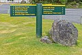
 Manaia sign.JPG 2,592 × 1,728; 1.25 MB
-
 Milnthorpe Nov 2021 06.jpg 4,032 × 3,024; 4.03 MB
-
 Moa Park intersection on Inland Track - panoramio.jpg 1,024 × 768; 697 KB
-
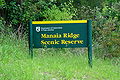
 Moeraki Boulders Scenic Reserve - 2013.04 - panoramio.jpg 4,608 × 3,456; 3.04 MB
-
 Mohi Bush.jpg 4,032 × 3,024; 2.34 MB
-
 Mt Aitken Track 03.jpg 4,000 × 3,000; 4.22 MB
-
 Nelson Line near Kawatiri 020.jpg 5,472 × 3,648; 6.64 MB
-
 New Zealand tramping from Crow Hut to Arthurs Pass 01.jpg 4,752 × 3,168; 4.92 MB
-
 Ninetymilebeach-Warning.jpg 2,160 × 1,440; 1,010 KB
-
 Okiato - 29003937723.jpg 5,687 × 3,791; 2.58 MB
-
 Okiato - 29517067722.jpg 5,527 × 3,685; 1.92 MB
-
 Otago Central Rail Trail Sign-Board.jpg 1,024 × 768; 397 KB
-
 Otira Valley - panoramio.jpg 2,816 × 1,880; 1.86 MB
-
 PreventWildFiresIn2010.jpg 3,072 × 2,304; 2.97 MB
-
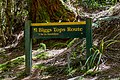
 Puketeraki Forest Conservation Area sign, Canterbury, New Zealand.jpg 5,472 × 3,648; 13.17 MB
-
 Russell 1759 (10260467293) (4).jpg 1,600 × 1,067; 1.45 MB
-
 Seals napier.jpg 535 × 640; 226 KB
-
 Sign at flora - panoramio.jpg 3,200 × 2,400; 2.46 MB
-
 Sign-1120746, Wainuiomata, Wellington, New Zealand.jpg 4,896 × 3,672; 5.38 MB
-
 Sign-8313, Wainuiomata, Wellington, New Zealand.jpg 1,920 × 1,080; 632 KB
-
 Start of hiking trails in Castle Hill Village, Canterbury, New Zealand.jpg 5,165 × 3,454; 13.78 MB
-
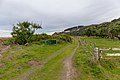
 Start of Hollyford Track.jpg 3,900 × 2,613; 4.69 MB
-
 Tauherenikau River 74.jpg 2,048 × 1,536; 696 KB
-
 Toilet sign by Cedar Flat hut, West Coast, New Zealand 03.jpg 5,472 × 3,648; 17.45 MB
-
 Tongariro River.JPG 2,592 × 1,728; 2.03 MB
-
 Top of Liburne Hill, Puketeraki Forest Conservation Area, Canterbury, New Zealand.jpg 5,230 × 3,503; 11.85 MB
-
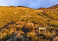
 Trailhead Sign for Orongorongo Track.jpg 4,549 × 3,381; 5.71 MB
-
 Tunnel Hill, Historic Walk - 27176342083.jpg 5,558 × 3,705; 2.72 MB
-
 Tunnel Hill, Historic Walk - 27176354273.jpg 3,532 × 2,355; 853 KB
-
 Tunnel Hill, Historic Walk - 27752791036.jpg 4,735 × 3,157; 2.13 MB
-
 Turnbull House sign - Wellington.jpg 2,592 × 1,944; 1.84 MB
-
 Waiohine Gorge campsite entrance.jpg 4,640 × 3,480; 7.47 MB
-
 Waiohine Gorge campsite map.jpg 4,640 × 3,480; 7.44 MB
-
 Wangapeka Saddle sign, Wangapeka Track, Kahurangi National Park, New Zealand.jpg 5,191 × 3,358; 12.32 MB
-
 Wangapeka Track - Warning Damaged Track.jpg 4,032 × 3,024; 3.27 MB
-
 Washbourne 45.jpg 4,032 × 3,024; 6.63 MB
-
 Washbourne 46.jpg 4,032 × 3,024; 7.08 MB
-
 Welcome Flat Hut 61.jpg 5,472 × 3,648; 4.1 MB
-
 Whanganui Rive3r, NZ - panoramio.jpg 832 × 468; 274 KB
-
 Yankee Wharf, Rangitoto.jpg 539 × 960; 173 KB


_(4).jpg)


