Category:Sint-Antonius Abtkerk (Moerbeke)
| Object location | | View all coordinates using: OpenStreetMap |
|---|
|
This is a category about Beschermd erfgoed number 8822
|
|
This is a category about onroerend erfgoed number 34245
|
church in Moerbeke, Belgium  | |||||
| Upload media | |||||
| Instance of | |||||
|---|---|---|---|---|---|
| Dedicated to | |||||
| Location | Moerbeke, Arrondissement of Ghent, East Flanders, Flemish Region, Belgium | ||||
| Diocese | |||||
 | |||||
Media in category "Sint-Antonius Abtkerk (Moerbeke)"
The following 17 files are in this category, out of 17 total.
-
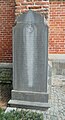 Grafmonument Jean Philippe Lippens 1697-1788 - Moerbeke.jpg 1,881 × 3,473; 1.85 MB
-
 Heilig Kruisbeeld - Sint Antonius Abtkerk - Moerbeke.jpg 2,025 × 2,689; 1.74 MB
-
-

-

-
 Moerbeke Waas Sint Antonius 2.JPG 2,991 × 2,624; 5.97 MB
-
 Moerbeke Waas Sint Antonius.JPG 2,736 × 3,648; 4.69 MB
-
 Moerbeke, parochiekerk Sint Antonius Abt oeg34245 foto6 2013-05-06 12.31.jpg 4,402 × 3,302; 12.92 MB
-
 Onroerenderfgoed34245 Moerbeke.jpg 3,661 × 2,592; 2.59 MB
-
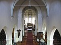
 Parochiekerk Sint-Antonius abt, Moerbeke 01.jpg 6,000 × 4,000; 13.56 MB
-
 Parochiekerk Sint-Antonius abt, Moerbeke 02.jpg 4,000 × 6,000; 10.04 MB
-
 Petrus Joannes Van de Gotte - 1771-1857 - Moerbeke.jpg 2,053 × 2,749; 1.51 MB
-
 Sint Antonius Abtkerk - Moerbeke (01).jpg 2,736 × 3,648; 3.29 MB
-
 Sint Antonius Abtkerk - Moerbeke (02).jpg 3,648 × 2,736; 4.02 MB
-
 Sint Antonius Abtkerk - Moerbeke (03).jpg 3,648 × 2,352; 2.02 MB
-
 Sint Antonius Abtkerk - Moerbeke (04).jpg 3,648 × 2,736; 3.98 MB
-
 Sint-Antonius Abt kerk, Moerbeke-Waas - panoramio.jpg 3,551 × 2,663; 4.75 MB


.jpg)
.jpg)
.jpg)
.jpg)
