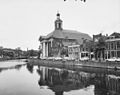
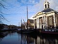
Category:Sint-Jan-de-Doperkerk (Schiedam)
| Object location | | View all coordinates using: OpenStreetMap |
|---|
church building in Schiedam, Netherlands  | |||||
| Upload media | |||||
| Instance of | |||||
|---|---|---|---|---|---|
| Location | Schiedam, South Holland, Netherlands | ||||
| Street address |
| ||||
| Located on street | |||||
| Architect | |||||
| Heritage designation |
| ||||
 | |||||
Nederlands: Sint Johannes de Doper kerk
|
This is a category about rijksmonument number 33223
|
| Address |
|
Subcategories
This category has only the following subcategory.
Media in category "Sint-Jan-de-Doperkerk (Schiedam)"
The following 30 files are in this category, out of 30 total.
-
 33223 Johannes de Doperkerk.jpg 2,000 × 1,467; 2.35 MB
-
 Exterieur - Schiedam - 20196556 - RCE.jpg 1,200 × 963; 286 KB
-
 Exterieur kerk - Schiedam - 20196844 - RCE.jpg 1,200 × 947; 275 KB
-
 Exterieur met overzicht - Schiedam - 20196559 - RCE.jpg 1,200 × 992; 255 KB
-
 Exterieur overzicht - Schiedam - 20196557 - RCE.jpg 1,200 × 953; 289 KB
-
 Gevels bij Rooms-Katholieke Sint Jan - Schiedam - 20196838 - RCE.jpg 1,200 × 805; 184 KB
-
 GraphyArchy - Wikipedia 00339.jpg 3,718 × 2,500; 8.46 MB
-
 Johannes de Doperkerk, Schiedam (01).JPG 6,000 × 4,000; 6.63 MB
-
 Lange Haven 72, exterieur - Schiedam - 20196506 - RCE.jpg 805 × 1,200; 149 KB
-
 Overzicht - Schiedam - 20196843 - RCE.jpg 1,200 × 944; 213 KB
-
 Overzicht - Schiedam - 20196845 - RCE.jpg 1,200 × 952; 185 KB
-
 Overzicht - Schiedam - 20196846 - RCE.jpg 1,200 × 946; 250 KB
-
 Overzicht - Schiedam - 20378699 - RCE.jpg 1,200 × 1,200; 395 KB
-
 Overzicht Lange Haven met Haven naar het zuid-oosten - Schiedam - 20196294 - RCE.jpg 1,200 × 1,192; 237 KB
-

-
 Overzicht met kerk - Schiedam - 20196558 - RCE.jpg 1,200 × 959; 224 KB
-
 Overzicht met kerk - Schiedam - 20196560 - RCE.jpg 1,200 × 951; 220 KB
-

-
 Overzicht neoclassicistische hallekerk - Schiedam - 20369631 - RCE.jpg 1,200 × 1,194; 227 KB
-
 Overzicht westgevel en een zuilenportiek - Schiedam - 20378706 - RCE.jpg 1,200 × 956; 288 KB
-
 Schiedam - Lange Haven 72.jpg 1,944 × 2,592; 1.34 MB
-
 Schiedam Centrum DSCF3808.JPG 2,816 × 2,112; 2.69 MB
-
 Schiedam Centrum DSCF3811.JPG 2,816 × 2,112; 2.66 MB
-
 Schiedam Havenkerk.jpg 4,000 × 3,000; 2.33 MB
-
 Schiedam, Johannes de Doperkerk RM33223 foto3 2013-07-07 17.19.jpg 4,319 × 3,239; 7.58 MB
-
 Schiedam, Netherlands - panoramio (48).jpg 2,048 × 1,148; 346 KB
-
 Schiedam, Netherlands - panoramio (52).jpg 2,048 × 1,148; 398 KB
-
 Voorgevel - Schiedam - 20196563 - RCE.jpg 1,200 × 1,124; 283 KB
-
 Voorgevel kerk - Schiedam - 20196562 - RCE.jpg 961 × 1,200; 217 KB
-
 Voorzijde kerk - Schiedam - 20196561 - RCE.jpg 955 × 1,200; 218 KB


.JPG)


.jpg)
.jpg)


