Category:Sint-Lambertuskerk, Gemonde
| Object location | | View all coordinates using: OpenStreetMap |
|---|
church in Gemonde, Netherlands .JPG) | |||||
| Upload media | |||||
| Instance of | |||||
|---|---|---|---|---|---|
| Part of | |||||
| Dedicated to | |||||
| Location | Gemonde, Sint-Michielsgestel, North Brabant, Netherlands | ||||
| Street address |
| ||||
| Located on street |
| ||||
| Architect | |||||
| Heritage designation |
| ||||
| Religion or worldview | |||||
 | |||||
|
This is a category about rijksmonument number 519910
|
| Address |
|
Subcategories
This category has only the following subcategory.
G
- Oude Sint-Lambertuskerk, Gemonde (14 F)
Media in category "Sint-Lambertuskerk, Gemonde"
The following 20 files are in this category, out of 20 total.
-
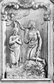
 Beeld H.Elisabeth van Thuringen - Gemonde - 20077110 - RCE.jpg 782 × 1,200; 237 KB
-
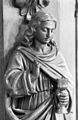
 Beeld van St.Lucia - Gemonde - 20077109 - RCE.jpg 788 × 1,200; 248 KB
-
 Detail klok - Gemonde - 20077098 - RCE.jpg 788 × 1,200; 238 KB
-
 Detail preekstoel (St.Petrus) - Gemonde - 20077102 - RCE.jpg 788 × 1,200; 189 KB
-
 Detail preekstoel - Gemonde - 20077099 - RCE.jpg 792 × 1,200; 251 KB
-
 Detail preekstoel - Gemonde - 20077100 - RCE.jpg 788 × 1,200; 243 KB
-
 Detail preekstoel - Gemonde - 20077101 - RCE.jpg 788 × 1,200; 138 KB
-
 Detail preekstoel - Gemonde - 20077103 - RCE.jpg 777 × 1,200; 185 KB
-
 Detail van preekstoel - Gemonde - 20077108 - RCE.jpg 792 × 1,200; 245 KB
-
 Interieur naar het oosten - Gemonde - 20077104 - RCE.jpg 788 × 1,200; 233 KB
-
 Interieur naar het westen - Gemonde - 20077105 - RCE.jpg 796 × 1,200; 245 KB
-
 Interieur, aanzicht orgel - Gemonde - 20369054 - RCE.jpg 817 × 1,200; 248 KB
-
 Klok - Gemonde - 20077096 - RCE.jpg 788 × 1,200; 272 KB
-
 Klok - Gemonde - 20077097 - RCE.jpg 788 × 1,200; 244 KB
-
 Orgel - Gemonde - 20077106 - RCE.jpg 788 × 1,200; 236 KB
-
 Preekstoel - Gemonde - 20077107 - RCE.jpg 788 × 1,200; 262 KB
-
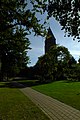 T.T RK Kerk Gemonde (1).JPG 3,072 × 4,608; 3.25 MB
-
 T.T RK Kerk Gemonde (2).JPG 3,072 × 4,608; 3.37 MB
-
 T.T RK Kerk Gemonde (3).JPG 3,072 × 4,608; 3.31 MB
-
 Tekening - Gemonde - 20077085 - RCE.jpg 897 × 1,200; 259 KB


_-_Gemonde_-_20077102_-_RCE.jpg)


.JPG)
.JPG)
