Category:Sint-Urbanuskerk (Duivendrecht)
| Object location | | View all coordinates using: OpenStreetMap |
|---|
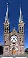
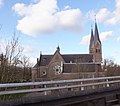
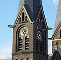
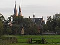
church building in Ouder-Amstel, Netherlands  | |||||
| Upload media | |||||
| Instance of | |||||
|---|---|---|---|---|---|
| Named after | |||||
| Location | Duivendrecht, Ouder-Amstel, North Holland, Netherlands | ||||
| Architectural style | |||||
| Architect | |||||
| Inception |
| ||||
| Religion or worldview | |||||
 | |||||
Media in category "Sint-Urbanuskerk (Duivendrecht)"
The following 39 files are in this category, out of 39 total.
-
 20150606-Sint Urbanuskerk Duivendrecht.jpg 2,874 × 5,839; 2.94 MB
-
 Amsterdam - Sint-Urbanuskerk v2.jpg 4,032 × 3,024; 2.74 MB
-
 Amsterdam - Sint-Urbanuskerk.jpg 2,818 × 3,911; 3.34 MB
-
 Belgie rail mei 1982 01.jpg 2,094 × 1,517; 330 KB
-
 Bikes in Holland.jpg 4,608 × 3,456; 3.57 MB
-
 Bouw station Duivendrecht 1991 4.jpg 2,124 × 1,499; 1.43 MB
-
 Bouw station Duivendrecht 1991 6.jpg 2,130 × 1,499; 1.26 MB
-
 Church of st Urban seen from Duivendrecht station.JPG 3,240 × 2,872; 2.62 MB
-
 Duivendrecht kościół św. Urbana kurek.JPG 2,952 × 3,824; 3.15 MB
-
 Duivendrecht kościół św. Urbana sygnaturka.JPG 2,312 × 4,088; 2.43 MB
-
 Duivendrecht kościół św. Urbana zegar.JPG 3,232 × 3,184; 3.13 MB
-
 Duivendrecht kościół św. Urbana.JPG 3,304 × 4,496; 4.79 MB
-
 Duivendrecht station 1991.jpg 2,145 × 1,494; 1.44 MB
-
 Duivendrecht station 1996.jpg 2,284 × 1,493; 553 KB
-
 Duivendrecht, foto 12 Jacob Olie (max res).jpg 3,732 × 4,961; 3.22 MB
-
 Duivendrecht, foto 2 Jacob Olie (max res).jpg 3,718 × 4,961; 2.58 MB
-

-

-

-

-

-

-
 Kerkduivendrecht.JPG 2,288 × 1,712; 729 KB
-
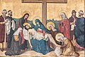 Kruisweg Sint-Urbanuskerk Duivendrecht statie 13.jpg 1,000 × 667; 401 KB
-
 Sint-Urbanuskerk (Duivendrecht).jpg 4,320 × 3,240; 3.94 MB
-
 Sint-Urbanuskerk in 1993.jpg 1,488 × 2,594; 1.33 MB
-
 Station Duivendrecht 1992 1.jpg 2,265 × 1,493; 569 KB
-
 Station Duivendrecht 1993 16.jpg 1,493 × 2,467; 471 KB
-
 Station Duivendrecht 1993 18.jpg 2,109 × 1,494; 359 KB
-
 Station Duivendrecht 1993 19.jpg 2,094 × 1,529; 621 KB
-
 Station Duivendrecht 1993 25.jpg 2,265 × 1,493; 608 KB
-
 Station Duivendrecht 1993 26.jpg 1,493 × 2,590; 1.65 MB
-
 Station Duivendrecht 1993 27.jpg 2,099 × 1,499; 1.69 MB
-
 Station Duivendrecht 1993 28.jpg 2,123 × 1,494; 1.43 MB
-
 Station Duivendrecht 1993 29.jpg 2,117 × 1,494; 1.36 MB
-
 Station Duivendrecht opening 1993 21.jpg 2,100 × 1,500; 473 KB
-
 Urbanusduivendrecht.JPG 1,712 × 2,288; 820 KB
-
 Urbanusdvd.JPG 2,288 × 1,712; 684 KB
-
 Urbanuskerk Duivendrecht 001.jpg 2,048 × 1,536; 1.28 MB


.jpg)
.jpg)


.jpg)


