Category:Sint Lambertuskerk (Beers, North Brabant)
| Object location | | View all coordinates using: OpenStreetMap |
|---|
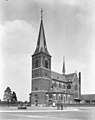
church in Beers, Netherlands  | |||||
| Upload media | |||||
| Instance of | |||||
|---|---|---|---|---|---|
| Location | Beers, Beers | ||||
| Street address |
| ||||
| Located on street |
| ||||
| Architect | |||||
| Heritage designation |
| ||||
| Religion or worldview | |||||
 | |||||
Kerk:
|
This is a category about rijksmonument number 8855
|
Toren:
|
This is a category about rijksmonument number 8856
|
| Address |
|
Subcategories
This category has only the following subcategory.
K
Media in category "Sint Lambertuskerk (Beers, North Brabant)"
The following 37 files are in this category, out of 37 total.
-
 20100724-067 Beers - Christus beeld bij de kerk.jpg 3,000 × 4,000; 3.65 MB
-
 Beers (N-Br) Sint Lambertuskerk, beeld H. Gerardus Majella.JPG 2,736 × 3,648; 2.88 MB
-
 Beers - Calvariegroep bij de Sint Lambertuskerk.jpg 3,000 × 4,000; 2.51 MB
-
 Beers - Christusbeeld op het kerkhof bij de Sint Lambertuskerk.jpg 4,000 × 3,000; 4.06 MB
-
 Beers la tour de l'eglise, XV--e-- siècle.jpg 2,304 × 3,072; 3.37 MB
-
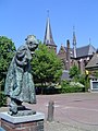 Beers, statue et église.JPG 1,536 × 2,048; 1.42 MB
-
 Biechtstoel - Beers - 20029595 - RCE.jpg 1,200 × 787; 204 KB
-
 Gebrandschilderd raam in koor - Beers - 20029600 - RCE.jpg 782 × 1,200; 254 KB
-
 Gebrandschilderd raam in koor - Beers - 20029601 - RCE.jpg 788 × 1,200; 256 KB
-
 Gebrandschilderd raam in koor - Beers - 20029602 - RCE.jpg 788 × 1,200; 261 KB
-
 Gebrandschilderd raam in koor - Beers - 20029603 - RCE.jpg 788 × 1,200; 263 KB
-
 Gebrandschilderd raam in koor - Beers - 20029604 - RCE.jpg 788 × 1,200; 244 KB
-
 Gebrandschilderd raam in transept - Beers - 20029605 - RCE.jpg 1,200 × 788; 215 KB
-
 Gebrandschilderd raam in transept - Beers - 20029606 - RCE.jpg 1,200 × 788; 212 KB
-
 Gedenksteen - Beers - 20029607 - RCE.jpg 788 × 1,200; 283 KB
-
 Hoofdaltaar - Beers - 20029592 - RCE.jpg 788 × 1,200; 231 KB
-
 Interieur kapel - Beers - 20029591 - RCE.jpg 1,200 × 788; 196 KB
-
 Interieur naar het koor - Beers - 20029589 - RCE.jpg 788 × 1,200; 198 KB
-
 Interieur naar het orgel - Beers - 20029590 - RCE.jpg 788 × 1,200; 215 KB
-
 Interieur, aanzicht orgel, orgelnummer 138 - Beers - 20370631 - RCE.jpg 879 × 1,200; 205 KB
-
 Interieur, gezien naar het westen - Beers - 20404365 - RCE.jpg 953 × 1,200; 241 KB
-
 Interieur, gezien naar het westen - Beers - 20404388 - RCE.jpg 948 × 1,200; 254 KB
-

-

-
 Preekstoel - Beers - 20029594 - RCE.jpg 782 × 1,200; 222 KB
-
 T.T RK Kerk Beers (1).JPG 2,048 × 3,072; 1.21 MB
-
 T.T RK Kerk Beers (3).JPG 2,048 × 3,072; 1.06 MB
-
 T.T RK Kerk Beers (4).JPG 3,072 × 2,048; 1.48 MB
-
 T.T RK Kerk Beers (5).JPG 2,048 × 3,072; 1.12 MB
-
 T.T RK Kerk Beers (6).JPG 3,072 × 2,048; 1.16 MB
-
 T.T Toren RK Kerk Beers (2).JPG 3,072 × 2,048; 1.29 MB
-
 Tegeltableau in koor - Beers - 20029596 - RCE.jpg 1,200 × 788; 267 KB
-
 Tegeltableau in koor - Beers - 20029597 - RCE.jpg 1,200 × 788; 267 KB
-
 Tegeltableau in koor - Beers - 20029598 - RCE.jpg 1,200 × 788; 242 KB
-
 Tegeltableau in koor - Beers - 20029599 - RCE.jpg 1,200 × 800; 255 KB
-
 Zijaltaar - Beers - 20029593 - RCE.jpg 788 × 1,200; 215 KB
-
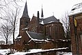
 Zuid-west zijde - Beers - 20029588 - RCE.jpg 953 × 1,200; 169 KB

_Sint_Lambertuskerk,_beeld_H._Gerardus_Majella.JPG)


.JPG)
.JPG)
.JPG)
.JPG)
.JPG)
.JPG)


