Category:Skenfrith
village in Wales   | |||||
| Upload media | |||||
| Instance of | |||||
|---|---|---|---|---|---|
| Location | Monmouthshire, Wales | ||||
 | |||||
Subcategories
This category has the following 7 subcategories, out of 7 total.
B
- The Bell at Skenfrith (11 F)
C
- Coedanghred Chapel (2 F)
S
- Skenfrith Bridge (16 F)
- Skenfrith Mill (12 F)
- St Bridget's church, Skenfrith (107 F)
W
- Skenfrith War Memorial (8 F)
Media in category "Skenfrith"
The following 200 files are in this category, out of 323 total.
(previous page) (next page)-
 ... black box. (3663874530).jpg 3,072 × 2,304; 2.57 MB
-
 2024 Wales Monmouthshire Community Skenfrith map.svg 512 × 682; 603 KB
-

-
 7-bar gate, Llanvetherine - geograph.org.uk - 5578904.jpg 800 × 680; 171 KB
-
 B4347 towards Crossway - geograph.org.uk - 6111045.jpg 800 × 600; 111 KB
-
 B4521 and pre-Worboys sign at Norton - geograph.org.uk - 6178570.jpg 1,024 × 769; 232 KB
-
 B4521 approaching Skenfrith - geograph.org.uk - 6111053.jpg 800 × 600; 84 KB
-
 B4521 at Box Bush Cottage - geograph.org.uk - 6178558.jpg 1,024 × 768; 148 KB
-
 B4521 at Lanes Agricultural Stores - geograph.org.uk - 6178525.jpg 1,024 × 768; 103 KB
-
 B4521 at Llanvetherine village boundary - geograph.org.uk - 6178520.jpg 1,024 × 768; 111 KB
-
 B4521 at The 1861 Restaurant - geograph.org.uk - 6178550.jpg 1,024 × 769; 169 KB
-
 B4521 east of Llanvetherine - geograph.org.uk - 6178531.jpg 1,024 × 769; 85 KB
-
 B4521 from Norton towards Skenfrith - geograph.org.uk - 5600993.jpg 800 × 551; 130 KB
-
 B4521 heading north west from Skenfrith - geograph.org.uk - 6111576.jpg 2,848 × 2,136; 1.45 MB
-
 B4521 heading north-west to Cross Ash - geograph.org.uk - 5958887.jpg 2,560 × 1,920; 2.55 MB
-
 B4521 heading west to Cross Ash - geograph.org.uk - 5958869.jpg 2,560 × 1,920; 2.55 MB
-
 B4521 near Ty-Deri - geograph.org.uk - 6178541.jpg 1,024 × 769; 194 KB
-
 B4521 nears Walson village boundary - geograph.org.uk - 6178566.jpg 1,024 × 767; 281 KB
-
 B4521 Old Ross Road - geograph.org.uk - 6178562.jpg 1,024 × 768; 270 KB
-
 B4521 Old Ross Road at Cross Ash - geograph.org.uk - 6178553.jpg 1,024 × 767; 127 KB
-
 B4521 Old Ross Road east of Offas Dyke Path - geograph.org.uk - 6178537.jpg 1,024 × 769; 205 KB
-
 B4521 Old Ross Road heading east - geograph.org.uk - 6178547.jpg 1,024 × 768; 177 KB
-
 B4521 Old Ross Road west of Trebella - geograph.org.uk - 6178556.jpg 1,024 × 770; 140 KB
-
 B4521 towards Ross - geograph.org.uk - 6111041.jpg 800 × 600; 185 KB
-
 B4521 towards Skenfrith - geograph.org.uk - 6110931.jpg 800 × 520; 62 KB
-
 B4521 towards Skenfrith - geograph.org.uk - 6111012.jpg 800 × 600; 96 KB
-
 B4521 towards Skenfrith - geograph.org.uk - 6111022.jpg 800 × 600; 167 KB
-
 B4521 towards Skenfrith - geograph.org.uk - 6111029.jpg 800 × 600; 143 KB
-
 B4521 towards Walson - geograph.org.uk - 5601134.jpg 800 × 522; 124 KB
-
 B4521, Golden Valley - geograph.org.uk - 6111003.jpg 800 × 600; 111 KB
-
 B4521, Norton - geograph.org.uk - 6111032.jpg 800 × 600; 98 KB
-
 B4521, Trebella - geograph.org.uk - 6111555.jpg 2,848 × 2,136; 1.19 MB
-
 Barn, Golden Valley - geograph.org.uk - 6110946.jpg 640 × 480; 95 KB
-
 Bend in Old Ross Road (B4521) - geograph.org.uk - 6110884.jpg 800 × 600; 131 KB
-

-

-

-
 Bend in the B4521 - geograph.org.uk - 6111005.jpg 640 × 480; 72 KB
-
 Bend in the B4521 towards Skenfrith - geograph.org.uk - 6111017.jpg 800 × 600; 84 KB
-

-
 Between the Castle wall and the River Monnow - geograph.org.uk - 6002914.jpg 1,024 × 768; 341 KB
-
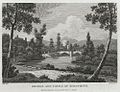 Bridge and Castle of Scenfrith (1129696).jpg 1,000 × 766; 249 KB
-
 Bridge at Skenfrith - geograph.org.uk - 5832031.jpg 1,000 × 665; 944 KB
-
 Brown waters of the River Monnow - geograph.org.uk - 1190066.jpg 640 × 480; 153 KB
-
 Bungalow on Old Ross Road (B4521) - geograph.org.uk - 6110935.jpg 800 × 600; 171 KB
-

-
 Caggle Street houses near Llanvetherine - geograph.org.uk - 5563915.jpg 683 × 800; 159 KB
-
 Cattle and sheep, east of Cherrytree Farm - geograph.org.uk - 5958874.jpg 1,627 × 1,220; 537 KB
-

-
 Church and castle at Skenfrith - geograph.org.uk - 3357009.jpg 640 × 480; 66 KB
-
 Church of St James the Elder, Llanvetherine - geograph.org.uk - 6111535.jpg 2,750 × 1,833; 1.15 MB
-
 Church tower, Llanvetherine - geograph.org.uk - 5578925.jpg 800 × 645; 142 KB
-
 Churchyard wall, Skenfrith - geograph.org.uk - 1190055.jpg 640 × 480; 147 KB
-
 Churning brown waters of the Monnow - geograph.org.uk - 1190082.jpg 480 × 640; 129 KB
-
 Clock on St. Bridget's Church (Bell Tower ^ Skenfrith) - geograph.org.uk - 5943884.jpg 3,648 × 2,736; 3.71 MB
-
 Close up, Elizabeth II postbox on the B4521, Trebella - geograph.org.uk - 6111553.jpg 1,295 × 2,502; 680 KB
-
 Close up, Elizabeth II postbox, Skenfrith - geograph.org.uk - 6111528.jpg 2,136 × 2,848; 1.31 MB
-

-

-

-
 Cottage, Walson - geograph.org.uk - 6111024.jpg 800 × 600; 136 KB
-
 Cottages with churchyard view, Skenfrith - geograph.org.uk - 714551.jpg 640 × 480; 210 KB
-
 Cross Ash semis - geograph.org.uk - 5601204.jpg 800 × 600; 135 KB
-

-
 Date stone, 1843 - geograph.org.uk - 1190058.jpg 640 × 480; 93 KB
-
 Dead end side road in Walson - geograph.org.uk - 5601030.jpg 800 × 786; 238 KB
-

-

-
 Derelict sheds, Skenfrith - geograph.org.uk - 5907069.jpg 1,024 × 768; 281 KB
-

-
 Dunkard Farm - geograph.org.uk - 6111006.jpg 800 × 600; 120 KB
-

-

-
 East along the B4521, Walson - geograph.org.uk - 5601040.jpg 640 × 483; 82 KB
-
 Elizabeth II postbox on Old Ross Road, Caggle Street - geograph.org.uk - 6111544.jpg 1,438 × 2,364; 653 KB
-
 Elizabeth II postbox on Old Ross Road, Llanvetherine - geograph.org.uk - 6111533.jpg 1,396 × 2,536; 648 KB
-
 Elizabeth II postbox on Old Ross Road, Llanvetherine - geograph.org.uk - 6111559.jpg 1,465 × 2,645; 699 KB
-
 Elizabeth II postbox on the B4521, Cross Ash - geograph.org.uk - 6111556.jpg 1,264 × 2,452; 641 KB
-
 Elizabeth II postbox on the B4521, Trebella - geograph.org.uk - 6111552.jpg 2,848 × 2,136; 1.25 MB
-
 Elizabeth II postbox, Skenfrith - geograph.org.uk - 6111526.jpg 2,848 × 2,136; 1.21 MB
-

-
 Entering Skenfrith - geograph.org.uk - 6111564.jpg 800 × 600; 113 KB
-
 Entering Walson - geograph.org.uk - 6111027.jpg 800 × 588; 171 KB
-

-

-

-
 Feature at St. Bridget's Church (Skenfrith) - geograph.org.uk - 5943874.jpg 3,648 × 2,736; 4.96 MB
-

-

-
 Field entrance off the B4521, Skenfrith - geograph.org.uk - 6111563.jpg 2,848 × 2,136; 1.3 MB
-

-
 Footpath off Old Ross Road (B4521) - geograph.org.uk - 6110877.jpg 800 × 600; 148 KB
-

-
 Footpath off the B4521, Norton - geograph.org.uk - 6111035.jpg 800 × 608; 223 KB
-

-

-

-
 Former school, Skenfrith - geograph.org.uk - 6004356.jpg 1,024 × 768; 137 KB
-

-

-
 Grazing near Cherrytree Farm - geograph.org.uk - 6111019.jpg 800 × 528; 78 KB
-
 Grazing near Dunkard - geograph.org.uk - 6111008.jpg 800 × 600; 145 KB
-
 Grazing near Trebella - geograph.org.uk - 6111014.jpg 800 × 600; 90 KB
-
 Grazing off Old Ross Road (B4521) - geograph.org.uk - 6110880.jpg 800 × 600; 106 KB
-
 Grazing off Old Ross Road (B4521) - geograph.org.uk - 6110927.jpg 800 × 600; 53 KB
-
 Grazing off the B4521 - geograph.org.uk - 6110860.jpg 800 × 600; 94 KB
-
 Grazing towards Norton Brook - geograph.org.uk - 6111038.jpg 800 × 600; 152 KB
-

-
 Grazing, Skenfrith - geograph.org.uk - 6111562.jpg 640 × 480; 53 KB
-
 Grazing, Ty-Deri - geograph.org.uk - 6110898.jpg 640 × 480; 59 KB
-
 Hay in transit, Llanvetherine - geograph.org.uk - 5579047.jpg 800 × 542; 96 KB
-

-

-

-
 House for sale in Skenfrith - geograph.org.uk - 6111565.jpg 800 × 600; 71 KB
-
 House in Llanvetherine - geograph.org.uk - 6111561.jpg 2,848 × 2,136; 1.41 MB
-
 House on Old Ross Road (B4521) - geograph.org.uk - 6110925.jpg 800 × 600; 86 KB
-

-
 House on Old Ross Road - geograph.org.uk - 6110867.jpg 800 × 600; 117 KB
-
 House on Old Ross Road, Caggle Street - geograph.org.uk - 6111545.jpg 800 × 600; 112 KB
-
 House on the B4521 - geograph.org.uk - 6110922.jpg 800 × 600; 121 KB
-
 House on the B4521, Cross Ash - geograph.org.uk - 6111558.jpg 2,848 × 2,136; 1.23 MB
-
 Houses opposite Skenfrith castle - geograph.org.uk - 2475992.jpg 640 × 480; 77 KB
-
 Houses opposite Skenfrith castle - geograph.org.uk - 2475994.jpg 640 × 480; 72 KB
-
 Houses opposite Skenfrith Castle - geograph.org.uk - 3731709.jpg 800 × 589; 117 KB
-

-

-
 Into Walson, Monmouthshire - geograph.org.uk - 5600932.jpg 800 × 481; 108 KB
-
 Junction in Cross Ash, Monmouthshire - geograph.org.uk - 5601257.jpg 800 × 694; 147 KB
-
 Junction in Walson, Monmouthshire - geograph.org.uk - 5600939.jpg 800 × 600; 184 KB
-
 K6 telephone box on the B4521, Skenfrith - geograph.org.uk - 6111566.jpg 2,848 × 2,136; 1.48 MB
-

-
 Kissing gate in Skenfrith - geograph.org.uk - 3731878.jpg 800 × 600; 164 KB
-

-
 Lane junction, Cross Ash, Monmouthshire - geograph.org.uk - 5598135.jpg 800 × 600; 130 KB
-

-

-
 Litter warning and river meadow - geograph.org.uk - 780201.jpg 640 × 426; 72 KB
-
 Llangattock Lingoed this way - geograph.org.uk - 5591184.jpg 800 × 695; 199 KB
-
 Llanvetherine field, Monmouthshire - geograph.org.uk - 5578910.jpg 800 × 600; 131 KB
-
 Local enterprise, Skenfrith - geograph.org.uk - 1405990.jpg 640 × 480; 120 KB
-

-

-
 Malthouse Wood - geograph.org.uk - 1190060.jpg 640 × 480; 99 KB
-

-
 Mill House (Skenfrith) - geograph.org.uk - 5945858.jpg 3,648 × 2,736; 3.43 MB
-
 Mill House, Skenfrith - geograph.org.uk - 3561795.jpg 800 × 627; 83 KB
-

-
 Minor road in Skenfrith - geograph.org.uk - 3731880.jpg 702 × 800; 107 KB
-
 Minor road to Llangattock Lingoed - geograph.org.uk - 5591162.jpg 800 × 637; 197 KB
-
 Minor road towards Newordden - geograph.org.uk - 6110920.jpg 800 × 600; 116 KB
-
 Monmow Villa (Skenfrith) - geograph.org.uk - 5943871.jpg 3,648 × 2,736; 4.7 MB
-
 Monnow Meadows - geograph.org.uk - 139706.jpg 640 × 480; 184 KB
-
 Muddy brown river - geograph.org.uk - 1190022.jpg 640 × 480; 170 KB
-
 Names on a Llanvetherine corner - geograph.org.uk - 5579018.jpg 800 × 709; 247 KB
-
 National School, Skenfrith, 1843 - geograph.org.uk - 5038798.jpg 3,254 × 2,164; 1.66 MB
-
 New footbridge across the River Monnow - geograph.org.uk - 1190068.jpg 640 × 480; 138 KB
-
 New Telephone Exchange, Skenfrith - geograph.org.uk - 5282398.jpg 2,592 × 1,944; 1.4 MB
-

-
 Norton Baptist Church - geograph.org.uk - 6111030.jpg 800 × 600; 149 KB
-
 Norton Baptist Church, Monmouthshire - geograph.org.uk - 5282331.jpg 2,592 × 1,944; 1.4 MB
-

-

-
 Norton House - geograph.org.uk - 6111049.jpg 800 × 600; 118 KB
-
 Not exactly a dual carriageway, Walson - geograph.org.uk - 5601060.jpg 800 × 600; 196 KB
-
 November in Walson, Monmouthshire - geograph.org.uk - 5601067.jpg 800 × 456; 98 KB
-
 Oak tree alongside the B4521, east of Cherrytree Farm - geograph.org.uk - 5958870.jpg 2,560 × 1,920; 2.42 MB
-

-

-
 Old barn at Little Pool Hall - geograph.org.uk - 6235246.jpg 1,024 × 768; 1.04 MB
-
 Old Milestone by the B4521 - geograph.org.uk - 6102909.jpg 294 × 447; 70 KB
-

-
 Old Milestone by the B4521, near The Old Court House - geograph.org.uk - 6102624.jpg 1,160 × 1,553; 403 KB
-

-

-

-
 Old Ross Road (B4521) near Ty-Deri - geograph.org.uk - 6110913.jpg 640 × 480; 55 KB
-
 Old Ross Road (B4521) towards Skenfrith - geograph.org.uk - 6110864.jpg 800 × 600; 106 KB
-

-

-
 Old Ross Road (B4521) towards Skenfrith - geograph.org.uk - 6110936.jpg 800 × 600; 110 KB
-

-
 Old Ross Road (B4521), Llanvetherine - geograph.org.uk - 6110873.jpg 640 × 480; 69 KB
-

-

-

-

-

-
 Old Ross Road west of Llanvetherine - geograph.org.uk - 5579005.jpg 641 × 800; 114 KB
-

-

-
 Outbuilding, Skenfrith Mill - geograph.org.uk - 1405957.jpg 640 × 480; 146 KB
-

-
 Plaque on Skenfrith Mill - geograph.org.uk - 5945843.jpg 3,648 × 2,736; 3.21 MB
-
 Pond at Skenfrith - geograph.org.uk - 5943814.jpg 3,648 × 2,736; 4.1 MB
-

-

-
 Quaintways, Caggle Street, Monmouthshire - geograph.org.uk - 5591099.jpg 800 × 600; 110 KB
-

-

.jpg)


_-_geograph.org.uk_-_6110884.jpg)


.jpg)


_-_geograph.org.uk_-_6110935.jpg)


_-_geograph.org.uk_-_5943884.jpg)


_-_geograph.org.uk_-_5943874.jpg)


_-_geograph.org.uk_-_6110877.jpg)
,_Llanvetherine_-_geograph.org.uk_-_6110870.jpg)


_-_geograph.org.uk_-_6110880.jpg)
_-_geograph.org.uk_-_6110927.jpg)


_-_geograph.org.uk_-_6110934.jpg)


_-_geograph.org.uk_-_6110925.jpg)
,_Caggle_Street_-_geograph.org.uk_-_6110885.jpg)


_-_geograph.org.uk_-_5945858.jpg)


_-_geograph.org.uk_-_5943871.jpg)


_near_Ty-Deri_-_geograph.org.uk_-_6110913.jpg)
_towards_Skenfrith_-_geograph.org.uk_-_6110864.jpg)
_towards_Skenfrith_-_geograph.org.uk_-_6110924.jpg)
_towards_Skenfrith_-_geograph.org.uk_-_6110930.jpg)
_towards_Skenfrith_-_geograph.org.uk_-_6110936.jpg)
_west_of_Llanvetherine_-_geograph.org.uk_-_6110868.jpg)
,_Llanvetherine_-_geograph.org.uk_-_6110873.jpg)


,_Caggle_Street_-_geograph.org.uk_-_6110889.jpg)


