Category:Snaith and Cowick
civil parish in East Riding of Yorkshire, UK  | |||||
| Upload media | |||||
| Instance of | |||||
|---|---|---|---|---|---|
| Named after | |||||
| Location | East Riding of Yorkshire, Yorkshire and the Humber, England | ||||
 | |||||
Subcategories
This category has the following 5 subcategories, out of 5 total.
Media in category "Snaith and Cowick"
The following 200 files are in this category, out of 361 total.
(previous page) (next page)-
 1 ^ 3 Church Lane, Snaith - geograph.org.uk - 5057900.jpg 1,280 × 960; 316 KB
-
 11 Market Place, Snaith - geograph.org.uk - 5057920.jpg 1,280 × 945; 338 KB
-
 15 ^ 17 Selby Road, Snaith - geograph.org.uk - 5057560.jpg 1,280 × 969; 288 KB
-

-
 3, Beast Fair, Snaith - geograph.org.uk - 5057571.jpg 1,280 × 834; 269 KB
-
 5, 7, ^ 9 High Street, Snaith - geograph.org.uk - 5057526.jpg 1,280 × 936; 315 KB
-
 9 Market Place, Snaith - geograph.org.uk - 5057924.jpg 976 × 1,280; 277 KB
-
 9 ^ 11 Church Lane, Snaith - geograph.org.uk - 5057077.jpg 1,280 × 960; 307 KB
-
 A little used footpath to West Cowick - geograph.org.uk - 4551981.jpg 800 × 533; 149 KB
-
 A pile of concrete sleepers - geograph.org.uk - 2726303.jpg 1,024 × 768; 195 KB
-
 A shady spot for a sundial - geograph.org.uk - 4551813.jpg 800 × 533; 210 KB
-
 A solitary blasted tree on Moor Hill - geograph.org.uk - 4551982.jpg 800 × 533; 81 KB
-
 A1041 leaving Snaith at a large warning sign - geograph.org.uk - 5921561.jpg 1,024 × 699; 157 KB
-

-
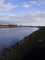
 Aire and Calder Navigation - geograph.org.uk - 2593588.jpg 1,600 × 1,200; 431 KB
-
 Aire and Calder Navigation Canal from Beever's Bridge - geograph.org.uk - 5639949.jpg 5,184 × 3,888; 4.32 MB
-
 Aire and Clader Navigation - geograph.org.uk - 2593583.jpg 1,600 × 1,200; 375 KB
-
 Aire ^ Calder Navigation, east of New Bridge - geograph.org.uk - 3920596.jpg 1,024 × 614; 45 KB
-

-

-

-
 Alongside Cowick Gorse - geograph.org.uk - 4272338.jpg 1,024 × 768; 173 KB
-
 Altar tombs in the churchyard, Snaith - geograph.org.uk - 5057069.jpg 1,280 × 960; 432 KB
-
 Angler on the Aire ^ Calder Navigation - geograph.org.uk - 4549325.jpg 1,024 × 768; 139 KB
-
 Approaching a railway embankment - geograph.org.uk - 4269808.jpg 1,024 × 768; 247 KB
-
 Arable field on the south bank of the River Aire - geograph.org.uk - 4802109.jpg 1,024 × 768; 176 KB
-

-
 Beaver Sailing Club - geograph.org.uk - 5638663.jpg 3,783 × 5,045; 4.25 MB
-
 Beevers Bridge Track - geograph.org.uk - 1256001.jpg 640 × 376; 25 KB
-
 Bench mark, Mill Lane, Snaith - geograph.org.uk - 5057548.jpg 1,280 × 960; 429 KB
-
 Bend in Berridge Lane - geograph.org.uk - 4268446.jpg 1,024 × 768; 155 KB
-
 Bend in the track - geograph.org.uk - 4268487.jpg 1,024 × 768; 275 KB
-
 Bend on the Aire ^ Calder Navigation - geograph.org.uk - 3920636.jpg 1,024 × 614; 37 KB
-

-
 Beside the Aire ^ Calder navigation - geograph.org.uk - 4568449.jpg 3,072 × 1,728; 1.75 MB
-
 Beside the canal. - geograph.org.uk - 1701902.jpg 480 × 640; 41 KB
-
 Between Rivers Farm - geograph.org.uk - 5638654.jpg 4,861 × 3,628; 4.01 MB
-
 Between Rivers Farm, from the north - geograph.org.uk - 6266632.jpg 1,600 × 900; 332 KB
-
 Between Rivers Lane - geograph.org.uk - 2394979.jpg 800 × 600; 262 KB
-
 Between the Aire ^ Calder and the River Went - geograph.org.uk - 3920734.jpg 1,024 × 768; 131 KB
-
 Big Patch or Tarmac - geograph.org.uk - 183833.jpg 640 × 480; 69 KB
-
 Bird scarer on the path - geograph.org.uk - 2935744.jpg 1,024 × 768; 267 KB
-
 Blocked access to the Dutch River embankment - geograph.org.uk - 2860175.jpg 1,024 × 768; 102 KB
-
 Brewers Arms, Snaith - geograph.org.uk - 5057894.jpg 1,280 × 960; 424 KB
-
 Bridge 21, New Bridge - geograph.org.uk - 2934942.jpg 1,024 × 768; 129 KB
-
 Bridge over River Don - geograph.org.uk - 2429400.jpg 1,600 × 1,200; 416 KB
-
 Bridge over the Aire - geograph.org.uk - 5781312.jpg 640 × 427; 245 KB
-

-
 Bridge over the Knottingley ^ Goole Canal - geograph.org.uk - 5994370.jpg 1,024 × 768; 83 KB
-
 Bridge over the motorway at East Cowick - geograph.org.uk - 6235290.jpg 1,600 × 1,200; 791 KB
-
 Bridge over the New junction canal - geograph.org.uk - 1701869.jpg 480 × 640; 42 KB
-
 Bridge over the River Aire - geograph.org.uk - 5995179.jpg 1,024 × 576; 72 KB
-
 Bridges at New Bridge - geograph.org.uk - 2934951.jpg 1,024 × 768; 108 KB
-
 Bringing in the hay - geograph.org.uk - 4568450.jpg 3,072 × 1,728; 1.73 MB
-
 Canal at Beever's Rack - geograph.org.uk - 5146548.jpg 1,600 × 1,200; 409 KB
-
 Canal junction - geograph.org.uk - 1184374.jpg 640 × 480; 50 KB
-
 Carlton Bridge - geograph.org.uk - 3794263.jpg 1,280 × 1,280; 295 KB
-
 Carlton Bridge - geograph.org.uk - 3794264.jpg 1,280 × 960; 308 KB
-
 Carlton Bridges - geograph.org.uk - 6016439.jpg 1,280 × 960; 309 KB
-
 Carlton New Bridge crossing the River Aire - geograph.org.uk - 5921560.jpg 1,024 × 745; 186 KB
-
 Carlton New Bridge, River Aire, Snaith - geograph.org.uk - 5891449.jpg 1,024 × 768; 232 KB
-
 Carlton Toll Bridge remains - geograph.org.uk - 3794265.jpg 1,280 × 960; 442 KB
-
 Carlton Toll Bridge remains - geograph.org.uk - 3794266.jpg 1,280 × 960; 156 KB
-
 Carr Lane - geograph.org.uk - 2727807.jpg 1,024 × 768; 180 KB
-
 Carr Lane - geograph.org.uk - 4268490.jpg 1,024 × 768; 266 KB
-
 Church of St Lawrence, Snaith - geograph.org.uk - 5057065.jpg 1,280 × 960; 271 KB
-
 Church of St Lawrence, Snaith, west doorway - geograph.org.uk - 5056994.jpg 1,280 × 960; 356 KB
-
 Church of the Holy Trinity - geograph.org.uk - 5056947.jpg 1,280 × 923; 251 KB
-

-
 Concertina-like shed, west of Oak Lane - geograph.org.uk - 3920645.jpg 1,024 × 768; 103 KB
-
 Corner of Carr Lane - geograph.org.uk - 4568332.jpg 3,072 × 1,728; 2.47 MB
-
 Cow Pasture - geograph.org.uk - 2934845.jpg 1,024 × 768; 247 KB
-
 Cowick School - geograph.org.uk - 5056896.jpg 1,280 × 960; 270 KB
-
 Crow Croft Bridge, from the east - geograph.org.uk - 4549347.jpg 1,024 × 768; 119 KB
-
 Crow Croft Canal Bridge - geograph.org.uk - 288880.jpg 640 × 480; 132 KB
-
 Dismantled railway bridge - geograph.org.uk - 4568356.jpg 3,072 × 1,728; 1.99 MB
-
 Don't mess with me - geograph.org.uk - 4269209.jpg 1,024 × 768; 199 KB
-
 Dorr Lane (track) off the A645 - geograph.org.uk - 2475519.jpg 1,600 × 1,200; 428 KB
-
 Dowsons Lane - geograph.org.uk - 1256037.jpg 640 × 480; 28 KB
-
 Drain and pumping station, west of New Bridge - geograph.org.uk - 3920619.jpg 1,024 × 768; 130 KB
-
 Drain and solar array - geograph.org.uk - 4268908.jpg 1,024 × 768; 230 KB
-
 Drain beside Johnny Moor Long Lane - geograph.org.uk - 1331706.jpg 640 × 480; 255 KB
-

-
 Dyke alongside footpath. - geograph.org.uk - 2255532.jpg 640 × 480; 80 KB
-
 East along Dutch River towards the M18 - geograph.org.uk - 2394892.jpg 800 × 600; 227 KB
-
 Emergency Access to the M18-M62 - geograph.org.uk - 2934812.jpg 1,024 × 768; 106 KB
-
 Entrance to a waste disposal site - geograph.org.uk - 2726597.jpg 1,024 × 768; 181 KB
-
 Farm crossing off Gowdall Lane - geograph.org.uk - 4550629.jpg 800 × 533; 139 KB
-
 Farm on Johnny Moor Long Lane - geograph.org.uk - 1222649.jpg 640 × 480; 52 KB
-
 Farm track at 3 metres above sea level - geograph.org.uk - 2859429.jpg 1,024 × 768; 143 KB
-
 Farm track off the A614 - geograph.org.uk - 2429381.jpg 1,600 × 1,200; 481 KB
-
 Farm track to Cow Pasture - geograph.org.uk - 2931830.jpg 1,024 × 768; 107 KB
-
 Farm track, Balne Croft - geograph.org.uk - 2593592.jpg 1,600 × 1,200; 476 KB
-
 Farmland and pylons off the A645 - geograph.org.uk - 2475520.jpg 1,600 × 1,200; 264 KB
-
 Farmland between South Field Lane and the M62 - geograph.org.uk - 6266611.jpg 1,600 × 1,067; 524 KB
-
 Farmland east of Southfield Reservoir - geograph.org.uk - 6266624.jpg 1,600 × 1,067; 469 KB
-
 Farmland near Poplars Farm - geograph.org.uk - 2429384.jpg 1,600 × 1,200; 385 KB
-
 Farmland near Priory Farm - geograph.org.uk - 2434064.jpg 1,600 × 1,051; 159 KB
-
 Farmland north of Greenland Lane - geograph.org.uk - 2860165.jpg 1,024 × 768; 114 KB
-
 Farmland north-east of Southfield Reservoir - geograph.org.uk - 6266613.jpg 1,600 × 1,067; 543 KB
-
 Farmland off Gowdall Lane - geograph.org.uk - 5781303.jpg 640 × 427; 230 KB
-
 Farmland off Greenland Lane, looking towards The M18 - geograph.org.uk - 2429399.jpg 1,600 × 1,200; 409 KB
-
 Farmland south of Greenland Cottage - geograph.org.uk - 2859383.jpg 1,024 × 768; 184 KB
-
 Farmland south of Greenland Lane - geograph.org.uk - 2860168.jpg 1,024 × 768; 217 KB
-
 Farmland, Greenland - geograph.org.uk - 2422355.jpg 1,600 × 1,200; 258 KB
-

-

-

-
 Fenced off farmland, near Greenland Cottage - geograph.org.uk - 2859420.jpg 1,024 × 768; 106 KB
-
 Ferry Lane - geograph.org.uk - 5781311.jpg 640 × 427; 219 KB
-
 Field of gold (currently green) - geograph.org.uk - 844311.jpg 640 × 480; 94 KB
-
 Flood bank and sewage works - geograph.org.uk - 2748574.jpg 1,024 × 768; 170 KB
-
 Flooding alongside the River Went - geograph.org.uk - 3921327.jpg 1,024 × 768; 113 KB
-
 Flooding by New Bridge - geograph.org.uk - 2934931.jpg 1,024 × 768; 162 KB
-
 Flooding, Went Ings - geograph.org.uk - 3920741.jpg 1,024 × 768; 105 KB
-
 Flush bracket bench mark, 1 Beast Fair, Snaith - geograph.org.uk - 5057578.jpg 1,280 × 960; 487 KB
-
 Fly-tipped rubbish off South Field Lane - geograph.org.uk - 6266579.jpg 1,024 × 683; 241 KB
-

-

-
 Footbridge, Southfield Reservoir - geograph.org.uk - 3920742.jpg 1,024 × 614; 84 KB
-
 Footpath and dike - geograph.org.uk - 4268917.jpg 1,024 × 768; 240 KB
-
 Footpath by Cowick Gorse - geograph.org.uk - 4551989.jpg 800 × 533; 123 KB
-
 Footpath from the canal bank - geograph.org.uk - 4268495.jpg 1,024 × 768; 217 KB
-
 Footpath off Finnley's Lane towards Snaith - geograph.org.uk - 6235265.jpg 1,600 × 1,200; 782 KB
-
 Footpath to West Cowick - geograph.org.uk - 4268456.jpg 1,024 × 768; 144 KB
-
 Footpath to West Cowick - geograph.org.uk - 4272332.jpg 1,024 × 768; 129 KB
-
 Former Bay Horse pub at East Cowick - geograph.org.uk - 6235294.jpg 1,600 × 1,200; 482 KB
-
 Former Carlton toll bridge - geograph.org.uk - 6016442.jpg 1,280 × 960; 344 KB
-
 Former East Lodge to Cowick Hall - geograph.org.uk - 5056929.jpg 1,280 × 960; 368 KB
-
 Former Hartley's Brewery and Maltkiln - geograph.org.uk - 2726633.jpg 1,024 × 768; 141 KB
-
 Former Hartley's Brewery, West Cowick - geograph.org.uk - 5056974.jpg 1,280 × 960; 275 KB
-
 Former route of narrow gauge railway - geograph.org.uk - 2708210.jpg 1,024 × 768; 215 KB
-
 Fox and Duck Farm - geograph.org.uk - 2708000.jpg 800 × 600; 186 KB
-

-
 Gated track off Ings Lane - geograph.org.uk - 2726270.jpg 1,024 × 768; 155 KB
-
 Gates by the canal - geograph.org.uk - 4268915.jpg 1,024 × 768; 165 KB
-
 Goathead Lane - geograph.org.uk - 2727238.jpg 1,024 × 768; 151 KB
-
 Gowdall Lane, Gowdall - geograph.org.uk - 6225915.jpg 1,600 × 1,065; 637 KB
-
 Gowdall Lane, looking east - geograph.org.uk - 4802095.jpg 1,024 × 768; 109 KB
-
 Gowdall Lane, looking west - geograph.org.uk - 4802088.jpg 1,024 × 768; 132 KB
-
 Green at the top of Spa Well Lane, West Cowick - geograph.org.uk - 5056963.jpg 1,280 × 960; 329 KB
-
 Green barley - geograph.org.uk - 1331709.jpg 640 × 480; 241 KB
-
 Greenland Bridge, M18 - geograph.org.uk - 5435926.jpg 640 × 426; 38 KB
-
 Greenland Farm - geograph.org.uk - 2429395.jpg 1,600 × 1,200; 325 KB
-
 Greenland Farm - geograph.org.uk - 2935734.jpg 1,024 × 768; 182 KB
-
 Greenland Farm on Greenland Lane - geograph.org.uk - 2394853.jpg 640 × 480; 42 KB
-
 Greenland Hall Farm - geograph.org.uk - 1222647.jpg 640 × 480; 52 KB
-
 Greenland Lane - geograph.org.uk - 2429397.jpg 1,600 × 1,200; 303 KB
-
 Greenland Lane - geograph.org.uk - 844303.jpg 640 × 480; 86 KB
-
 Greenland Lane heading east - geograph.org.uk - 2429392.jpg 1,600 × 1,292; 282 KB
-
 Greenland Lane towards New Bridge - geograph.org.uk - 2394905.jpg 800 × 600; 190 KB
-
 Greenland, Yorkshire - geograph.org.uk - 2860160.jpg 1,024 × 768; 164 KB
-
 Greenlandic tree - geograph.org.uk - 2859448.jpg 1,024 × 768; 126 KB
-
 Hall Lodge, Pontefract Road, Snaith - geograph.org.uk - 5057892.jpg 1,280 × 960; 278 KB
-

-
 Heading towards Cowick Gorse - geograph.org.uk - 4568343.jpg 3,072 × 1,728; 2.56 MB
-
 High Street, Snaith - geograph.org.uk - 5057530.jpg 1,280 × 979; 310 KB
-
 Highland cattle at Snaith - geograph.org.uk - 6016468.jpg 1,280 × 960; 505 KB
-
 Highways depot near West Cowick - geograph.org.uk - 6235278.jpg 1,600 × 1,200; 771 KB
-
 Ings Drain and Ings Lane - geograph.org.uk - 2726295.jpg 1,024 × 768; 188 KB
-
 Ings Lane (1) - geograph.org.uk - 2726249.jpg 1,024 × 768; 209 KB
-
 Ings Lane (2) - geograph.org.uk - 2726260.jpg 1,024 × 768; 203 KB
-
 Ings Lane (2) - geograph.org.uk - 2727859.jpg 1,024 × 768; 178 KB
-
 Ings Lane - geograph.org.uk - 2726308.jpg 1,024 × 768; 203 KB
-
 Ings Lane - geograph.org.uk - 2727855.jpg 1,024 × 768; 156 KB
-
 Ings Lane Crossing, north of East Cowick - geograph.org.uk - 6235297.jpg 1,600 × 1,200; 678 KB
-
 Johnny Moor Long Lane - geograph.org.uk - 2934707.jpg 1,024 × 768; 122 KB
-
 Johnny Moor Long Lane - geograph.org.uk - 4930169.jpg 4,608 × 3,456; 3.97 MB
-
 Johnny Moor Long Lane - geograph.org.uk - 5264134.jpg 1,024 × 768; 179 KB
-
 Johnny Moor Long Lane - geograph.org.uk - 844296.jpg 640 × 385; 37 KB
-
 Johnny Moor Long Lane heading north - geograph.org.uk - 2422352.jpg 1,600 × 1,200; 338 KB
-
 Junction of Greenland Lane and Johnny Moor Long Lane - geograph.org.uk - 4930181.jpg 4,263 × 3,051; 3.37 MB
-

-

-
 Large building at Greenland Farm - geograph.org.uk - 2860172.jpg 1,024 × 768; 135 KB
-
 Left turn Doncaster (and Sheffield) - geograph.org.uk - 1184387.jpg 640 × 410; 53 KB
-
 Line from Pontefract to Goole near Snaith - geograph.org.uk - 4567971.jpg 3,072 × 1,728; 2.14 MB
-
 Lone tree - geograph.org.uk - 4272319.jpg 1,024 × 768; 132 KB
-

-
 Looking east from Crow Croft Bridge - geograph.org.uk - 2255550.jpg 480 × 640; 38 KB
-

-
 Looking towards Greenland Farm - geograph.org.uk - 3920568.jpg 1,024 × 768; 139 KB
-
 Looking towards Park Lodge shooting school - geograph.org.uk - 4568348.jpg 3,072 × 1,728; 1.74 MB
-

-
 M18 Greenland Lane Flyover - geograph.org.uk - 1264057.jpg 640 × 450; 24 KB
-

-
 M18 northbound - geograph.org.uk - 3682480.jpg 640 × 481; 38 KB
-
 M62 - geograph.org.uk - 2255536.jpg 640 × 480; 57 KB
-
 M62 eastbound near junction 35 - geograph.org.uk - 2271291.jpg 640 × 407; 34 KB
-
 M62 junction 35 - geograph.org.uk - 2271326.jpg 640 × 386; 36 KB
-
 M62 westbound near Cowick Hall - geograph.org.uk - 3687327.jpg 640 × 481; 46 KB
-
 M62 westbound near Pollington - geograph.org.uk - 1264151.jpg 640 × 480; 30 KB
-

-
 M62 westbound near The Carr - geograph.org.uk - 3687333.jpg 640 × 480; 48 KB
-
 Manor Hill from Little London Lane - geograph.org.uk - 6235287.jpg 1,600 × 1,200; 557 KB
-
 Market Place, Snaith - geograph.org.uk - 5057908.jpg 1,280 × 991; 298 KB
-
 Market Place, Snaith - geograph.org.uk - 5057929.jpg 1,280 × 920; 274 KB
-
 Mooring bollards, New Junction Canal - geograph.org.uk - 3921305.jpg 1,024 × 615; 70 KB
-
 Narrow entrance into a field - geograph.org.uk - 4101501.jpg 1,024 × 768; 206 KB
-
 New Bridge - geograph.org.uk - 4858396.jpg 1,500 × 724; 775 KB


_off_the_A645_-_geograph.org.uk_-_2475519.jpg)


_-_geograph.org.uk_-_844311.jpg)


_-_geograph.org.uk_-_2726249.jpg)
_-_geograph.org.uk_-_2726260.jpg)
_-_geograph.org.uk_-_2727859.jpg)


_-_geograph.org.uk_-_1184387.jpg)


_towards_Poplars_Farm_-_geograph.org.uk_-_2394924.jpg)

_-_geograph.org.uk_-_2394959.jpg)


