Category:Snow in the United States in July
Media in category "Snow in the United States in July"
The following 103 files are in this category, out of 103 total.
-

-
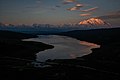
 Alaska051.jpg 1,182 × 788; 75 KB
-
 Bagley Icefield Looking Southeast Towards Mount St. Elias (21424797388).jpg 5,551 × 3,701; 10.9 MB
-
 Banshee Peak seen from Sourdough Ridge.jpg 2,272 × 1,704; 767 KB
-
 Blackburn From Lake 2 - Donoho Basin (21410814808).jpg 22,867 × 5,674; 67.49 MB
-
 Cashmere Mountain Meadow (3293970519).jpg 1,024 × 1,280; 1.71 MB
-
 Chugach Mountains, Mt. St. Elias (39131211445).jpg 5,665 × 3,777; 7.41 MB
-
 Clouds around Mount Blackburn, Wrangell Mountains (28250456539).jpg 3,840 × 5,760; 7.31 MB
-
 Clouds around Mount Blackburn, Wrangell Mountains (39319219264).jpg 9,912 × 4,758; 14.83 MB
-
 Clouds around Mount Blackburn, Wrangell Mountains (39319221594).jpg 5,760 × 3,840; 7.39 MB
-
 Columbus Glacier and Mount St. Elias (2) (21601824022).jpg 5,352 × 3,568; 10.12 MB
-
 Columbus Glacier and Mount St. Elias (21601816682).jpg 5,672 × 3,292; 9.08 MB
-
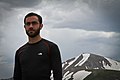
 Could my feet keep up here? (5902796891).jpg 3,648 × 2,052; 3.95 MB
-
 Denali Towering.jpg 1,280 × 851; 409 KB
-
 Denali wilderness - panoramio.jpg 5,616 × 3,744; 3.97 MB
-
 Denali, from Eielson Visitor Center (2da29f2f-4e43-48b0-9fd3-8d445d2cf4d7).jpg 6,000 × 4,000; 1.07 MB
-
 Denali, looming over the Thorofare River. (6a888845-c071-4c3a-8c37-3b4074e90e8c).jpg 6,000 × 4,000; 1.44 MB
-
 Denali, seen from Wonder Lake, around 2-30 am. (2701cb23-1071-4701-a4b6-09ffe990e291).jpg 6,000 × 4,000; 1.82 MB
-
 Falsepass ak isanotskipeaks roundtop.JPG 2,592 × 1,383; 1.13 MB
-
 Fernow and Glacier Pk from Otter Point.jpg 1,667 × 1,239; 417 KB
-
 Gates Glacier From Lake 3 - Donoho Basin (21606760481).jpg 12,700 × 3,783; 29.34 MB
-
 Glacier Peak 7119.JPG 4,272 × 2,848; 4.15 MB
-
 Glacier Peak 9173.JPG 4,272 × 2,848; 3.83 MB
-
 Glacier Peak and Black Mountain at nightfall.jpg 2,376 × 1,419; 826 KB
-
 Glacier Peak Peek (20346317026).jpg 800 × 1,200; 305 KB
-
 Guyot Glacier, Falls, Icy Bay, and Mount St. Elias (20990013684).jpg 5,552 × 3,701; 12.91 MB
-
 Guyot Glacier, Guyot Hills, Icy Bay, and Mount St. Elias (20990022474).jpg 5,760 × 3,840; 12.64 MB
-
 Guyot Hills, Guyot Glacier, Icy Bay, and Mount St. Elias (21586741566).jpg 5,370 × 3,580; 11.82 MB
-
 Guyot Hills, Icy Bay, and Mount St. Elias (2) (20991841433).jpg 5,538 × 3,692; 11.75 MB
-
 Guyot Hills, Icy Bay, and Mount St. Elias (4) (21425001368).jpg 5,573 × 3,715; 10.56 MB
-
 Head of Columbus Glacier and Mount St. Elias (21586994856).jpg 5,760 × 3,840; 11.95 MB
-
 Icy Bay & Mt. St. Elias (26156476198).jpg 5,760 × 3,840; 12.57 MB
-
 Icy Bay & Mt. St. Elias (26156480888).jpg 4,980 × 3,320; 9.48 MB
-
 Icy Bay & Mt. St. Elias (39131199745).jpg 5,537 × 3,691; 8.91 MB
-
 Icy Bay, Tyndall Glacier, and Mount St. Elias (2) (20992373073).jpg 5,760 × 3,840; 12.18 MB
-
 Icy Bay, Tyndall Glacier, and Mount St. Elias (21426102339).jpg 5,410 × 3,607; 10.57 MB
-
 Independence Pass alpine tundra 2.jpg 938 × 727; 430 KB
-
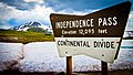
 Independence Pass CO.jpg 1,600 × 1,200; 411 KB
-
 Independence Pass Continental Divide - July 2011 (5902799447).jpg 3,215 × 1,809; 2.89 MB
-
 Independence Pass Continental Divide - July 2011 (5902799967).jpg 3,648 × 2,432; 2.77 MB
-
 Independence Pass Continental Divide - July 2011 (5902804883).jpg 5,184 × 2,916; 10.98 MB
-
 Independence Pass Continental Divide - July 2011 (5902808343).jpg 4,766 × 2,681; 6.27 MB
-
 Independence Pass Continental Divide - July 2011 (5902810559).jpg 4,438 × 2,497; 4.68 MB
-
 Independence Pass Continental Divide - July 2011 (5902819085).jpg 5,184 × 3,456; 8.11 MB
-
 Independence Pass Continental Divide - July 2011 (5902823351).jpg 5,184 × 2,916; 7.25 MB
-
 Independence Pass Continental Divide - July 2011 (5902838993).jpg 5,184 × 3,456; 9.79 MB
-
 Independence Pass Continental Divide - July 2011 (5903354728).jpg 3,648 × 2,052; 3.43 MB
-
 Independence Pass Continental Divide - July 2011 (5903356278).jpg 3,648 × 2,606; 5.23 MB
-
 Independence Pass Continental Divide - July 2011 (5903362024).jpg 5,184 × 3,456; 10.07 MB
-
 Independence Pass Continental Divide - July 2011 (5903365388).jpg 5,184 × 3,456; 10.04 MB
-
 Independence Pass Continental Divide - July 2011 (5903366038).jpg 3,909 × 2,199; 4.56 MB
-
 Independence Pass Continental Divide - July 2011 (5903368354).jpg 4,580 × 3,053; 7.42 MB
-
 Independence Pass Continental Divide - July 2011 (5903370586).jpg 5,184 × 2,916; 7.98 MB
-
 Independence Pass Continental Divide - July 2011 (5903371570).jpg 3,781 × 2,701; 5.48 MB
-
 Independence Pass Continental Divide - July 2011 (5903372538).jpg 4,140 × 2,329; 5.61 MB
-
 Independence Pass Continental Divide - July 2011 (5903378336).jpg 4,838 × 3,456; 7.39 MB
-
 Independence Pass Continental Divide - July 2011 (5903379256).jpg 5,184 × 2,916; 6.85 MB
-
 Independence Pass Continental Divide - July 2011 (5903381158).jpg 5,184 × 3,456; 7.66 MB
-
 Independence Pass Continental Divide - July 2011 (5903383734).jpg 4,838 × 3,456; 9.93 MB
-
 Independence Pass Continental Divide - July 2011 (5903386850).jpg 4,838 × 3,456; 10.19 MB
-
 Independence Pass Continental Divide - July 2011 (5903387938).jpg 4,768 × 3,406; 8.91 MB
-
 Isanotski Peaks Volcano.jpg 1,050 × 701; 96 KB
-
 La Plata Peak from Independence Pass.jpg 2,370 × 1,425; 2.25 MB
-
 Lake 2 Creek Sunset and Mount Blackburn (21606609241).jpg 5,633 × 3,755; 14.21 MB
-
 McKinley and a hiker.jpg 3,111 × 2,076; 4.23 MB
-
 McKinleyPan.jpg 8,053 × 2,645; 1.61 MB
-
 Menydh Denali.jpg 4,320 × 3,240; 3.16 MB
-
 Mount Baker showing Park Glacier.jpg 1,024 × 530; 78 KB
-
 Mount Blackburn and Hikers on Root Glacier (21607868461).jpg 5,760 × 3,840; 11.35 MB
-
 Mount Daniel.jpg 1,123 × 676; 119 KB
-
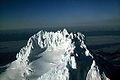
 Mount McKinley (7980890430).jpg 3,456 × 5,184; 16.63 MB
-
 Mount McKinley Alaska 2.jpg 3,456 × 2,304; 5.86 MB
-
 Mount McKinley Alaska.jpg 3,456 × 2,304; 4.8 MB
-
 Mount Rainier Mowich Face.jpg 2,272 × 1,346; 626 KB
-
 Mount Rainier seen from Sourdough Ridge.jpg 2,272 × 1,341; 808 KB
-
 Mount St. Elias (2) (21586923606).jpg 5,760 × 3,840; 13.74 MB
-
 Mount St. Elias (21425254998).jpg 5,471 × 3,647; 12.46 MB
-
 Mount St. Elias (3) (21425280828).jpg 5,760 × 3,840; 14.82 MB
-
 Mount St. Elias (4) (21622035801).jpg 5,760 × 3,840; 14.59 MB
-
 Mount Stuart.jpg 1,792 × 1,456; 507 KB
-
 Mt Shuksan from Picture Lake.jpg 980 × 650; 125 KB
-
 Mt. McKinley, Denali National Park.jpg 3,456 × 2,304; 1.37 MB
-
 Oolah Valley (16089307144).jpg 4,288 × 2,848; 5.54 MB
-

-

-
 PanoMacKinley.jpg 5,272 × 2,195; 1.18 MB
-
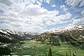
 Rainier Meadow (July 2005).jpg 2,100 × 1,495; 701 KB
-
 Reflections on Denali.jpg 1,280 × 851; 444 KB
-
 Sahale Peak.jpg 1,024 × 411; 627 KB
-

-
 Shuksan from Ruth.jpg 1,169 × 738; 678 KB
-
 Snowking Mountain from Hidden Lake Peak.jpg 768 × 1,024; 1.16 MB
-
 Stony Overlook July 29, 2012 (7956378510).jpg 11,856 × 4,302; 26.74 MB
-
-
-
 Sunset, Mt. St. Elias, Mt. Miller, Bagley Icefield (25158870487).jpg 5,393 × 3,595; 10.07 MB
-
 The Bagley Icefield and Mt. St. Elias (26156485268).jpg 5,044 × 3,363; 8.35 MB
-
 The Triplets from Sahale Arm.jpg 1,024 × 731; 1.11 MB
-
 Top of (this part of) the world - Flickr - Unhindered by Talent.jpg 3,456 × 2,304; 5.53 MB
-
 Tracy Arm Fjord (3730004415).jpg 2,592 × 3,888; 4.36 MB
-
 Unpathed Waters (Unsplash).jpg 5,160 × 3,312; 1.93 MB
-
 View across Independence Pass from north.jpg 841 × 646; 366 KB
-
 Yoga dancer pose at Independence Pass, CO.jpg 705 × 727; 341 KB
.jpg)

.jpg)

.jpg)
.jpg)
.jpg)
.jpg)
.jpg)
_(21601824022).jpg)
.jpg)
.jpg)


.jpg)
.jpg)
.jpg)


.jpg)
.jpg)
.jpg)
.jpg)
_(20991841433).jpg)
_(21425001368).jpg)
.jpg)
.jpg)
.jpg)
.jpg)
_(20992373073).jpg)
.jpg)


.jpg)
.jpg)
.jpg)
.jpg)
.jpg)
.jpg)
.jpg)
.jpg)
.jpg)
.jpg)
.jpg)
.jpg)
.jpg)
.jpg)
.jpg)
.jpg)
.jpg)
.jpg)
.jpg)
.jpg)
.jpg)
.jpg)
.jpg)


.jpg)


.jpg)

.jpg)


_(21586923606).jpg)
.jpg)
_(21425280828).jpg)
_(21622035801).jpg)


.jpg)
.jpg)
.jpg)

.jpg)


.jpg)
.jpg)
.jpg)
.jpg)

_the_world_-_Flickr_-_Unhindered_by_Talent.jpg)
.jpg)
.jpg)


.jpg)
.jpg)
.jpg)