Category:South Kirkby
town in West Yorkshire, United Kingdom  | |||||
| Upload media | |||||
| Instance of | |||||
|---|---|---|---|---|---|
| Location | South Kirkby and Moorthorpe, Wakefield, West Yorkshire, Yorkshire and the Humber, England | ||||
 | |||||
South Kirkby is a small town in the civil parish of South Kirkby and Moorthorpe, in the City of Wakefield district of West Yorkshire, England.

Subcategories
This category has only the following subcategory.
S
- All Saints' Church, South Kirkby (11 F)
Media in category "South Kirkby"
The following 45 files are in this category, out of 45 total.
-

-

-
 Beacon View - Carr Lane - geograph.org.uk - 1348578.jpg 640 × 480; 222 KB
-
 Bowling Green - Park - Barnsley Road - geograph.org.uk - 1348519.jpg 640 × 480; 255 KB
-
 Bridleway to Clayton - geograph.org.uk - 597442.jpg 640 × 480; 87 KB
-
 Brierley Crescent - geograph.org.uk - 1349167.jpg 640 × 480; 239 KB
-
 Brooksfield - Carr Lane - geograph.org.uk - 1348628.jpg 640 × 480; 218 KB
-
 Burnt Wood Lane, near South Kirkby - geograph.org.uk - 341824.jpg 640 × 480; 139 KB
-
 Carr View - from Wentworth Drive - geograph.org.uk - 1348643.jpg 640 × 480; 270 KB
-
 Carr View - from Wentworth Drive - geograph.org.uk - 1348647.jpg 640 × 480; 237 KB
-
 Chapel Lane - Northfield Lane - geograph.org.uk - 1349169.jpg 480 × 640; 267 KB
-
 Church House - Barnsley Road - geograph.org.uk - 1349177.jpg 640 × 454; 233 KB
-
 Clock Row Avenue - Barnsley Road - geograph.org.uk - 1348509.jpg 640 × 480; 247 KB
-
 Clock Row Grove - Ings Walk - geograph.org.uk - 1348420.jpg 640 × 480; 224 KB
-
 Coronation Club - Barnsley Road - geograph.org.uk - 1348550.jpg 640 × 532; 223 KB
-
 Crawley Avenue - Carr Lane - geograph.org.uk - 1348575.jpg 640 × 480; 257 KB
-
 Footpath - top of Brierley Crescent - geograph.org.uk - 1349164.jpg 480 × 640; 332 KB
-

-
 Heather Close - Ings Walk - geograph.org.uk - 1348500.jpg 640 × 480; 239 KB
-
 Ings Close - Ings Walk - geograph.org.uk - 1348421.jpg 640 × 470; 206 KB
-
 Ings Walk - geograph.org.uk - 1348504.jpg 640 × 480; 231 KB
-
 Kirkby Mill at South Kirkby, West Yorkshire, England.jpg 1,022 × 690; 686 KB
-
 Miners Memorial - geograph.org.uk - 287244.jpg 640 × 480; 122 KB
-
 Minsthorpe Lane - Barnsley Road - geograph.org.uk - 1349183.jpg 640 × 480; 226 KB
-
 Muddy Track - geograph.org.uk - 118114.jpg 640 × 480; 89 KB
-

-
 Northfield Lane - geograph.org.uk - 1349173.jpg 640 × 480; 254 KB
-
 Out of these depths this village grew (27081599304).jpg 3,278 × 1,913; 6.15 MB
-
 Park - Barnsley Road - geograph.org.uk - 1348556.jpg 640 × 480; 273 KB
-
 Park View Apartments - Barnsley Road - geograph.org.uk - 1348513.jpg 640 × 480; 247 KB
-
 Playground - Park - Barnsley Road - geograph.org.uk - 1348524.jpg 640 × 480; 346 KB
-

-
 South Kirkby Post Office - Carr Lane - geograph.org.uk - 1348563.jpg 482 × 640; 210 KB
-
 Spring Vale Road - Wentworth Drive - geograph.org.uk - 1348633.jpg 640 × 480; 286 KB
-
 Tempest Road - Wentworth Drive - geograph.org.uk - 1348636.jpg 640 × 480; 273 KB
-
 The Miner (26687348743).jpg 2,354 × 2,653; 6.43 MB
-
 The Miner (27311869251).jpg 3,674 × 2,939; 9.06 MB
-
 The Miner (27368647971).jpg 2,124 × 3,216; 5.19 MB
-
 The Old Crown Inn - Barnsley Road - geograph.org.uk - 1348547.jpg 549 × 640; 219 KB
-
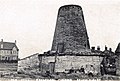
 The Old Mill - geograph.org.uk - 118113.jpg 640 × 480; 83 KB
-
 Travellers Inn - Carr Lane - geograph.org.uk - 1348568.jpg 640 × 480; 252 KB
-
 Waterton Close - Ings Walk - geograph.org.uk - 1348502.jpg 640 × 480; 227 KB
-
 Wentworth Drive - Carr Lane - geograph.org.uk - 1348629.jpg 640 × 480; 242 KB
-
 Wentworth Drive - Carr View - geograph.org.uk - 1348639.jpg 640 × 480; 248 KB
-
 West Farm on Broad Lane, South Kirkby, West Yorkshire.jpg 640 × 480; 105 KB


.jpg)


.jpg)
.jpg)
.jpg)


