Category:Southrop
village in United Kingdom  | |||||
| Upload media | |||||
| Instance of | |||||
|---|---|---|---|---|---|
| Location | Cotswold, Gloucestershire, South West England, England | ||||
 | |||||
Subcategories
This category has the following 2 subcategories, out of 2 total.
P
S
- The Swan, Southrop (12 F)
Media in category "Southrop"
The following 106 files are in this category, out of 106 total.
-
 Approaching Southrop - geograph.org.uk - 1072507.jpg 640 × 427; 100 KB
-
 Approaching Southrop - geograph.org.uk - 3150105.jpg 640 × 480; 164 KB
-
 Arable land at Southrop - geograph.org.uk - 2704954.jpg 1,024 × 680; 243 KB
-
 Barley field in Hammersmith Bottom - geograph.org.uk - 5458767.jpg 1,024 × 768; 321 KB
-
 Barley field near Homeleaze Farm - geograph.org.uk - 5458738.jpg 1,024 × 768; 233 KB
-
 Bee Furlong Barn and Shelter Sheds - geograph.org.uk - 3162367.jpg 3,648 × 2,736; 3.95 MB
-
 Bridge over the River Leach - geograph.org.uk - 1592827.jpg 640 × 480; 123 KB
-
 Building work at Southrop C of E school - geograph.org.uk - 3150519.jpg 640 × 480; 184 KB
-

-
 Corner on lane towards Southrop - geograph.org.uk - 4192472.jpg 640 × 480; 121 KB
-
 Cottage on Lechlade Road - geograph.org.uk - 4241419.jpg 1,600 × 1,200; 365 KB
-
 Cottages in Southrop - geograph.org.uk - 3150507.jpg 640 × 480; 180 KB
-
 Cottages, Southrop - geograph.org.uk - 3883639.jpg 4,000 × 3,000; 2.8 MB
-
 Crossroads near Southrop - geograph.org.uk - 1078633.jpg 640 × 427; 92 KB
-
 Dovecote Approximately 10 Metres North West Of The Pines, Southrop.jpg 6,000 × 4,000; 9.03 MB
-

-
 Entrance to Great Lemhill Farm - geograph.org.uk - 3148920.jpg 640 × 480; 187 KB
-
 Farm buildings, Homeleaze Farm - geograph.org.uk - 5458744.jpg 1,024 × 768; 234 KB
-
 Farm track and footpath - geograph.org.uk - 2619511.jpg 640 × 480; 147 KB
-
 Farmland near Southrop - geograph.org.uk - 2705734.jpg 1,024 × 680; 147 KB
-
 Farmland track - geograph.org.uk - 5458764.jpg 1,024 × 768; 266 KB
-
 Footpath from Southrop - geograph.org.uk - 3150639.jpg 480 × 640; 152 KB
-
 Gate to Tubbs Cottage, Southrop - geograph.org.uk - 3150412.jpg 640 × 480; 232 KB
-
 Hambidge Lane junction with unnamed road to Fairford - geograph.org.uk - 3162363.jpg 3,517 × 2,510; 2.15 MB
-
 Hambidge Lane passes Stanford Hall Farm - geograph.org.uk - 3162356.jpg 3,350 × 2,408; 1.68 MB
-

-

-
 Houses on the Lechlade Road, Southrop - geograph.org.uk - 3150107.jpg 640 × 480; 160 KB
-
 Ivy Cottage Keble Cottage Wadham Cottage, Southrop.jpg 6,000 × 4,000; 9.11 MB
-
 Ivy Cottage Keble Cottage Wadham Cottage.jpg 6,000 × 4,000; 8.01 MB
-
 Junction on the edge of Southrop - geograph.org.uk - 1592838.jpg 640 × 480; 48 KB
-

-
 Lane towards Eastleach - geograph.org.uk - 4192484.jpg 640 × 480; 116 KB
-
 Laurel Cottage, Southrop.jpg 6,000 × 4,000; 7.79 MB
-
 Leaving Southrop - geograph.org.uk - 296668.jpg 640 × 427; 78 KB
-
 Newmans House, Southrop.jpg 6,000 × 4,000; 9.49 MB
-
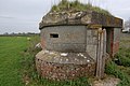 Pillbox at the former RAF Southrop - geograph.org.uk - 776708.jpg 640 × 426; 94 KB
-
 Postbox, Southrop - geograph.org.uk - 1687454.jpg 480 × 640; 123 KB
-
 River Leach - geograph.org.uk - 2242278.jpg 3,072 × 2,304; 3.11 MB
-
 Road junction near Southrop - geograph.org.uk - 2704516.jpg 1,024 × 680; 149 KB
-
 Road through Southrop - geograph.org.uk - 1592833.jpg 640 × 480; 68 KB
-
 Road to Homeleaze Farm - geograph.org.uk - 1613894.jpg 640 × 480; 85 KB
-
 Road to Southrop Manor Estate - geograph.org.uk - 3150102.jpg 640 × 480; 131 KB
-

-
 Southrop Ford - geograph.org.uk - 3269434.jpg 3,872 × 2,592; 2.39 MB
-
 Southrop Post Office ... once ... (2499992822).jpg 1,072 × 918; 265 KB
-
 Southrop Primary School - geograph.org.uk - 2704963.jpg 1,024 × 680; 195 KB
-
 Southrop village hall - geograph.org.uk - 3150643.jpg 640 × 480; 200 KB
-
 Southrop, Bradborough Farm - geograph.org.uk - 5627259.jpg 1,600 × 1,200; 831 KB
-
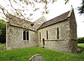
 Southrop, St. Peter's Church - geograph.org.uk - 5441954.jpg 3,679 × 2,455; 5.29 MB
-

-

-

-

-

-

-

-
 Southrop, St. Peter's Church, Norman doorway and window - geograph.org.uk - 5442034.jpg 3,488 × 5,398; 7.33 MB
-
 Southrop, St. Peter's Church, The Early English chancel - geograph.org.uk - 5441991.jpg 5,202 × 3,323; 7.29 MB
-
 Southrop, St. Peter's Church, The nave - geograph.org.uk - 5442027.jpg 4,537 × 2,977; 6.78 MB
-
 Southrop, St. Peter's Church, The Norman North Doorway - geograph.org.uk - 5441960.jpg 2,700 × 4,424; 5.62 MB
-
 Southrop, St. Peter's Church, The organ - geograph.org.uk - 5442016.jpg 5,472 × 3,606; 5.49 MB
-
 Southrop, St. Peter's Church, The Thomas Kebla memorial 1670 - geograph.org.uk - 5441997.jpg 2,412 × 3,654; 4.65 MB
-

-

-
 Spring Blossom at Southrop - geograph.org.uk - 6131791.jpg 1,600 × 1,200; 479 KB
-
 St Peter, Southrop - Chancel - geograph.org.uk - 3503260.jpg 1,000 × 707; 140 KB
-
 St Peter, Southrop - Churchyard - geograph.org.uk - 3503272.jpg 1,000 × 667; 231 KB
-
 St Peter, Southrop - East end - geograph.org.uk - 3503206.jpg 1,000 × 705; 127 KB
-
 St Peter, Southrop - East end - geograph.org.uk - 3503207.jpg 1,000 × 667; 123 KB
-
 St Peter, Southrop - Font - geograph.org.uk - 3304002.jpg 591 × 831; 614 KB
-
 St Peter, Southrop - Font - geograph.org.uk - 3503267.jpg 620 × 1,000; 162 KB
-
 St Peter, Southrop - Font - geograph.org.uk - 3503268.jpg 771 × 1,000; 186 KB
-
 St Peter, Southrop - Font - geograph.org.uk - 3503269.jpg 618 × 1,000; 209 KB
-
 St Peter, Southrop - geograph.org.uk - 3503203.jpg 1,000 × 703; 168 KB
-
 St Peter, Southrop - geograph.org.uk - 3503205.jpg 1,000 × 727; 218 KB
-
 St Peter, Southrop - Monument - geograph.org.uk - 3503263.jpg 1,000 × 453; 102 KB
-
 St Peter, Southrop - Monument - geograph.org.uk - 3503264.jpg 1,000 × 741; 145 KB
-
 St Peter, Southrop - Porch - geograph.org.uk - 3503273.jpg 1,000 × 738; 215 KB
-
 St Peter, Southrop - Wall monument - geograph.org.uk - 3503274.jpg 677 × 1,000; 111 KB
-
 St Peter, Southrop - War Memorial WWI ^ WWII - geograph.org.uk - 3503276.jpg 1,000 × 736; 159 KB
-
 St Peter, Southrop - West end - geograph.org.uk - 3503262.jpg 1,000 × 716; 136 KB
-
 Stone stile and public footpath to Southrop - geograph.org.uk - 3883146.jpg 4,000 × 3,000; 2.91 MB
-
 The Mill House, Southrop - geograph.org.uk - 3150525.jpg 640 × 480; 215 KB
-
 The Mill House, Southrop, Gloucestershire - geograph.org.uk - 4566029.jpg 4,952 × 2,901; 3.19 MB
-

-
 The Pinmes, Southrop.jpg 6,000 × 4,000; 8.1 MB
-
 The rear of Newmans House - geograph.org.uk - 3150484.jpg 640 × 480; 179 KB
-
 The River Leach - geograph.org.uk - 4241468.jpg 1,600 × 1,200; 411 KB
-
 The River Leach at Southrop - geograph.org.uk - 1592830.jpg 640 × 480; 129 KB
-
 The Swan, Southrop - geograph.org.uk - 6131785.jpg 1,600 × 1,200; 514 KB
-
 Track to Bradborough Farm, Southrop - geograph.org.uk - 3883633.jpg 4,000 × 3,000; 2.82 MB
-
 Track to Tubbs Cottage - geograph.org.uk - 4241431.jpg 1,600 × 1,132; 452 KB
-

-
 View along the Lechlade Road in Southrop - geograph.org.uk - 3150453.jpg 640 × 480; 147 KB
-
 View to Rottonborough Copse - geograph.org.uk - 3148928.jpg 640 × 480; 186 KB
-
 Village Hall, Southrop - geograph.org.uk - 2704960.jpg 1,024 × 680; 347 KB
-
 Water features in Southrop - geograph.org.uk - 4241474.jpg 1,600 × 1,093; 356 KB
-
 Barn ripe for conversion - geograph.org.uk - 305039.jpg 640 × 480; 96 KB
-
 Bend in the lane - geograph.org.uk - 296679.jpg 640 × 427; 63 KB
-
 Building at Southrop Football Club - geograph.org.uk - 278590.jpg 640 × 427; 57 KB
-
 Cotswold house - geograph.org.uk - 305098.jpg 640 × 480; 137 KB
-
 Field and woodland near Southrop - geograph.org.uk - 278595.jpg 640 × 427; 107 KB
-
 Fuel Tank and barn - geograph.org.uk - 278603.jpg 640 × 427; 82 KB
-
 Oaks by the lechlade to Hatherop road - geograph.org.uk - 296681.jpg 640 × 427; 102 KB
-
 Track and footpath junction - geograph.org.uk - 305035.jpg 640 × 480; 69 KB


.jpg)


