Category:Speicher (Regensdorf)
| Object location | | View all coordinates using: OpenStreetMap |
|---|
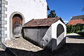
building in Regensdorf in the canton of Zürich, Switzerland  | |||||
| Upload media | |||||
| Instance of | |||||
|---|---|---|---|---|---|
| Part of | |||||
| Location | Watt, Regensdorf, Dielsdorf district, Canton of Zürich, Switzerland | ||||
| Street address |
| ||||
| Heritage designation | |||||
 | |||||
Media in category "Speicher (Regensdorf)"
The following 14 files are in this category, out of 14 total.
-
 Regensdorf - Speicher, Im Sand 7 2011-08-28 13-39-48 ShiftN.jpg 4,000 × 2,667; 3.27 MB
-
 Regensdorf - Speicher, Im Sand 7 2011-08-28 13-40-14 ShiftN.jpg 2,667 × 4,000; 1.77 MB
-
 Regensdorf - Speicher, Im Sand 7 2011-08-28 13-40-50.JPG 4,288 × 2,848; 6.12 MB
-
 Regensdorf - Speicher, Im Sand 7 2011-08-28 13-41-00.jpg 2,848 × 4,288; 2.82 MB
-
 Regensdorf - Speicher, Im Sand 7 2011-08-28 13-41-14 ShiftN.jpg 2,664 × 3,999; 3.04 MB
-
 Regensdorf - Speicher, Im Sand 7 2011-08-28 13-41-34 ShiftN.jpg 4,000 × 2,667; 2.92 MB
-
 Regensdorf - Speicher, Im Sand 7 2011-08-28 13-41-52 ShiftN.jpg 3,733 × 2,800; 3.05 MB
-
 Regensdorf - Speicher, Im Sand 7 2011-08-28 13-42-08.jpg 4,288 × 2,848; 3.11 MB
-
 Regensdorf - Speicher, Im Sand 7 2011-08-28 13-42-24 ShiftN.jpg 2,667 × 4,000; 2.93 MB
-
 Regensdorf - Speicher, Im Sand 7 2011-08-28 13-42-38.jpg 4,000 × 2,667; 2.64 MB
-
 Regensdorf - Speicher, Im Sand 7 2011-08-28 13-42-56.jpg 4,000 × 2,667; 3.85 MB
-
 Regensdorf - Speicher, Im Sand 7 2011-08-28 13-43-12 ShiftN.jpg 2,667 × 3,999; 2.74 MB
-

-
 Speicher, Im Sand 7 in Regensdorf 2011-08-28 13-43-06 ShiftN.jpg 4,000 × 2,667; 2.48 MB


