Category:Spennymoor
town and civil parish in County Durham, England  | |||||
| Upload media | |||||
| Instance of | |||||
|---|---|---|---|---|---|
| Location | County Durham, North East England, England | ||||
| official website | |||||
 | |||||
Subcategories
This category has the following 9 subcategories, out of 9 total.
Media in category "Spennymoor"
The following 200 files are in this category, out of 243 total.
(previous page) (next page)-
 "The Frog and Ferret", Spennymoor - geograph.org.uk - 405553.jpg 640 × 480; 58 KB
-
 "The Winning Post" - geograph.org.uk - 405555.jpg 640 × 480; 61 KB
-

-
 A house by Stanner's Farm - geograph.org.uk - 3673816.jpg 1,368 × 1,824; 590 KB
-
 A167 Approaching Thinford - geograph.org.uk - 2480170.jpg 640 × 480; 253 KB
-
 A167 Towards Durham - geograph.org.uk - 2480163.jpg 640 × 480; 177 KB
-
 A167 towards Durham - geograph.org.uk - 4800933.jpg 640 × 480; 66 KB
-
 Arbour rear of Whitworth Hall Hotel - geograph.org.uk - 2088675.jpg 640 × 480; 127 KB
-
 Auckland Walk west of Spennymoor - geograph.org.uk - 3037861.jpg 1,500 × 843; 1.7 MB
-
 B6288 entering Croxdale - geograph.org.uk - 4818119.jpg 1,500 × 1,000; 1.4 MB
-
 B6288 heading north - geograph.org.uk - 4707935.jpg 1,500 × 1,125; 1.33 MB
-

-

-
 Barn, Todhills Farm - geograph.org.uk - 5891422.jpg 640 × 480; 56 KB
-
 Big foot - geograph.org.uk - 2589602.jpg 480 × 640; 72 KB
-
 Bishop's Close Farmhouse - geograph.org.uk - 1364525.jpg 640 × 480; 71 KB
-
 Black Plantation Spennymoor - geograph.org.uk - 2336361.jpg 640 × 480; 55 KB
-
 Bollards beside road climbing towards Kirk Merrington - geograph.org.uk - 4735700.jpg 1,500 × 1,125; 1.83 MB
-

-
 Bridleway heading towards Merrington Lane - geograph.org.uk - 4707918.jpg 1,500 × 1,125; 1.36 MB
-
 Bridleway near Burton Beck Farm - geograph.org.uk - 1018542.jpg 600 × 450; 115 KB
-
 Burton Woods at Whitworth Park - geograph.org.uk - 5069846.jpg 3,648 × 2,352; 4.88 MB
-
 Burton Woods at Whitworth Park - geograph.org.uk - 5069860.jpg 3,648 × 1,963; 4.38 MB
-
 Burton Woods housing estate, Spennymoor (2013) - geograph.org.uk - 3673841.jpg 1,549 × 1,177; 334 KB
-

-

-

-

-
 Bus stop on Vyners Close (B6288) - geograph.org.uk - 4812551.jpg 640 × 480; 63 KB
-
 Bus stop on Weardale Street (B6288) - geograph.org.uk - 4812561.jpg 640 × 480; 88 KB
-
 Bus stop opposite Dene Villas - geograph.org.uk - 4799667.jpg 640 × 480; 84 KB
-
 Byers Green Old Hall with arched door.jpg 4,320 × 3,240; 3.77 MB
-
 Byers Green Station - geograph.org.uk - 5835160.jpg 1,024 × 768; 395 KB
-
 Cheapside, Spennymoor - geograph.org.uk - 2589312.jpg 640 × 480; 130 KB
-
 Church Street towards Binchester - geograph.org.uk - 5891980.jpg 640 × 480; 91 KB
-

-
 Conference Suite in Spennymoor - geograph.org.uk - 1492109.jpg 640 × 480; 74 KB
-
 Crawleas Farm Leasingthorne County Durham - geograph.org.uk - 2025642.jpg 2,048 × 1,536; 674 KB
-
 Crop field near Todhills - geograph.org.uk - 5889013.jpg 640 × 480; 63 KB
-
 Crop field, North Close - geograph.org.uk - 4812550.jpg 640 × 480; 70 KB
-

-
 Cycle Shelter, Surgery, Spennymoor - geograph.org.uk - 2905604.jpg 515 × 543; 63 KB
-
 David Wilson Homes, Whitworth Park - geograph.org.uk - 3673866.jpg 1,793 × 1,144; 555 KB
-
 Deer Park Lodge, Stanners Lane, Spennymoor - geograph.org.uk - 2336334.jpg 1,030 × 725; 46 KB
-
 Disused commercial property - geograph.org.uk - 4818901.jpg 1,500 × 808; 1 MB
-
 Downstream River Wear - geograph.org.uk - 3673753.jpg 1,731 × 1,271; 732 KB
-
 Duck, Whitworth Hall Country Park - geograph.org.uk - 2088659.jpg 640 × 480; 129 KB
-
 Durhamgate - geograph.org.uk - 4800937.jpg 640 × 401; 57 KB
-
 Edge of wheat field below Merrington Road - geograph.org.uk - 5499948.jpg 1,500 × 1,125; 1.4 MB
-
 Edison Drive, Spennymoor - geograph.org.uk - 4812555.jpg 640 × 480; 50 KB
-

-
 Elizabeth II postbox on High Street, Byers Green - geograph.org.uk - 5892211.jpg 3,183 × 2,374; 1.07 MB
-
 Elizabeth II postbox on Wear View, Byers Green - geograph.org.uk - 5892217.jpg 1,486 × 2,996; 877 KB
-
 Entering Byers Green - geograph.org.uk - 5891965.jpg 640 × 480; 67 KB
-
 Entering Kirk Merrington - geograph.org.uk - 4812540.jpg 640 × 480; 76 KB
-
 Entering North Close - geograph.org.uk - 4812542.jpg 640 × 480; 83 KB
-
 Entrance to Parkside off Carr Lane in Spennymoor - geograph.org.uk - 3322340.jpg 3,083 × 2,351; 3.39 MB
-
 Entrance to Spennymoor Cemetery - geograph.org.uk - 2042732.jpg 2,048 × 1,536; 645 KB
-
 Entry to Burton Woods at Whitworth Park - geograph.org.uk - 3673833.jpg 1,824 × 1,368; 601 KB
-
 Entry to Tudhoe Mill Wood - geograph.org.uk - 4794411.jpg 1,200 × 1,600; 683 KB
-
 Erosion of River Wear - geograph.org.uk - 4794746.jpg 1,500 × 984; 1.06 MB
-
 Erosion on the River Wear - geograph.org.uk - 1574399.jpg 640 × 480; 125 KB
-
 Farm machinery beside farm road - geograph.org.uk - 4794728.jpg 1,500 × 874; 1.31 MB
-
 Farm track near Red Hall Farm - geograph.org.uk - 4800921.jpg 640 × 480; 81 KB
-
 Field access gate - geograph.org.uk - 3673736.jpg 1,753 × 1,303; 832 KB
-

-
 Field near Binchester - geograph.org.uk - 5891978.jpg 640 × 480; 49 KB
-
 Fields north of Binchester - geograph.org.uk - 3322787.jpg 1,500 × 915; 1.06 MB
-

-
 Five Lane Ends Cemetery - geograph.org.uk - 4818860.jpg 1,500 × 1,000; 1.85 MB
-
 Flooded farmland near Stanner's Farm - geograph.org.uk - 4813761.jpg 640 × 480; 53 KB
-
 Footbridge over Brancepeth Beck - geograph.org.uk - 2337686.jpg 640 × 480; 70 KB
-

-
 Footpath along field edge - geograph.org.uk - 4707976.jpg 1,500 × 1,125; 2.04 MB
-
 Footpath leading off Merrington Lane - geograph.org.uk - 2564088.jpg 3,648 × 2,736; 3.23 MB
-
 Footpath to Merrington Grange and beyond - geograph.org.uk - 2564098.jpg 3,648 × 2,736; 3.75 MB
-
 Forest life in Spring Wood - geograph.org.uk - 1581679.jpg 640 × 480; 123 KB
-
 Former water company pumping station. Now a residence - geograph.org.uk - 3322336.jpg 2,545 × 1,975; 1.6 MB
-
 Front Street (B6288), Tudhoe - geograph.org.uk - 2479621.jpg 640 × 480; 223 KB
-
 Fungi, Whitworth Hall Hotel - geograph.org.uk - 2087685.jpg 640 × 480; 125 KB
-
 Gated entry into field - geograph.org.uk - 4347483.jpg 1,500 × 1,125; 1.33 MB
-
 Gateway to Whitworth Hall Park - geograph.org.uk - 2336345.jpg 640 × 480; 41 KB
-
 Gilling Crescent, Spennymoor - geograph.org.uk - 2047951.jpg 640 × 480; 50 KB
-
 Gravestones with autumnal trees - geograph.org.uk - 4704465.jpg 1,500 × 996; 1.6 MB
-
 Gravestones with autumnal trees - geograph.org.uk - 4706963.jpg 1,500 × 996; 1.86 MB
-
 Grazing Kirk Merrington - geograph.org.uk - 4812541.jpg 640 × 480; 58 KB
-
 Green Lane Industrial Estate - geograph.org.uk - 409050.jpg 640 × 480; 71 KB
-
 Half Moon Lane, Spennymoor - geograph.org.uk - 409053.jpg 640 × 480; 70 KB
-
 High Street, Byers Green - geograph.org.uk - 5891969.jpg 640 × 480; 50 KB
-
 High Street, Spennymoor - geograph.org.uk - 2589603.jpg 640 × 480; 135 KB
-
 Houses on High Street, Byers Green - geograph.org.uk - 5892215.jpg 640 × 495; 55 KB
-
 Houses on North Close Road - geograph.org.uk - 4812546.jpg 640 × 480; 66 KB
-
 Houses on Wear View, Byers Green - geograph.org.uk - 5891966.jpg 640 × 480; 64 KB
-
 Houses on Wear View, Byers Green - geograph.org.uk - 5892218.jpg 3,648 × 2,736; 1.49 MB
-
 Housing development in Middlestone Moor - geograph.org.uk - 4706935.jpg 1,500 × 958; 1.02 MB
-
 John Willetts Fireplace and Stove Centre - geograph.org.uk - 3322383.jpg 3,648 × 2,736; 1.6 MB
-
 Jubilee Gardens, Spennymoor - geograph.org.uk - 404783.jpg 640 × 480; 75 KB
-
 King Street, Spennymoor - geograph.org.uk - 4813712.jpg 640 × 480; 63 KB
-
 Kirk Merrington Parish Church - geograph.org.uk - 5862574.jpg 683 × 1,024; 184 KB
-

-

-
 Leafy crop, multiple pylon lines beyond - geograph.org.uk - 6007883.jpg 1,500 × 788; 1.08 MB
-
 Leisure Centre. Spennymoor. - geograph.org.uk - 502920.jpg 640 × 480; 79 KB
-
 Long Lane near Todhills - geograph.org.uk - 5889014.jpg 640 × 480; 90 KB
-
 Looking across to Stanner's Farm - geograph.org.uk - 3091752.jpg 4,608 × 3,456; 5.52 MB
-
 Merrington Grange Farm - geograph.org.uk - 4798666.jpg 640 × 480; 67 KB
-
 Merrington Mill Farm - geograph.org.uk - 408658.jpg 640 × 480; 89 KB
-
 Merrington Road towards Kirk Merrington - geograph.org.uk - 3549291.jpg 2,432 × 1,824; 1.43 MB
-
 Merrington View, Spennymoor - geograph.org.uk - 2047943.jpg 640 × 480; 85 KB
-
 Middlestone Moor Working Mens Club Spennymoor - geograph.org.uk - 2043710.jpg 2,048 × 1,536; 643 KB
-
 Nanny Pop Lonnen - geograph.org.uk - 1364385.jpg 640 × 480; 89 KB
-
 North Close Road - geograph.org.uk - 4812547.jpg 640 × 480; 85 KB
-
 North Road, Tudhoe - geograph.org.uk - 2499255.jpg 608 × 456; 135 KB
-
 Old ford on the river Wear - geograph.org.uk - 245810.jpg 640 × 480; 95 KB
-
 Old Park Terrace - geograph.org.uk - 1373983.jpg 640 × 480; 71 KB
-
 Open space at 'DurhamGate' - geograph.org.uk - 4818889.jpg 1,499 × 779; 772 KB
-
 Ordnance Survey Cut Mark - geograph.org.uk - 5907139.jpg 1,024 × 644; 214 KB
-
 Parkwood Precinct, Spennymoor - geograph.org.uk - 2589609.jpg 640 × 480; 116 KB
-
 Parkwood Precinct, Spennymoor - geograph.org.uk - 2589611.jpg 640 × 480; 109 KB
-
 Path at west side of Spennymoor - geograph.org.uk - 3038193.jpg 1,500 × 931; 1.62 MB
-
 Path beside the A167 - geograph.org.uk - 4800918.jpg 640 × 480; 51 KB
-
 Path beside the A167 - geograph.org.uk - 4800928.jpg 640 × 480; 55 KB
-
 Pond near North Park Lodge Farm - geograph.org.uk - 4813730.jpg 640 × 480; 81 KB
-
 Pony trotting, Spennymoor - geograph.org.uk - 404411.jpg 640 × 480; 84 KB
-
 Red Hall Farm - geograph.org.uk - 4800922.jpg 640 × 440; 48 KB
-
 River Wear - geograph.org.uk - 1018594.jpg 600 × 450; 122 KB
-
 River Wear - geograph.org.uk - 1018596.jpg 600 × 450; 89 KB
-
 River Wear at Page Bank - geograph.org.uk - 2054166.jpg 640 × 480; 125 KB
-
 River Wear near East Park - geograph.org.uk - 1737832.jpg 2,048 × 1,536; 2.11 MB
-
 River Wear west of Lowfield Farm - geograph.org.uk - 2770569.jpg 1,500 × 1,125; 1.65 MB
-
 Road off Cobey's Carr Lane - geograph.org.uk - 5889018.jpg 640 × 480; 92 KB
-
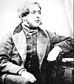 Robert Duncombe Shafto.jpg 800 × 916; 151 KB
-

-
 Roundabout at Binchester Moor - geograph.org.uk - 6364276.jpg 3,078 × 1,011; 1.18 MB
-
 Santa on roundabout, Spennymoor - geograph.org.uk - 4813723.jpg 640 × 480; 56 KB
-

-
 Shafto's Bar and Restaurant, Spennymoor, County Durham.jpg 1,632 × 1,224; 305 KB
-
 Shingle bank in the River Wear - geograph.org.uk - 2336158.jpg 640 × 480; 39 KB
-
 Shops on Cheapside, Spennymoor - geograph.org.uk - 4812568.jpg 640 × 464; 68 KB
-
 Shops on Cheapside, Spennymoor - geograph.org.uk - 4813721.jpg 640 × 480; 64 KB
-

-

-
 Sign for The Weardale, Spennymoor - geograph.org.uk - 4787643.jpg 497 × 640; 64 KB
-
 Spennymoor entrance sign - geograph.org.uk - 2026261.jpg 640 × 480; 74 KB
-
 Spennymoor fire station - geograph.org.uk - 2022700.jpg 640 × 427; 209 KB
-
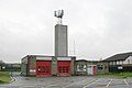 Spennymoor fire station - geograph.org.uk - 288103.jpg 640 × 427; 149 KB
-
 Spennymoor Greyhound Stadium c.1980.png 858 × 627; 919 KB
-
 Spennymoor War Memorial - geograph.org.uk - 2589594.jpg 480 × 640; 60 KB
-
 Spennymoor, roadside gardens on route of old railway - geograph.org.uk - 3037917.jpg 1,500 × 843; 1.53 MB
-
 Spennymoor, sensory garden in Victoria Jubilee Park - geograph.org.uk - 3038000.jpg 1,500 × 843; 1.47 MB
-
 St Andrew's Church, Spennymoor - geograph.org.uk - 4812565.jpg 640 × 480; 62 KB
-
 St Paul's Gardens Spennymoor - geograph.org.uk - 2043658.jpg 2,048 × 1,536; 855 KB
-
 St. David's Church, Tudhoe - geograph.org.uk - 4818148.jpg 1,500 × 1,000; 1.42 MB
-
 Stanner's Lane - geograph.org.uk - 2634530.jpg 640 × 480; 135 KB
-
 Stanner's Lane - geograph.org.uk - 4813764.jpg 640 × 480; 51 KB
-
 Stone barn, Todhills Farm - geograph.org.uk - 5891423.jpg 640 × 480; 70 KB
-
 Sue's Florist, Windlestone Lane - geograph.org.uk - 404816.jpg 640 × 480; 71 KB
-

-
 The Bridge, High Street, Spennymoor - geograph.org.uk - 2589597.jpg 640 × 480; 122 KB
-
 The Bridge, Spennymoor - geograph.org.uk - 4787662.jpg 640 × 480; 56 KB
-
 The Fox Cub at Durham Gate - geograph.org.uk - 2859263.jpg 3,648 × 2,736; 2.12 MB
-
 The Fox Cub Public House - geograph.org.uk - 6364272.jpg 2,445 × 977; 1.92 MB
-
 The Frog ^ Ferret, Spennymoor - geograph.org.uk - 4787637.jpg 640 × 543; 62 KB
-
 The Grand Electric Hall, Spennymoor - geograph.org.uk - 4787648.jpg 640 × 480; 65 KB
-
 The North Eastern, Spennymoor - geograph.org.uk - 4787678.jpg 640 × 480; 64 KB
-
 The North Eastern, Spennymoor - geograph.org.uk - 4787680.jpg 640 × 458; 60 KB
-
 The Old Eden Arms a residence in Leasingthorne - geograph.org.uk - 2048876.jpg 2,048 × 1,536; 868 KB
-
 The Penny Gill, Cheapside, Spennymoor - geograph.org.uk - 2589295.jpg 640 × 480; 144 KB
-
 The Penny Gill, Spennymoor - geograph.org.uk - 4787651.jpg 640 × 480; 80 KB
-
 The promise of things to come - geograph.org.uk - 405551.jpg 480 × 640; 123 KB
-
 The Railway Tavern, Spennymoor - geograph.org.uk - 4787681.jpg 640 × 480; 61 KB
-
 The River Wear - geograph.org.uk - 4813766.jpg 640 × 480; 61 KB
-
 The Royal Oak Inn, Byers Green - geograph.org.uk - 5891970.jpg 640 × 474; 54 KB
-
 The Thinford Inn - geograph.org.uk - 4788435.jpg 640 × 480; 55 KB
-

-
 The Weardale, Cheapside, Spennymoor - geograph.org.uk - 2589284.jpg 480 × 640; 68 KB
-
 The Weardale, Spennymoor - geograph.org.uk - 4787644.jpg 640 × 480; 75 KB
-
 The Winning Post at Spennymoor - geograph.org.uk - 2432861.jpg 3,648 × 2,736; 2.93 MB
-

-
 The Winning Post, Spennymoor - geograph.org.uk - 2576625.jpg 640 × 480; 108 KB
-
 Tomb at Whitworth Parish Church - geograph.org.uk - 2088627.jpg 640 × 480; 86 KB
-
 Tomb at Whitworth Parish Church - geograph.org.uk - 2088639.jpg 640 × 480; 81 KB
-
 Town Centre. Spennymoor. - geograph.org.uk - 502925.jpg 640 × 480; 65 KB
-
 Traffic calming on Whitworth Road - geograph.org.uk - 4813729.jpg 640 × 480; 83 KB
-
 Traffic lights at urban road junction in Spennymoor - geograph.org.uk - 3673888.jpg 1,713 × 1,058; 455 KB
-
 Trees and water-run ground on south side of River Wear - geograph.org.uk - 4794743.jpg 1,500 × 1,125; 1.86 MB
-
 Trees in a crop field, North Close - geograph.org.uk - 4812548.jpg 640 × 480; 104 KB
-
 Upper Church Street, Spennymoor - geograph.org.uk - 404413.jpg 480 × 640; 74 KB
-
 Upstream River Wear - geograph.org.uk - 3673801.jpg 1,824 × 1,368; 797 KB
-
 View from Long Lane - geograph.org.uk - 4733014.jpg 640 × 584; 86 KB
-
 View from Whitworth Hall - geograph.org.uk - 2026280.jpg 640 × 480; 105 KB
-
 Vyners Close (B6288), Spennymoor - geograph.org.uk - 4812557.jpg 640 × 492; 64 KB
-
 War Memorial, Byers Green - geograph.org.uk - 5891973.jpg 640 × 480; 46 KB
-
 War Memorial, Spennymoor - geograph.org.uk - 4813719.jpg 640 × 480; 53 KB
-

-

-
 Wear View, Byers Green - geograph.org.uk - 4733004.jpg 640 × 480; 87 KB
-
 Wear View, Byers Green - geograph.org.uk - 5891967.jpg 640 × 480; 58 KB
-
 Well Cottages Windlestone Lane - geograph.org.uk - 2562734.jpg 3,648 × 2,736; 2.74 MB
-
 Well Plantation - geograph.org.uk - 4709273.jpg 1,500 × 1,125; 2.15 MB


%27_(11241610325).jpg)


_-_geograph.org.uk_-_3673841.jpg)

_-_geograph.org.uk_-_4812543.jpg)


_-_geograph.org.uk_-_4812551.jpg)
_-_geograph.org.uk_-_4812561.jpg)


,_Tudhoe_-_geograph.org.uk_-_2479621.jpg)


_-_geograph.org.uk_-_4812559.jpg)


,_Spennymoor_-_geograph.org.uk_-_4812557.jpg)


_rear_of_Whitworth_Hall_Hotel_-_geograph.org.uk_-_2088456.jpg)


