Category:Spratton
English: Spratton is a village in the English county of Northamptonshire. The local government authority is West Northamptonshire Council, whose headquarters are in Angel Street, Northampton, Northamptonshire. Spratton is 7.1 miles north of Northampton, 6.5 miles from Long Buckby and 11.4 miles from Daventry. The village is situated on the A5199 road.
village and civil parish in Northamptonshire, United Kingdom .JPG) | |||||
| Upload media | |||||
| Instance of | |||||
|---|---|---|---|---|---|
| Location | West Northamptonshire, Northamptonshire, East Midlands, England | ||||
| Population |
| ||||
| Area |
| ||||
 | |||||
Subcategories
This category has only the following subcategory.
A
- St Andrew's church, Spratton (5 F)
Media in category "Spratton"
The following 121 files are in this category, out of 121 total.
-
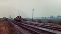
 19750426 Spratton Signalbox.jpg 2,984 × 1,895; 927 KB
-
 8137 8042 Spratton 1973-03-18 -O.jpg 4,032 × 2,268; 2.29 MB
-
 A full stream - geograph.org.uk - 3823036.jpg 640 × 480; 100 KB
-
 A gated housing estate - geograph.org.uk - 5433077.jpg 2,000 × 1,333; 3.08 MB
-
 A quiet playground - geograph.org.uk - 5433075.jpg 2,000 × 1,333; 2.59 MB
-
 A snowy walk near Spratton - geograph.org.uk - 5368137.jpg 2,000 × 1,333; 1.44 MB
-
 A Spratton Garden - geograph.org.uk - 5433068.jpg 1,333 × 2,000; 3.1 MB
-
 A view from the Broomhill Hotel - geograph.org.uk - 5361202.jpg 2,000 × 1,333; 2.24 MB
-
 Across the fields - geograph.org.uk - 6013775.jpg 2,000 × 1,333; 2.52 MB
-
 Brampton Valley Way - geograph.org.uk - 2666545.jpg 640 × 427; 69 KB
-
 Brampton Valley Way near Brixworth - geograph.org.uk - 5864284.jpg 1,024 × 768; 320 KB
-
 Brampton Valley Way near Brixworth - geograph.org.uk - 5864290.jpg 1,024 × 768; 311 KB
-
 Bridge out - geograph.org.uk - 3823035.jpg 640 × 480; 102 KB
-
 Bridge with Serious Cyclists - geograph.org.uk - 224991.jpg 640 × 480; 90 KB
-
 Brixworth Road (geograph 1867410).jpg 480 × 640; 49 KB
-
 Brixworth Road, Spratton - geograph.org.uk - 5400963.jpg 2,304 × 1,728; 819 KB
-
 Brixworth Road, Stratton - geograph.org.uk - 5419463.jpg 2,304 × 1,728; 1.36 MB
-
 Church Road (geograph 1867426).jpg 640 × 480; 104 KB
-
 Church Road - geograph.org.uk - 1844821.jpg 640 × 480; 89 KB
-
 Crossroads in Spratton - geograph.org.uk - 5400350.jpg 2,304 × 1,728; 834 KB
-
 Dawn Mallard hairdressers, Spratton - geograph.org.uk - 5399028.jpg 2,304 × 1,728; 837 KB
-
 Erskine Wood - geograph.org.uk - 1867401.jpg 640 × 480; 79 KB
-
 Farmland near Spratton - geograph.org.uk - 1867360.jpg 640 × 480; 50 KB
-
 Field entrance on Brixworth Road, Stratton - geograph.org.uk - 5419461.jpg 2,140 × 1,579; 1.31 MB
-
 Fields - geograph.org.uk - 3823037.jpg 640 × 480; 66 KB
-
 Fields in Spratton - geograph.org.uk - 5403374.jpg 2,268 × 1,678; 873 KB
-
 Gorse Road - geograph.org.uk - 1844810.jpg 640 × 480; 54 KB
-
 High Street (geograph 1844813).jpg 640 × 480; 75 KB
-
 Manor Road (geograph 1844817).jpg 640 × 480; 61 KB
-
 Manor Road (geograph 3900150).jpg 640 × 480; 62 KB
-
 Manor Road - geograph.org.uk - 3900155.jpg 640 × 480; 61 KB
-
 Manor Road, Spratton - geograph.org.uk - 5400959.jpg 2,304 × 1,728; 867 KB
-
 Merry Tom Crossing - geograph.org.uk - 224998.jpg 640 × 480; 115 KB
-
 Sandhills - geograph.org.uk - 1867441.jpg 640 × 480; 62 KB
-
 Saul's of Spratton - geograph.org.uk - 5433073.jpg 1,333 × 2,000; 2.07 MB
-
 School Road (geograph 1867407).jpg 640 × 480; 59 KB
-
 School Road at the junction of Brixworth Road - geograph.org.uk - 5419462.jpg 2,304 × 1,728; 1,006 KB
-
 School Road Spratton - geograph.org.uk - 5433080.jpg 2,000 × 1,333; 2.76 MB
-
 Smith Street (geograph 1867365).jpg 480 × 640; 76 KB
-
 Smith Street - geograph.org.uk - 1770177.jpg 640 × 480; 86 KB
-
 Spratton Folk Festival - geograph.org.uk - 5317857.jpg 2,000 × 1,333; 710 KB
-
 Spratton Recreation Ground - geograph.org.uk - 1844801.jpg 640 × 480; 49 KB
-
 Spratton School (geograph 1867376).jpg 480 × 640; 60 KB
-
 Spratton Village sign (3).JPG 2,560 × 1,920; 699 KB
-
 Spratton Village Store (geograph 1867437).jpg 640 × 480; 57 KB
-
 Spratton Village Store - geograph.org.uk - 2567315.jpg 640 × 480; 74 KB
-
 Spratton-Brixworth Road (geograph 2567280).jpg 640 × 480; 82 KB
-
 Spratton-Brixworth Road (geograph 2567297).jpg 640 × 480; 92 KB
-
 Spratton-High Street (geograph 2564107).jpg 640 × 480; 68 KB
-
 Spratton-Holdenby Road - geograph.org.uk - 2564094.jpg 640 × 480; 102 KB
-
 Spratton-The Kings Head (geograph 2560836).jpg 640 × 480; 82 KB
-
 St Andrew's Church, Spratton - geograph.org.uk - 5400351.jpg 2,304 × 1,728; 822 KB
-
 St Andrew, Spratton - Chancel - geograph.org.uk - 5105656.jpg 1,000 × 768; 746 KB
-
 St Andrew, Spratton - Churchyard - geograph.org.uk - 5105683.jpg 629 × 1,000; 777 KB
-
 St Andrew, Spratton - East end - geograph.org.uk - 5105649.jpg 1,000 × 694; 746 KB
-
 St Andrew, Spratton - Font - geograph.org.uk - 5105681.jpg 706 × 1,000; 630 KB
-
 St Andrew, Spratton - geograph.org.uk - 5105645.jpg 1,000 × 650; 542 KB
-
 St Andrew, Spratton - geograph.org.uk - 5105647.jpg 1,000 × 707; 633 KB
-
 St Andrew, Spratton - North arcade - geograph.org.uk - 5105653.jpg 1,000 × 821; 768 KB
-
 St Andrew, Spratton - Poppyhead - geograph.org.uk - 5105685.jpg 669 × 1,000; 531 KB
-
 St Andrew, Spratton - Poppyhead - geograph.org.uk - 5105688.jpg 592 × 1,000; 504 KB
-
 St Andrew, Spratton - South arcade - geograph.org.uk - 5105651.jpg 1,000 × 864; 819 KB
-
 St Andrew, Spratton - South chapel - geograph.org.uk - 5105679.jpg 1,000 × 667; 620 KB
-
 St Andrew, Spratton - Stained glass window - geograph.org.uk - 5105662.jpg 597 × 1,000; 917 KB
-
 St Andrew, Spratton - Stained glass window - geograph.org.uk - 5105664.jpg 490 × 1,000; 710 KB
-
 St Andrew, Spratton - Stained glass window - geograph.org.uk - 5105665.jpg 478 × 1,000; 625 KB
-
 St Andrew, Spratton - Stained glass window - geograph.org.uk - 5105668.jpg 654 × 1,000; 955 KB
-
 St Andrew, Spratton - Tomb chest - geograph.org.uk - 5105658.jpg 1,000 × 633; 588 KB
-
 St Andrew, Spratton - Tomb chest - geograph.org.uk - 5105660.jpg 1,000 × 680; 697 KB
-
 St Andrew, Spratton - Wall monument - geograph.org.uk - 5105677.jpg 608 × 1,000; 396 KB
-
 St Andrew, Spratton - West door - geograph.org.uk - 5105641.jpg 698 × 1,000; 809 KB
-
 St Lukes Close (geograph 1867431).jpg 640 × 480; 61 KB
-
 St. Andrew's Church - geograph.org.uk - 5353175.jpg 2,000 × 1,328; 2.43 MB
-
 The A5199 near Spratton - geograph.org.uk - 4986018.jpg 640 × 480; 37 KB
-
 The Brixworth Road - geograph.org.uk - 5493031.jpg 2,000 × 1,333; 2.49 MB
-
 The entrance to Folly Farm on Spratton Road - geograph.org.uk - 5419459.jpg 2,182 × 1,552; 1.71 MB
-
 The King's Head, Spratton - geograph.org.uk - 530642.jpg 640 × 480; 82 KB
-
 The King's Head, Spratton - geograph.org.uk - 5400349.jpg 2,304 × 1,728; 805 KB
-
 Track through fields near Brixworth - geograph.org.uk - 5864294.jpg 1,024 × 768; 271 KB
-
 View from the Brampton Valley Way - geograph.org.uk - 2666542.jpg 640 × 427; 88 KB
-
 Welford Road - geograph.org.uk - 1841967.jpg 640 × 480; 48 KB
-
 Welford Road - geograph.org.uk - 4056664.jpg 640 × 480; 69 KB
-
 Welford Road, Spratton - geograph.org.uk - 6296011.jpg 2,034 × 1,526; 2.6 MB
-
 Welford Road, Spratton - geograph.org.uk - 6296012.jpg 2,034 × 1,526; 1.82 MB
-
 Woodlands by Brixworth Road, Stratton - geograph.org.uk - 5419460.jpg 2,304 × 1,728; 1.66 MB
-
 Ascent towards Guilsborough Road - geograph.org.uk - 446842.jpg 640 × 477; 82 KB
-
 Bridge 14 - geograph.org.uk - 225684.jpg 640 × 429; 99 KB
-
 Bridleway with Marker - geograph.org.uk - 232188.jpg 640 × 480; 112 KB
-
 Buildings of Beck Dairy - geograph.org.uk - 446655.jpg 640 × 477; 55 KB
-
 Cank Farm - geograph.org.uk - 232199.jpg 640 × 480; 123 KB
-
 Cank Farm - geograph.org.uk - 232309.jpg 640 × 480; 106 KB
-
 Circular Spinney - geograph.org.uk - 232315.jpg 640 × 480; 90 KB
-
 Disused mill-race - geograph.org.uk - 389011.jpg 640 × 480; 141 KB
-
 Diverging footpaths - geograph.org.uk - 530649.jpg 640 × 480; 111 KB
-
 Dog Shows Interest in a Rabbit - geograph.org.uk - 232997.jpg 640 × 480; 104 KB
-
 Farm on the Teeton Road, Spratton - geograph.org.uk - 530644.jpg 640 × 480; 119 KB
-
 Farm Track - geograph.org.uk - 231464.jpg 640 × 480; 112 KB
-
 Footpath and Tractor - geograph.org.uk - 232171.jpg 640 × 480; 114 KB
-
 From a Bridleway - geograph.org.uk - 233000.jpg 640 × 480; 100 KB
-
 Gorse on Guilsborough Road - geograph.org.uk - 446846.jpg 640 × 477; 106 KB
-
 Holdenby Road - geograph.org.uk - 231534.jpg 640 × 480; 103 KB
-
 Holdenby Road - geograph.org.uk - 231536.jpg 640 × 480; 96 KB
-
 Macmillan Way near Blueberry Grange - geograph.org.uk - 446624.jpg 640 × 477; 98 KB
-
 More rape across the stream - geograph.org.uk - 446663.jpg 640 × 477; 127 KB
-
 Offloading fertiliser bags - geograph.org.uk - 446651.jpg 640 × 477; 105 KB
-
 Offloading the feed bags - geograph.org.uk - 446644.jpg 640 × 477; 96 KB
-

-
 Rape, rape and more rape - geograph.org.uk - 446659.jpg 640 × 477; 94 KB
-
 Row of pines - geograph.org.uk - 389170.jpg 640 × 480; 66 KB
-
 Sander's Covert - geograph.org.uk - 232992.jpg 640 × 480; 85 KB
-
 South west of Blueberry Lodge - geograph.org.uk - 446615.jpg 640 × 477; 128 KB
-
 Spratton cemetery - geograph.org.uk - 389165.jpg 640 × 480; 121 KB
-
 Straw Bales - geograph.org.uk - 224977.jpg 640 × 480; 123 KB
-
 The Broomhill Hotel - geograph.org.uk - 231529.jpg 640 × 480; 105 KB
-
 The King's Head, Spratton - geograph.org.uk - 230413.jpg 640 × 480; 82 KB
-
 The Midshires Way - geograph.org.uk - 225680.jpg 640 × 480; 90 KB
-
 Tilton Milne - geograph.org.uk - 446854.jpg 640 × 477; 132 KB
-
 Towards Long Spinney - geograph.org.uk - 232304.jpg 640 × 480; 77 KB
-
 View from a Farm Track - geograph.org.uk - 231454.jpg 640 × 480; 116 KB
-
 View from Footpath - geograph.org.uk - 231526.jpg 640 × 480; 102 KB
-
 Yew Tree Lane - geograph.org.uk - 230415.jpg 640 × 480; 116 KB


.jpg)


.jpg)


.jpg)
.jpg)
.jpg)


.jpg)


.jpg)


.jpg)
.jpg)

.jpg)
.jpg)
.jpg)

.jpg)


.jpg)


