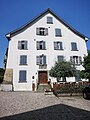
Category:Städtisches Bürgerheim (Kaiserstuhl AG)
| Object location | | View all coordinates using: OpenStreetMap |
|---|
building in Kaiserstuhl in the canton of Aargau, Switzerland  | |||||
| Upload media | |||||
| Instance of | |||||
|---|---|---|---|---|---|
| Part of | |||||
| Location | Kaiserstuhl, Zurzach, Zurzach District, Aargau, Switzerland | ||||
| Street address |
| ||||
| Heritage designation | |||||
| Inception |
| ||||
 | |||||
Media in category "Städtisches Bürgerheim (Kaiserstuhl AG)"
This category contains only the following file.
-
 Kaiserstuhl Bürgerheim.JPG 2,112 × 2,816; 1.46 MB