Category:St. Mariä Vermählung (Oedekoven)
| Object location | | View all coordinates using: OpenStreetMap |
|---|
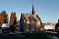
church building in Alfter, Germany  | |||||
| Upload media | |||||
| Instance of | |||||
|---|---|---|---|---|---|
| Location | Alfter, Rhein-Sieg District, Cologne Government Region, North Rhine-Westphalia, Germany | ||||
 | |||||
| This category shows a heritage building in Germany, located in the North Rhine-Westphalian municipality Alfter (no. 20). |
Subcategories
This category has only the following subcategory.
Media in category "St. Mariä Vermählung (Oedekoven)"
The following 8 files are in this category, out of 8 total.
-
 Beleuchte Kapelle .jpg 3,024 × 4,032; 629 KB
-
 Alfter GinggasseStaffelsgasse.jpg 384 × 256; 16 KB
-
 Oedekoven Kapelle (01).jpg 1,056 × 1,452; 424 KB
-
 Oedekoven Kapelle (02).jpg 1,098 × 1,497; 441 KB
-
 Oedekoven Kapelle (03).jpg 1,200 × 1,600; 437 KB
-
 Oedekoven Kapelle (04).jpg 1,155 × 1,329; 441 KB
-
 Oedekoven Kapelle (05).jpg 1,600 × 2,604; 1.01 MB
-
 Oedekoven Kapelle (10).png 1,710 × 2,861; 7.35 MB

.jpg)
.jpg)
.jpg)
.jpg)
.jpg)
.png)