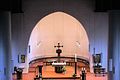
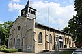
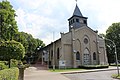
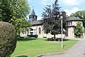
Category:St. Marien (Hervest)
| Object location | | View all coordinates using: OpenStreetMap |
|---|
| Upload media | |||||
| Instance of | |||||
|---|---|---|---|---|---|
| Location | Hervest, Dorsten, Recklinghausen, Münster Government Region, North Rhine-Westphalia, Germany | ||||
 | |||||
Media in category "St. Marien (Hervest)"
The following 23 files are in this category, out of 23 total.
-
 2017-01-20-Marienkirche-Klaus-Strube-16179008 394477740903067 7435678144693497489 o.jpg 2,048 × 1,536; 547 KB
-
 Dorsten-Hervest St. Marien (01).jpg 2,969 × 2,238; 939 KB
-
 Dorsten-Hervest St. Marien (02).jpg 3,872 × 2,592; 4.75 MB
-
 Dorsten-Hervest St. Marien (03).jpg 3,872 × 2,592; 2.11 MB
-
 Dorsten-Hervest St. Marien (04).jpg 3,872 × 2,592; 2.32 MB
-
 Dorsten-Hervest St. Marien (05).jpg 3,872 × 2,592; 2.61 MB
-
 Dorsten-Hervest St. Marien (06).jpg 2,592 × 3,872; 1.85 MB
-
 Dorsten-Hervest St. Marien (07).jpg 2,592 × 3,872; 2.92 MB
-
 Dorsten-Hervest St. Marien (08).jpg 3,872 × 2,592; 2.25 MB
-
 Dorsten-Hervest St. Marien (09).jpg 3,872 × 2,592; 2.25 MB
-
 Dorsten-Hervest St. Marien (10).jpg 3,872 × 2,592; 2.37 MB
-
 Dorsten-Hervest St. Marien (11).jpg 1,320 × 1,153; 236 KB
-
 Dorsten-Hervest St. Marien (12).jpg 3,513 × 2,351; 1.45 MB
-
 Dorsten-Hervest St. Marien (13).jpg 3,872 × 2,592; 2.66 MB
-
 Dorsten-Hervest St. Marien (14).jpg 3,872 × 2,592; 2.63 MB
-
 Dorsten-Hervest St. Marien (15).jpg 3,872 × 2,592; 2.42 MB
-
 Dorsten-Hervest St. Marien (16).jpg 5,184 × 3,456; 6.93 MB
-
 Dorsten-Hervest St. Marien (17).jpg 5,184 × 3,456; 4.71 MB
-
 Dorsten-Hervest St. Marien (18).jpg 5,184 × 3,456; 7.19 MB
-
 Dorsten-Hervest St. Marien (19).jpg 5,184 × 3,456; 11.18 MB
-
 Dorsten-Hervest St. Marien (20).jpg 5,184 × 3,456; 7.58 MB
-
 Dorsten-Hervest St. Marien 1909.jpg 800 × 512; 69 KB
-
 Dorsten-Hervest St. Marien 1912.jpg 4,937 × 3,775; 2.03 MB

.jpg)
.jpg)
.jpg)
.jpg)
.jpg)
.jpg)
.jpg)
.jpg)
.jpg)
.jpg)
.jpg)
.jpg)
.jpg)
.jpg)
.jpg)
.jpg)
.jpg)
.jpg)
.jpg)
.jpg)

