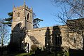
Category:St Andrew's Church, Cold Aston
| Object location | | View all coordinates using: OpenStreetMap |
|---|
This is a category about listed building number 1089877. |
Grade I listed church, Cotswold, United Kingdom  | |||||
| Upload media | |||||
| Instance of | |||||
|---|---|---|---|---|---|
| Dedicated to | |||||
| Location | Cold Aston, Cotswold, Gloucestershire, South West England, England | ||||
| Diocese | |||||
| Heritage designation |
| ||||
| Inception |
| ||||
| Religion or worldview | |||||
 | |||||
Media in category "St Andrew's Church, Cold Aston"
The following 6 files are in this category, out of 6 total.
-
 Cold Aston Church (geograph 3335236).jpg 640 × 480; 99 KB
-
 ColdAstonChurch.jpg 640 × 426; 140 KB
-
 St Andrews Church, Cold Aston (geograph 1857105).jpg 4,000 × 3,000; 3.26 MB
-
 St Andrews Church, Cold Aston (geograph 4021358).jpg 1,600 × 1,064; 654 KB
-
 St Andrews Church, Cold Aston (geograph 4021370).jpg 1,600 × 1,064; 659 KB
-
 View to the church - geograph.org.uk - 3013232.jpg 4,320 × 3,240; 4.73 MB
.jpg)
.jpg)
.jpg)
.jpg)
