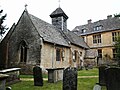
Category:St Bartholomew's church, Whittington
| Object location | | View all coordinates using: OpenStreetMap |
|---|
church in Whittington, Gloucestershire, England, UK  | |||||
| Upload media | |||||
| Instance of | |||||
|---|---|---|---|---|---|
| Location | Whittington, Cotswold, Gloucestershire, South West England, England | ||||
| Diocese | |||||
| Heritage designation |
| ||||
| Religion or worldview | |||||
 | |||||
Subcategories
This category has only the following subcategory.
Media in category "St Bartholomew's church, Whittington"
The following 2 files are in this category, out of 2 total.
-

-
 St. Bartholomew's Church, Whittington.jpg 2,048 × 1,536; 1.09 MB
