Category:St Germanus' church, Rame
| Object location | | View all coordinates using: OpenStreetMap |
|---|
church in Rame, Cornwall, England, UK  | |||||
| Upload media | |||||
| Instance of | |||||
|---|---|---|---|---|---|
| Dedicated to | |||||
| Location | Rame, Maker-with-Rame, Cornwall, South West England, England | ||||
| Diocese | |||||
| Heritage designation |
| ||||
| Inception |
| ||||
| Religion or worldview | |||||
 | |||||
Subcategories
This category has only the following subcategory.
S
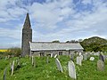
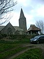
Media in category "St Germanus' church, Rame"
The following 6 files are in this category, out of 6 total.
-
 Rame Church - geograph.org.uk - 1273997.jpg 640 × 480; 83 KB
-
 Rame Church - geograph.org.uk - 325134.jpg 640 × 428; 73 KB
-
 Rame Church - geograph.org.uk - 36825.jpg 640 × 460; 71 KB
-
 Rame Church and Church Yard - geograph.org.uk - 1537920.jpg 640 × 428; 76 KB
-
 St Germanus' Church, Rame, Cornwall.jpg 4,896 × 3,672; 16.54 MB
-
 St Germanus, Rame - geograph.org.uk - 338137.jpg 480 × 640; 90 KB


