Category:St Giles' church, Chideock
| Object location | | View all coordinates using: OpenStreetMap |
|---|
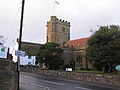
church in Chideock, Dorset, UK  | |||||
| Upload media | |||||
| Instance of | |||||
|---|---|---|---|---|---|
| Dedicated to | |||||
| Location | Chideock, Dorset, South West England, England | ||||
| Diocese | |||||
| Heritage designation |
| ||||
| Inception |
| ||||
| Religion or worldview | |||||
 | |||||
Subcategories
This category has the following 2 subcategories, out of 2 total.
Media in category "St Giles' church, Chideock"
The following 23 files are in this category, out of 23 total.
-
 1GL Bolt, Chideock, St Giles Church - geograph.org.uk - 3131315.jpg 640 × 480; 112 KB
-
 Chideock , St Giles Church - geograph.org.uk - 3555851.jpg 2,848 × 4,288; 6.35 MB
-
 Chideock, parish church of St. Giles - geograph.org.uk - 496535.jpg 640 × 446; 67 KB
-
 Chideock, St Giles Church - geograph.org.uk - 3131326.jpg 480 × 640; 94 KB
-
 Church of St Giles - geograph.org.uk - 2851711.jpg 640 × 430; 61 KB
-
 Church of St Giles - geograph.org.uk - 2851715.jpg 430 × 640; 68 KB
-
 Church, Chideock - geograph.org.uk - 303093.jpg 640 × 480; 126 KB
-
 Churchyard, St Giles - geograph.org.uk - 2856448.jpg 640 × 430; 69 KB
-
 Parish Church of St Giles - geograph.org.uk - 2856432.jpg 640 × 430; 92 KB
-
 Parish Church of St Giles - geograph.org.uk - 2856491.jpg 640 × 430; 49 KB
-
 Parish Church of St Giles - geograph.org.uk - 2856497.jpg 430 × 640; 55 KB
-

-
 St Giles' church, Chideock - geograph.org.uk - 4946591.jpg 1,024 × 768; 241 KB
-
 St Giles, Chideock (22851901268).jpg 2,837 × 2,393; 1.54 MB
-
 St Giles, Chideock (30994734946).jpg 2,246 × 1,354; 930 KB
-
 St Giles, Chideock (30994744466).jpg 2,841 × 3,061; 1.47 MB
-
 St Giles, Chideock - geograph.org.uk - 4470297.jpg 3,888 × 2,592; 3.35 MB
-
 St Giles, Chideock - geograph.org.uk - 4470304.jpg 3,888 × 2,592; 4.13 MB
-

-
 St Giles, Chideock, September 2013 - geograph.org.uk - 3643337.jpg 640 × 480; 76 KB
-
 The Church of St Giles - Chideock - geograph.org.uk - 1227103.jpg 640 × 483; 77 KB
-
 The tower of Chideock church - geograph.org.uk - 4946594.jpg 600 × 800; 99 KB
-
 Weathered benchmark on St Giles Church - geograph.org.uk - 3131154.jpg 683 × 1,024; 310 KB


.jpg)
.jpg)
.jpg)


