Category:St Harmon
village and community in Powys, Wales  | |||||
| Upload media | |||||
| Instance of | |||||
|---|---|---|---|---|---|
| Location | Powys, Wales | ||||
| Population |
| ||||
| Area |
| ||||
 | |||||
Cymraeg: Cymuned a phentref bychan gwledig a phlwyf eglwysig yng ngogledd Powys yw Sant Harmon. Fe'i lleolir 2 filltir i'r gogledd o bentref Rhaeadr Gwy ar lôn fynydd rhwng y pentref hwnnw a Llanidloes. Saif ar lan Afon Marteg, ffrwd sy'n aberu yn Afon Gwy ger Rhaeadr. Enwir y pentref ar ôl Sant Garmon ('Harmon').
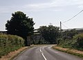
English: St Harmon is a village and community in Powys, Wales. It is located on the River Marteg on the minor road running between Llanidloes and Rhayader.
Subcategories
This category has the following 2 subcategories, out of 2 total.
B
- Bryn Titli Wind Farm (9 F)
G
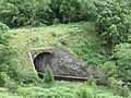
- Gilfach Tunnel (7 F)
Media in category "St Harmon"
The following 200 files are in this category, out of 489 total.
(previous page) (next page)-
 'The Cottage' - geograph.org.uk - 2113443.jpg 2,000 × 1,500; 3.02 MB
-
 A dusting of snow on Moel Hywel - geograph.org.uk - 1594628.jpg 640 × 480; 79 KB
-
 A plantation near Tynshimley - geograph.org.uk - 2998782.jpg 2,592 × 1,944; 1.86 MB
-
 A Ring of Stones - geograph.org.uk - 4109335.jpg 1,024 × 768; 260 KB
-
 A Stone Fern - geograph.org.uk - 4109411.jpg 600 × 800; 161 KB
-
 A well surfaced byway - geograph.org.uk - 1271633.jpg 640 × 480; 69 KB
-
 A470 below Bwlch-gwyn-isaf - geograph.org.uk - 1863392.jpg 1,944 × 1,458; 1.01 MB
-
 A470 between Llangurig and Rhayader - geograph.org.uk - 5014431.jpg 640 × 480; 451 KB
-
 A470 passing the foot of the Marteg valley - geograph.org.uk - 2961972.jpg 1,024 × 768; 213 KB
-
 A470 road to Llangurig in Powys - geograph.org.uk - 6213219.jpg 1,440 × 960; 1.29 MB
-
 A470 road to Llangurig in Powys - geograph.org.uk - 6213289.jpg 1,440 × 960; 1.55 MB
-
 A470 road to Rhayader in Powys - geograph.org.uk - 6213296.jpg 1,440 × 960; 1.51 MB
-
 A470, South of Dolfach - geograph.org.uk - 5014472.jpg 640 × 480; 448 KB
-
 A470, Southbound towards Rhayader - geograph.org.uk - 5014512.jpg 640 × 480; 419 KB
-
 Above Craig yr Eryr - geograph.org.uk - 1914050.jpg 640 × 426; 89 KB
-
 Across the Wye Valley south of Llangurig, Powys - geograph.org.uk - 6213217.jpg 1,600 × 900; 1.45 MB
-
 Afon Dulas - geograph.org.uk - 2135397.jpg 640 × 426; 189 KB
-
 Afon Dulas near Tylwch - geograph.org.uk - 2135396.jpg 640 × 427; 199 KB
-
 Afon Marteg - geograph.org.uk - 2998728.jpg 2,592 × 1,944; 2.13 MB
-
 Afon Marteg Looking North - geograph.org.uk - 4114506.jpg 1,024 × 768; 300 KB
-
 Allt-goch, Afon Marteg - geograph.org.uk - 1244041.jpg 640 × 480; 118 KB
-
 Allt-goch, Mid Wales Railway - geograph.org.uk - 1244047.jpg 640 × 480; 97 KB
-
 Alltlwyd Farm entrance lane - geograph.org.uk - 3553395.jpg 640 × 480; 62 KB
-
 Approach to bridge - geograph.org.uk - 462412.jpg 640 × 480; 148 KB
-

-
 At the entrance - geograph.org.uk - 4109263.jpg 1,024 × 768; 251 KB
-
 B4518 above Rhayader - geograph.org.uk - 2526979.jpg 950 × 713; 303 KB
-
 B4518 and hillside - geograph.org.uk - 2527059.jpg 950 × 713; 290 KB
-
 B4518 approaching Pant-y-dwr - geograph.org.uk - 2114286.jpg 2,000 × 1,299; 2.48 MB
-
 B4518 at Banc Gelli-las - geograph.org.uk - 3553450.jpg 640 × 468; 55 KB
-
 B4518 climbing up to the barns at West Fedw Farm - geograph.org.uk - 5028565.jpg 1,024 × 768; 147 KB
-
 B4518 entering Pant-y-dwr - geograph.org.uk - 3553416.jpg 640 × 464; 58 KB
-
 B4518 north-east of Rhayader - geograph.org.uk - 2114174.jpg 2,000 × 1,191; 2.26 MB
-
 B4518 passing the quarry - geograph.org.uk - 3553455.jpg 640 × 496; 68 KB
-
 B4518 south of disused quarry - geograph.org.uk - 3553462.jpg 640 × 475; 50 KB
-
 Back to Pont Marteg - geograph.org.uk - 4109426.jpg 1,024 × 768; 191 KB
-
 Back to the bridge - geograph.org.uk - 1295423.jpg 640 × 426; 82 KB
-
 Barn at Dolhelfa-uchaf - geograph.org.uk - 2105059.jpg 2,000 × 1,296; 2.75 MB
-
 Barn at road junction in Pant-y-dwr - geograph.org.uk - 2114552.jpg 2,000 × 1,512; 2.79 MB
-
 Base of wind turbine - geograph.org.uk - 1912170.jpg 640 × 426; 58 KB
-
 Benchmark at Pont Marteg Bridge - geograph.org.uk - 4116328.jpg 600 × 800; 173 KB
-
 Bend near Sychnant-fawr - geograph.org.uk - 3553404.jpg 640 × 517; 63 KB
-
 Bend round Yr Wylorn - geograph.org.uk - 2006736.jpg 1,024 × 768; 114 KB
-
 Between the bridges on the B4518 at Tylwch - geograph.org.uk - 5028526.jpg 1,024 × 768; 168 KB
-
 Blaen y Bwlch - geograph.org.uk - 2113614.jpg 2,000 × 1,500; 2.77 MB
-

-
 Board in the car park - geograph.org.uk - 1295513.jpg 400 × 600; 87 KB
-
 Board on the corner - geograph.org.uk - 1292098.jpg 640 × 426; 54 KB
-
 Bridge Across the Marteg - geograph.org.uk - 4114502.jpg 1,024 × 768; 227 KB
-
 Bridge in the valley - geograph.org.uk - 1292136.jpg 640 × 426; 96 KB
-
 Bridge over Afon Dulas, west of Cenarth Mill - geograph.org.uk - 5028719.jpg 1,024 × 768; 195 KB
-
 Bridge over old railway - geograph.org.uk - 3082410.jpg 640 × 427; 206 KB
-
 Bridge over the Marcheini - geograph.org.uk - 3137758.jpg 640 × 427; 274 KB
-
 Bridge support on the long-disused Mid-Wales Railway line. - geograph.org.uk - 5480322.jpg 3,964 × 2,029; 3.15 MB
-
 Bridge through the Trees - geograph.org.uk - 4114735.jpg 1,024 × 768; 302 KB
-
 Bridleway at Cwmyrychen - geograph.org.uk - 1913998.jpg 640 × 426; 116 KB
-
 Bridleway sign, Dulas valley - geograph.org.uk - 1910597.jpg 426 × 640; 81 KB
-
 Bridleway track leaving the B4518 near Llidiarddau - geograph.org.uk - 5796637.jpg 4,000 × 3,000; 3.92 MB
-
 Bridleway working round Cefn Cenarth - geograph.org.uk - 3082329.jpg 640 × 446; 304 KB
-
 Broken footbridge - geograph.org.uk - 1294084.jpg 640 × 426; 111 KB
-
 Broken off the top - geograph.org.uk - 1294097.jpg 640 × 426; 121 KB
-
 Bryn Titli Wind Farm - geograph.org.uk - 1902009.jpg 640 × 426; 93 KB
-
 Bryn Titli Wind Farm - geograph.org.uk - 1902061.jpg 640 × 426; 95 KB
-
 Bryn Titli Wind Farm - geograph.org.uk - 1912185.jpg 640 × 426; 81 KB
-
 Bryn Titli Wind Farm - geograph.org.uk - 1914158.jpg 640 × 426; 87 KB
-
 Bug on a Stone - geograph.org.uk - 4109342.jpg 600 × 800; 140 KB
-
 Bull at Cefn Llech - geograph.org.uk - 1913945.jpg 640 × 426; 81 KB
-
 Bus shelter on the B4518, near The Store Farm - geograph.org.uk - 5030698.jpg 1,024 × 768; 159 KB
-
 Carn y Gaseg - geograph.org.uk - 1899990.jpg 640 × 426; 77 KB
-
 Cattle grid - geograph.org.uk - 3137738.jpg 640 × 427; 202 KB
-
 Cefn Cenarth - geograph.org.uk - 3310552.jpg 1,600 × 1,200; 1,012 KB
-
 Cefn Cennarth in winter - geograph.org.uk - 3285626.jpg 800 × 600; 120 KB
-
 Cefn Llech - geograph.org.uk - 1913953.jpg 640 × 426; 66 KB
-
 Cefn Pen-lan from the west - geograph.org.uk - 3285647.jpg 800 × 600; 128 KB
-
 Cefnbychan, gate - geograph.org.uk - 1244012.jpg 640 × 480; 53 KB
-
 Cefnfaes Hall Farmhouse - geograph.org.uk - 2998826.jpg 2,592 × 1,944; 1.61 MB
-
 Centre of communications, Nantgwyn - geograph.org.uk - 5028754.jpg 1,024 × 768; 140 KB
-
 Check this Wall - geograph.org.uk - 4116326.jpg 1,024 × 768; 251 KB
-
 Close up of Heather - geograph.org.uk - 4116169.jpg 1,024 × 768; 231 KB
-
 Coedllwydion - geograph.org.uk - 2114302.jpg 2,000 × 1,500; 3.32 MB
-
 Conifer plantation at West Fedw - geograph.org.uk - 5028570.jpg 1,024 × 768; 139 KB
-
 Conifer plantation on the bank of Afon Dulas - geograph.org.uk - 5028552.jpg 1,024 × 768; 178 KB
-
 Conifer plantation west of Llidiarddau - geograph.org.uk - 5028700.jpg 1,024 × 614; 76 KB
-
 Cottage, St Harmon - geograph.org.uk - 5222231.jpg 1,600 × 1,200; 478 KB
-
 Cottages at Tylwch - geograph.org.uk - 159636.jpg 640 × 420; 114 KB
-
 Course of the Mid Wales Railway - geograph.org.uk - 3082420.jpg 640 × 427; 244 KB
-
 Cutting on the old Mid Wales Railway - geograph.org.uk - 3059902.jpg 640 × 427; 269 KB
-
 Cwm-is-y-rhiw from B4518 - geograph.org.uk - 3553440.jpg 640 × 463; 85 KB
-
 Cyn rheilffordd - Former railway - geograph.org.uk - 3873838.jpg 640 × 480; 105 KB
-
 Dead end lane east of St. Harmon - geograph.org.uk - 901648.jpg 640 × 428; 106 KB
-
 Deciduous woodland - geograph.org.uk - 2114020.jpg 2,000 × 1,308; 2.15 MB
-
 Derelict Rail Waggon - geograph.org.uk - 5237508.jpg 3,776 × 2,520; 3.89 MB
-
 Devastated Forest on Cefn Cenarth - geograph.org.uk - 2114680.jpg 2,000 × 1,500; 2.82 MB
-

-
 Disappearing Road - geograph.org.uk - 4114860.jpg 1,024 × 768; 143 KB
-

-
 Disused quarry near Glan Marteg - geograph.org.uk - 3082399.jpg 640 × 427; 184 KB
-
 Double bend near Lingen - geograph.org.uk - 3553422.jpg 640 × 487; 57 KB
-
 Down the hill towards St Harmon - geograph.org.uk - 3553428.jpg 640 × 412; 62 KB
-
 Entering St Harmon - geograph.org.uk - 3553429.jpg 597 × 640; 77 KB
-
 Entrance to Bryncenarth - geograph.org.uk - 3553414.jpg 640 × 480; 76 KB
-
 Entrance to Gilfach - geograph.org.uk - 1295639.jpg 640 × 426; 71 KB
-
 Entrance to Gilfach - geograph.org.uk - 4114738.jpg 1,024 × 768; 271 KB
-
 Entrance to Nantgwyn - geograph.org.uk - 3241583.jpg 640 × 456; 41 KB
-
 Entrance to Tylwch - geograph.org.uk - 3241598.jpg 640 × 480; 74 KB
-
 Entrance to West Fedw - geograph.org.uk - 3553393.jpg 640 × 468; 80 KB
-
 Esgair, road - geograph.org.uk - 1244093.jpg 640 × 480; 75 KB
-

-
 Ewe and lamb - geograph.org.uk - 1910610.jpg 640 × 426; 84 KB
-

-
 Farm track and landscape south of Llangurig in Powys - geograph.org.uk - 6208544.jpg 1,440 × 960; 1.72 MB
-
 Farm track at field edge, south of Green Farm - geograph.org.uk - 5030735.jpg 1,024 × 768; 156 KB
-
 Farm track entrance from B4518 - geograph.org.uk - 3553458.jpg 640 × 423; 41 KB
-
 Farmland around Pwll - geograph.org.uk - 5028870.jpg 1,024 × 768; 184 KB
-
 Farmland at the head of the Nant Serth valley - geograph.org.uk - 3179703.jpg 1,152 × 768; 421 KB
-
 Farmland beside Nant Tawelan - geograph.org.uk - 1911889.jpg 640 × 426; 88 KB
-
 Farmland between Pwll and Llwyn y brain - geograph.org.uk - 5028763.jpg 1,024 × 768; 176 KB
-
 Farmland east of Green Farm, Pant y dwr - geograph.org.uk - 5030718.jpg 1,024 × 768; 145 KB
-
 Farmland near Pant-y-dwr - geograph.org.uk - 2527064.jpg 950 × 640; 267 KB
-
 Farmland south of St. Harmon - geograph.org.uk - 3179725.jpg 1,152 × 768; 490 KB
-
 Farmland south-east of Pwll - geograph.org.uk - 5028873.jpg 1,024 × 768; 162 KB
-
 Fence in the ferns - geograph.org.uk - 4116174.jpg 1,024 × 768; 290 KB
-
 Fence posts sticking up - geograph.org.uk - 4116176.jpg 1,024 × 768; 319 KB
-
 Fence round the Cutting - geograph.org.uk - 4114749.jpg 1,024 × 768; 182 KB
-

-
 Field and gate east of Tylwch - geograph.org.uk - 3082198.jpg 640 × 427; 225 KB
-
 Field east of St. Harmon - geograph.org.uk - 901650.jpg 640 × 428; 72 KB
-
 Field near Cefnfaes Hall - geograph.org.uk - 901594.jpg 640 × 428; 101 KB
-
 Field near Sychnant Chapel - geograph.org.uk - 3082244.jpg 640 × 427; 181 KB
-
 Fields below Wennallt - geograph.org.uk - 5028708.jpg 1,024 × 768; 113 KB
-
 Fields by the Nant Tawelan - geograph.org.uk - 3082307.jpg 640 × 427; 194 KB
-
 Fields east of Cefn Lech farm - geograph.org.uk - 3082253.jpg 640 × 427; 151 KB
-
 Fields in the Nant Tawelan valley - geograph.org.uk - 3082324.jpg 640 × 427; 219 KB
-
 Fields in the upper Marteg valley - geograph.org.uk - 2527071.jpg 950 × 713; 278 KB
-
 Fields near St. Harmon - geograph.org.uk - 3179736.jpg 1,152 × 768; 413 KB
-
 Fields on Bryn Scolfa - geograph.org.uk - 3207425.jpg 1,152 × 768; 456 KB
-
 Final Resting Place - geograph.org.uk - 4967353.jpg 1,600 × 1,200; 576 KB
-
 Flowery meadow, east of Alltlwyd - geograph.org.uk - 5028711.jpg 1,024 × 768; 156 KB
-
 Flowing down the Valley - geograph.org.uk - 1293950.jpg 640 × 426; 68 KB
-
 Follow the Sign - geograph.org.uk - 4114380.jpg 1,024 × 768; 283 KB
-
 Footpath on the otherside - geograph.org.uk - 1294010.jpg 400 × 600; 80 KB
-
 Footpath over the bridge - geograph.org.uk - 2006694.jpg 1,024 × 768; 360 KB
-
 Forestry near Pant y Brwyn - geograph.org.uk - 901678.jpg 640 × 428; 102 KB
-
 Foxglove on the Hillside - geograph.org.uk - 4116318.jpg 600 × 800; 102 KB
-
 Frost and Sunshine - geograph.org.uk - 5578045.jpg 640 × 480; 40 KB
-
 Fullbrook Valley - geograph.org.uk - 3285686.jpg 800 × 600; 123 KB
-
 Gamallt - geograph.org.uk - 1263160.jpg 640 × 480; 74 KB
-
 Gamallt - geograph.org.uk - 3981324.jpg 2,400 × 3,600; 4.09 MB
-
 Gamallt and Wye Valley - geograph.org.uk - 3285692.jpg 800 × 600; 109 KB
-
 Gamallt ger Rhaeadr Gwy - Gamallt near Rhayader - geograph.org.uk - 3980780.jpg 3,600 × 2,400; 4.05 MB
-
 Gamult (hill) - geograph.org.uk - 6045821.jpg 768 × 1,024; 426 KB
-
 Garden between the Wye and the A470 - geograph.org.uk - 1851126.jpg 640 × 480; 157 KB
-
 Gate in the Wye valley - geograph.org.uk - 3137697.jpg 640 × 444; 248 KB
-
 Gate on the road - geograph.org.uk - 3082288.jpg 640 × 427; 210 KB
-
 Gilfach Farm Nature Reserve - geograph.org.uk - 4967358.jpg 1,600 × 1,200; 522 KB
-
 Gilfach Farmhouse - geograph.org.uk - 5237483.jpg 3,968 × 2,232; 3.81 MB
-
 Gilfach Nature Reserve - geograph.org.uk - 1870835.jpg 2,048 × 1,536; 1.34 MB
-
 Gilfach Nature Reserve - geograph.org.uk - 4114742.jpg 600 × 800; 161 KB
-
 Glorious Welsh countryside near Rhayader - geograph.org.uk - 5145785.jpg 3,988 × 1,682; 2.78 MB
-
 Grassland above Tylwch - geograph.org.uk - 1899728.jpg 640 × 426; 84 KB
-
 Grassland near Allt-goch - geograph.org.uk - 1911825.jpg 640 × 426; 95 KB
-
 Graveyard, Nantgwyn Baptist Church - geograph.org.uk - 5028758.jpg 1,024 × 768; 169 KB
-
 Heather in bloom - geograph.org.uk - 943905.jpg 640 × 480; 107 KB
-
 Heather on the Hill - geograph.org.uk - 4109422.jpg 1,024 × 768; 204 KB
-
 Heather on the Hillside - geograph.org.uk - 4116166.jpg 1,024 × 768; 316 KB
-
 Heron with a Fish - geograph.org.uk - 4109402.jpg 600 × 800; 152 KB
-
 Hide beside the Bridge - geograph.org.uk - 4114731.jpg 1,024 × 768; 270 KB
-
 Hills and valley near Rhayader - geograph.org.uk - 5361185.jpg 2,000 × 1,333; 2.68 MB
-
 Hills to the north of Rhayader - geograph.org.uk - 1910707.jpg 640 × 426; 80 KB
-
 Hillside of Yr Wyron - geograph.org.uk - 4116316.jpg 1,024 × 768; 167 KB
-
 House at track entrance to Lingen - geograph.org.uk - 3553425.jpg 640 × 488; 77 KB
-
 Houses at Cwmyrychen - geograph.org.uk - 1914009.jpg 640 × 426; 78 KB
-
 In the Wye valley - geograph.org.uk - 2609411.jpg 2,592 × 1,944; 1.62 MB
-
 Lambs on aMay field - geograph.org.uk - 1271655.jpg 640 × 480; 53 KB
-
 Lane accessing The Gorse - geograph.org.uk - 901660.jpg 640 × 428; 154 KB
-
 Lane leading to Cae'rneuadd farm - geograph.org.uk - 3082315.jpg 640 × 427; 232 KB
-
 Lane near Cefn Llech - geograph.org.uk - 1913975.jpg 640 × 426; 62 KB
-
 Lane near Penrhos - geograph.org.uk - 2527075.jpg 950 × 685; 304 KB
-
 Lane past Woodhouse - geograph.org.uk - 2961637.jpg 1,024 × 787; 205 KB
-
 Lane to Gilfach farm - geograph.org.uk - 3137750.jpg 640 × 427; 249 KB
-
 Lane to Lingen Farm - geograph.org.uk - 2114222.jpg 2,000 × 1,359; 3.54 MB
-
 Lane towards St Harmon - geograph.org.uk - 2961628.jpg 1,024 × 768; 299 KB
-
 Lane towards Tylwch - geograph.org.uk - 2962037.jpg 1,024 × 768; 249 KB
-
 Lane, Marteg valley, near Gilfach - geograph.org.uk - 2527000.jpg 950 × 713; 272 KB
-
 Large deciduous tree in summer, Nantgwyn - geograph.org.uk - 5028750.jpg 1,024 × 768; 164 KB
-

-
 Lazing round the pond - geograph.org.uk - 2006703.jpg 1,024 × 768; 200 KB
-
 Leaf on a rock - geograph.org.uk - 4109404.jpg 1,024 × 768; 283 KB
-
 Leafy crop in field - geograph.org.uk - 2107747.jpg 2,000 × 1,191; 2.38 MB
-
 Lizard on a rock - geograph.org.uk - 4109339.jpg 1,024 × 768; 257 KB
-

-
 Llidiart Carnau - geograph.org.uk - 3873854.jpg 640 × 480; 102 KB
-
 Llidiart-carnau, farmhouse - geograph.org.uk - 1243995.jpg 640 × 480; 108 KB
-
 Llidiart-carnau, molehills - geograph.org.uk - 1244019.jpg 640 × 480; 75 KB
-
 Llidiart-carnau, sheep - geograph.org.uk - 1244003.jpg 640 × 480; 73 KB
-
 Llidiart-carnau, track - geograph.org.uk - 1243999.jpg 640 × 480; 87 KB
-
 Llwybr Tynshimley Path - geograph.org.uk - 3873849.jpg 640 × 480; 72 KB
-
 Locked Gate - geograph.org.uk - 2104318.jpg 6,048 × 4,032; 1.95 MB
-
 Long shadows at Llidiart Carnau farmhouse, near Rhayader - geograph.org.uk - 5146004.jpg 2,000 × 1,500; 741 KB
-
 Looking across the bridge - geograph.org.uk - 1294004.jpg 400 × 600; 66 KB


_-_geograph.org.uk_-_6045821.jpg)


