Category:St Keyne and Trewidland
English: St Keyne and Trewidland is a civil parish in the Cornwall district, in the ceremonial county of Cornwall, England.
civil parish in Cornwall, England | |||||
| Upload media | |||||
| Instance of | |||||
|---|---|---|---|---|---|
| Location | Cornwall, South West England, England | ||||
 | |||||
Subcategories
This category has the following 4 subcategories, out of 4 total.
Media in category "St Keyne and Trewidland"
The following 19 files are in this category, out of 19 total.
-
 Autumnal Hillside - geograph.org.uk - 269320.jpg 640 × 427; 106 KB
-
 Causeland Station building - geograph.org.uk - 1837774.jpg 640 × 480; 108 KB
-
 East Trevillies - geograph.org.uk - 1555622.jpg 640 × 428; 99 KB
-
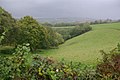 Looe Valley from St Keyne - geograph.org.uk - 1554711.jpg 640 × 428; 74 KB
-
 Looe Valley Line from Trussel Bridge - geograph.org.uk - 269304.jpg 640 × 427; 129 KB
-
 Looe Valley Railway - geograph.org.uk - 269884.jpg 640 × 427; 148 KB
-
 Saint Keyne Plaque.JPG 3,072 × 1,948; 3.78 MB
-
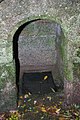
 St Keyne's Holy Well - geograph.org.uk - 93820.jpg 396 × 568; 147 KB
-
 St Keyne's Well - geograph.org.uk - 1556008.jpg 428 × 640; 109 KB
-
 St Keyne's Well - geograph.org.uk - 1556016.jpg 428 × 640; 111 KB
-
 St Keyne, Lametton Mill - geograph.org.uk - 77456.jpg 640 × 425; 164 KB
-
 The East Looe River - geograph.org.uk - 1837771.jpg 640 × 480; 146 KB
-
 The way to Badham Farm - geograph.org.uk - 1552499.jpg 640 × 428; 118 KB
-
 Train on the Looe Valley Railway Line - geograph.org.uk - 219842.jpg 640 × 427; 128 KB
-
 Turn left for the Wurlitzer - geograph.org.uk - 1554715.jpg 640 × 428; 108 KB
-
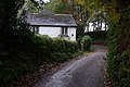
 Cottage by the lane at Killigorrick - geograph.org.uk - 431027.jpg 640 × 480; 98 KB
-
 House and byway - geograph.org.uk - 431032.jpg 640 × 480; 138 KB
-
 St Keyne Holy Well - geograph.org.uk - 269976.jpg 640 × 427; 147 KB
-
 Steep Valleyside - geograph.org.uk - 269333.jpg 640 × 427; 139 KB


