Category:St Leonard's Tower, West Malling
| Object location | | View all coordinates using: OpenStreetMap |
|---|
This is a category about listed building number 1219087. |
This is a category about listed building number 1013382. |
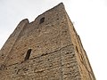
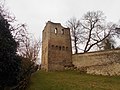
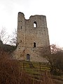
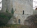
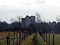
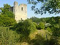
Grade I listed tower in West Malling, Kent, England, UK  | |||||
| Upload media | |||||
| Instance of | |||||
|---|---|---|---|---|---|
| Location | West Malling, Tonbridge and Malling, Kent, South East England, England | ||||
| Owned by | |||||
| Operator | |||||
| Heritage designation |
| ||||
| official website | |||||
 | |||||

Media in category "St Leonard's Tower, West Malling"
The following 52 files are in this category, out of 52 total.
-
 St Leonard's Tower - geograph.org.uk - 3971972.jpg 3,000 × 4,000; 3.91 MB
-
 St Leonard's tower - geograph.org.uk - 4173850.jpg 427 × 640; 102 KB
-
 St Leonard's Tower 01.jpg 5,152 × 3,864; 4.28 MB
-
 St Leonard's Tower 02.jpg 3,864 × 5,152; 4.24 MB
-
 St Leonard's Tower 03.jpg 5,152 × 3,864; 4.52 MB
-
 St Leonard's Tower 04.jpg 3,864 × 5,152; 4.31 MB
-
 St Leonard's Tower 05.jpg 5,152 × 3,864; 4.41 MB
-
 St Leonard's Tower 06.jpg 5,152 × 3,864; 4.58 MB
-
 St Leonard's Tower 07.jpg 3,864 × 5,152; 11.02 MB
-
 St Leonard's Tower 08.jpg 5,152 × 3,864; 4.4 MB
-
 St Leonard's Tower 09.jpg 5,152 × 3,864; 4.32 MB
-
 St Leonard's Tower 10.jpg 5,152 × 3,864; 4.33 MB
-
 St Leonard's Tower 11.jpg 5,152 × 3,864; 4.52 MB
-
 St Leonard's Tower 12.jpg 5,152 × 3,864; 4.58 MB
-
 St Leonard's Tower 13.jpg 5,152 × 3,864; 4.58 MB
-
 St Leonard's Tower 14.jpg 3,864 × 5,152; 4.58 MB
-
 St Leonard's Tower 15.jpg 3,864 × 5,152; 4.29 MB
-
 St Leonard's Tower 16.jpg 5,152 × 3,864; 4.33 MB
-
 St Leonard's Tower 17.jpg 3,864 × 5,152; 4.35 MB
-
 St Leonard's Tower 18.jpg 3,864 × 5,152; 4.43 MB
-
 St Leonard's Tower 19.jpg 3,864 × 5,152; 4.51 MB
-
 St Leonard's Tower 20.jpg 3,864 × 5,152; 4.41 MB
-
 St Leonard's Tower 21.jpg 3,864 × 5,152; 4.5 MB
-
 St Leonard's Tower 22.jpg 3,864 × 5,152; 4.57 MB
-
 St Leonard's Tower 23.jpg 3,864 × 5,152; 4.34 MB
-
 St Leonard's Tower 24.jpg 5,152 × 3,864; 4.39 MB
-
 St Leonard's Tower 25.jpg 5,152 × 3,864; 4.32 MB
-
 St Leonard's Tower 26.jpg 5,152 × 3,864; 4.47 MB
-
 St Leonard's Tower 27.jpg 5,152 × 3,864; 4.44 MB
-
 St Leonard's Tower 28.jpg 5,152 × 3,864; 4.45 MB
-
 St Leonard's Tower 29.jpg 5,152 × 3,864; 4.42 MB
-
 St Leonard's Tower 30.jpg 3,864 × 5,152; 4.26 MB
-
 St Leonard's Tower 31.jpg 3,864 × 5,152; 4.27 MB
-
 St Leonard's Tower 32.jpg 5,152 × 3,864; 10.24 MB
-
 St Leonard's Tower 33.jpg 3,864 × 5,152; 7.94 MB
-
 St Leonard's Tower 34.jpg 5,152 × 3,864; 4.57 MB
-
 St Leonard's Tower 35.jpg 5,152 × 3,864; 4.36 MB
-
 St Leonard's Tower 36.jpg 5,152 × 3,864; 4.37 MB
-
 St Leonard's Tower 37.jpg 5,152 × 3,864; 10 MB
-
 St Leonard's Tower 38.jpg 5,152 × 3,864; 7.5 MB
-
 St Leonard's Tower above a hawthorn - geograph.org.uk - 3973664.jpg 4,000 × 3,000; 3.84 MB
-
 St Leonard's Tower from footpath to the west - geograph.org.uk - 3973658.jpg 4,000 × 3,000; 4.04 MB
-
 St Leonard's Tower plan.png 1,862 × 1,771; 70 KB
-
 St Leonard's Tower, West Malling - geograph.org.uk - 22019.jpg 640 × 480; 174 KB
-
 St Leonard's Tower, West Malling - view from E.jpg 3,611 × 5,417; 6.48 MB
-
 St Leonard's Tower, West Malling - view from NW.jpg 4,895 × 9,848; 43.99 MB
-
 St Leonard's Tower, West Malling - view from SW.jpg 3,648 × 5,472; 7.5 MB
-
 St Leonard's Tower, West Malling - view of west entrance.jpg 3,648 × 5,472; 9.76 MB
-
 St Leonard's Tower, West Malling.jpg 1,567 × 1,175; 665 KB
-
 St leonards tower.jpg 500 × 375; 125 KB
-
 St. Leonard's Tower, West Malling - geograph.org.uk - 2209541.jpg 1,148 × 771; 647 KB
-
 The base of St Leonard's Tower - geograph.org.uk - 3973652.jpg 4,000 × 3,000; 4.25 MB


