Category:St Mary's Church, Hale
| Object location | | View all coordinates using: OpenStreetMap |
|---|
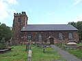
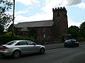
grade II listed church in Cheshire, United Kingdom  | |||||
| Upload media | |||||
| Instance of | |||||
|---|---|---|---|---|---|
| Location | Hale, Halton, Cheshire, North West England, England | ||||
| Architectural style | |||||
| Diocese | |||||
| Heritage designation |
| ||||
| Inception |
| ||||
| Religion or worldview | |||||
| official website | |||||
 | |||||
Subcategories
This category has only the following subcategory.
Media in category "St Mary's Church, Hale"
The following 30 files are in this category, out of 30 total.
-
 Bench mark on St Mary's, Hale Village - geograph.org.uk - 5483026.jpg 767 × 1,024; 341 KB
-
 Benchmark at St Mary's church, Hale.jpg 4,672 × 3,168; 11.95 MB
-
 Childe of Hale and St Mary's Church - geograph.org.uk - 519063.jpg 640 × 426; 46 KB
-

-
 Hale - St. Mary's church - geograph.org.uk - 226564.jpg 640 × 480; 97 KB
-
 Hale Church 1.jpg 2,592 × 1,944; 4.54 MB
-
 Main graveyard of St Mary's, Hale.jpg 5,152 × 3,864; 9.11 MB
-
 New graveyard of St Mary's, Hale.jpg 5,152 × 3,864; 10.12 MB
-
 Northern side of St Mary's, Hale.jpg 4,482 × 3,188; 7.04 MB
-
 South door of St Mary's, Hale 1.jpg 4,880 × 3,720; 8.77 MB
-
 South side of St Mary's Church, Hale - geograph.org.uk - 5509582.jpg 1,600 × 1,200; 717 KB
-
 Southern lych gate, St Mary's, Hale.jpg 4,947 × 3,697; 10.82 MB
-
 St Mary's church Hale - geograph.org.uk - 2056449.jpg 1,600 × 1,198; 368 KB
-
 St Mary's Church Tower, Hale - geograph.org.uk - 2551787.jpg 480 × 640; 55 KB
-
 St Mary's Church, Church Road, Hale - geograph.org.uk - 5509580.jpg 1,600 × 1,204; 645 KB
-
 St Mary's Church, Hale - geograph.org.uk - 2551786.jpg 640 × 480; 64 KB
-
 St Mary's Church, Hale - geograph.org.uk - 2785148.jpg 640 × 480; 80 KB
-
 St Mary's Church, Hale - geograph.org.uk - 2965222.jpg 640 × 480; 473 KB
-
 St Mary's Church, Hale Village - geograph.org.uk - 5483115.jpg 1,024 × 769; 166 KB
-
 St Mary's, Hale - geograph.org.uk - 311381.jpg 640 × 480; 91 KB
-
 St Mary's, Hale from the south.jpg 4,643 × 3,458; 8.43 MB
-
 St Mary's, Hale from the southeast.jpg 4,572 × 3,432; 8.79 MB
-
 St Mary, Hale - geograph.org.uk - 725211.jpg 640 × 480; 57 KB
-
 St. Mary's Church, Hale - geograph.org.uk - 2864481.jpg 640 × 480; 37 KB
-
 St. Mary's Church, Hale - geograph.org.uk - 2864483.jpg 480 × 640; 68 KB
-
 The church of St Mary at Hale - geograph.org.uk - 2852293.jpg 4,325 × 2,878; 6.6 MB
-
 The Church of St Mary, Hale - geograph.org.uk - 2965226.jpg 640 × 480; 524 KB
-
 The north face of St Mary's tower, Hale Village - geograph.org.uk - 5483034.jpg 768 × 1,024; 212 KB
-
 Weather cock on St Mary's tower, Hale Village - geograph.org.uk - 5483127.jpg 766 × 1,024; 109 KB
-
 West end of St Mary's, Hale.jpg 4,811 × 3,639; 9.1 MB


