Category:St Mary's church, Frampton, Dorset
| Object location | | View all coordinates using: OpenStreetMap |
|---|
church in Frampton, Dorset, United Kingdom  | |||||
| Upload media | |||||
| Instance of | |||||
|---|---|---|---|---|---|
| Location | Frampton, Dorset, South West England, England | ||||
| Diocese | |||||
| Heritage designation |
| ||||
| Inception |
| ||||
| Religion or worldview | |||||
 | |||||
Subcategories
This category has the following 2 subcategories, out of 2 total.
Media in category "St Mary's church, Frampton, Dorset"
The following 17 files are in this category, out of 17 total.
-
 Dreamy days in Dorset 21, Frampton - geograph.org.uk - 3125454.jpg 640 × 480; 79 KB
-

-
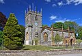
 Frampton Church - geograph.org.uk - 895190.jpg 640 × 426; 69 KB
-
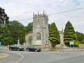
 Frampton, parish church of St. Mary - geograph.org.uk - 479016.jpg 640 × 429; 89 KB
-
 Frampton, St Mary's Church - geograph.org.uk - 2346202.jpg 1,280 × 960; 401 KB
-
 Frampton, St. Mary's - geograph.org.uk - 4581448.jpg 1,024 × 768; 158 KB
-
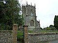
 St Mary's Church, Frampton - geograph.org.uk - 4982302.jpg 1,600 × 1,065; 1.08 MB
-
 St Mary's Church, Frampton - geograph.org.uk - 534072.jpg 640 × 480; 94 KB
-
 St Mary's parish church - Frampton - geograph.org.uk - 2429591.jpg 640 × 439; 393 KB
-
 St Mary, Frampton - geograph.org.uk - 3286534.jpg 640 × 437; 47 KB
-
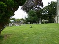
 St Mary, Frampton, churchyard (A) - geograph.org.uk - 3175687.jpg 640 × 480; 101 KB
-
 St Mary, Frampton, churchyard (B) - geograph.org.uk - 3175688.jpg 640 × 480; 107 KB
-
 St Mary, Frampton, churchyard (B) - geograph.org.uk - 3175689.jpg 640 × 480; 93 KB
-
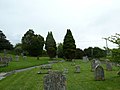 St Mary, Frampton, churchyard (C) - geograph.org.uk - 3175690.jpg 640 × 480; 60 KB
-
 St Mary, Frampton, churchyard (D) - geograph.org.uk - 3175696.jpg 640 × 480; 94 KB
-
 St Mary, Frampton, memorial (1) - geograph.org.uk - 3175693.jpg 463 × 640; 111 KB
-
 The Church of St Mary at Frampton - geograph.org.uk - 3930088.jpg 4,000 × 3,000; 2.38 MB


_-_geograph.org.uk_-_3175687.jpg)
_-_geograph.org.uk_-_3175688.jpg)
_-_geograph.org.uk_-_3175689.jpg)
_-_geograph.org.uk_-_3175690.jpg)
_-_geograph.org.uk_-_3175696.jpg)
_-_geograph.org.uk_-_3175693.jpg)
